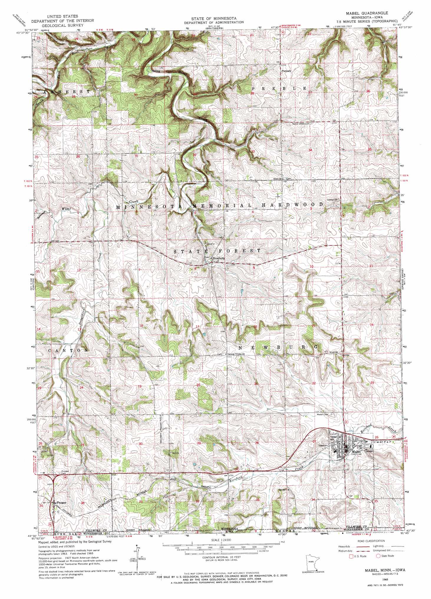
Mabel Topo Map Minnesota
To zoom in, hover over the map of Mabel
USGS Topo Quad 43091e7 - 1:24,000 scale
| Topo Map Name: | Mabel |
| USGS Topo Quad ID: | 43091e7 |
| Print Size: | ca. 21 1/4" wide x 27" high |
| Southeast Coordinates: | 43.5° N latitude / 91.75° W longitude |
| Map Center Coordinates: | 43.5625° N latitude / 91.8125° W longitude |
| U.S. States: | MN, IA |
| Filename: | o43091e7.jpg |
| Download Map JPG Image: | Mabel topo map 1:24,000 scale |
| Map Type: | Topographic |
| Topo Series: | 7.5´ |
| Map Scale: | 1:24,000 |
| Source of Map Images: | United States Geological Survey (USGS) |
| Alternate Map Versions: |
Mabel MN 1965, updated 1966 Download PDF Buy paper map Mabel MN 2010 Download PDF Buy paper map Mabel MN 2013 Download PDF Buy paper map Mabel MN 2016 Download PDF Buy paper map |
1:24,000 Topo Quads surrounding Mabel
Pilot Mound |
Arendahl |
Rushford West |
Rushford East |
Houston |
Preston |
Lanesboro |
Bratsberg |
Yucatan |
Sheldon |
Harmony |
Canton |
Mabel |
Spring Grove |
Wilmington |
Cresco Ne |
Bluffton |
Burr Oak |
Highlandville |
Dorchester |
Cresco Se |
Ridgeway |
Decorah |
Freeport |
Hanover |
> Back to 43091e1 at 1:100,000 scale
> Back to 43090a1 at 1:250,000 scale
> Back to U.S. Topo Maps home
Mabel topo map: Gazetteer
Mabel: Airports
Sellman Field elevation 409m 1341′Mabel: Dams
Rediske-Vatland Group Dam elevation 359m 1177′Mabel: Parks
Tawney Wayside Park elevation 357m 1171′Mabel: Populated Places
Green Lea Mobile Home Park elevation 345m 1131′Mabel elevation 345m 1131′
Newburg elevation 331m 1085′
Prosper elevation 413m 1354′
Tawney elevation 358m 1174′
Mabel: Post Offices
Mabel Post Office elevation 345m 1131′Newburg Post Office (historical) elevation 331m 1085′
Prosper Post Office elevation 413m 1354′
Tawney Post Office (historical) elevation 358m 1174′
Mabel: Streams
Donaldson Creek elevation 323m 1059′Sorenson Creek elevation 325m 1066′
Mabel digital topo map on disk
Buy this Mabel topo map showing relief, roads, GPS coordinates and other geographical features, as a high-resolution digital map file on DVD: