Yucatan Topo Map Minnesota
To zoom in, hover over the map of Yucatan
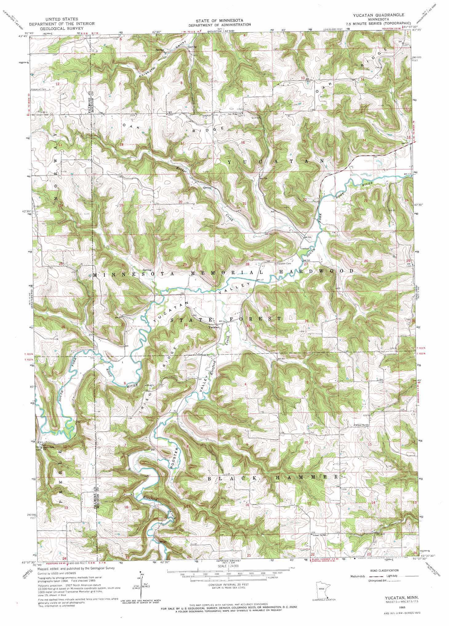
USGS Topo Quad 43091f6 - 1:24,000 scale
| Topo Map Name: | Yucatan |
| USGS Topo Quad ID: | 43091f6 |
| Print Size: | ca. 21 1/4" wide x 27" high |
| Southeast Coordinates: | 43.625° N latitude / 91.625° W longitude |
| Map Center Coordinates: | 43.6875° N latitude / 91.6875° W longitude |
| U.S. State: | MN |
| Filename: | o43091f6.jpg |
| Download Map JPG Image: | Yucatan topo map 1:24,000 scale |
| Map Type: | Topographic |
| Topo Series: | 7.5´ |
| Map Scale: | 1:24,000 |
| Source of Map Images: | United States Geological Survey (USGS) |
| Alternate Map Versions: |
Yucatan MN 1965, updated 1966 Download PDF Buy paper map Yucatan MN 2010 Download PDF Buy paper map Yucatan MN 2013 Download PDF Buy paper map Yucatan MN 2016 Download PDF Buy paper map |
1:24,000 Topo Quads surrounding Yucatan
Utica |
Lewiston |
Wilson |
Witoka |
Pickwick |
Arendahl |
Rushford West |
Rushford East |
Houston |
Mound Prairie |
Lanesboro |
Bratsberg |
Yucatan |
Sheldon |
Caledonia |
Canton |
Mabel |
Spring Grove |
Wilmington |
Eitzen |
Bluffton |
Burr Oak |
Highlandville |
Dorchester |
Waukon Nw |
> Back to 43091e1 at 1:100,000 scale
> Back to 43090a1 at 1:250,000 scale
> Back to U.S. Topo Maps home
Yucatan topo map: Gazetteer
Yucatan: Dams
Thorson Group North Detention Dam elevation 331m 1085′Thorson Group West Detention Dam elevation 253m 830′
Yucatan: Populated Places
Yucatan elevation 228m 748′Yucatan: Post Offices
Yucatan Post Office (historical) elevation 228m 748′Yucatan: Ridges
Irish Ridge elevation 338m 1108′Oak Ridge elevation 365m 1197′
Yucatan: Streams
Bridge Creek elevation 219m 718′Riceford Creek elevation 223m 731′
Yucatan: Valleys
Rooster Valley elevation 227m 744′Yucatan Valley elevation 219m 718′
Yucatan digital topo map on disk
Buy this Yucatan topo map showing relief, roads, GPS coordinates and other geographical features, as a high-resolution digital map file on DVD: