Bratsberg Topo Map Minnesota
To zoom in, hover over the map of Bratsberg
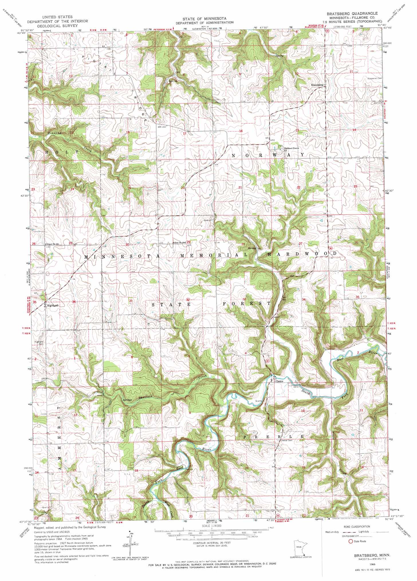
USGS Topo Quad 43091f7 - 1:24,000 scale
| Topo Map Name: | Bratsberg |
| USGS Topo Quad ID: | 43091f7 |
| Print Size: | ca. 21 1/4" wide x 27" high |
| Southeast Coordinates: | 43.625° N latitude / 91.75° W longitude |
| Map Center Coordinates: | 43.6875° N latitude / 91.8125° W longitude |
| U.S. State: | MN |
| Filename: | o43091f7.jpg |
| Download Map JPG Image: | Bratsberg topo map 1:24,000 scale |
| Map Type: | Topographic |
| Topo Series: | 7.5´ |
| Map Scale: | 1:24,000 |
| Source of Map Images: | United States Geological Survey (USGS) |
| Alternate Map Versions: |
Bratsberg MN 1965, updated 1966 Download PDF Buy paper map Bratsberg MN 2010 Download PDF Buy paper map Bratsberg MN 2013 Download PDF Buy paper map Bratsberg MN 2016 Download PDF Buy paper map |
1:24,000 Topo Quads surrounding Bratsberg
Saint Charles |
Utica |
Lewiston |
Wilson |
Witoka |
Pilot Mound |
Arendahl |
Rushford West |
Rushford East |
Houston |
Preston |
Lanesboro |
Bratsberg |
Yucatan |
Sheldon |
Harmony |
Canton |
Mabel |
Spring Grove |
Wilmington |
Cresco Ne |
Bluffton |
Burr Oak |
Highlandville |
Dorchester |
> Back to 43091e1 at 1:100,000 scale
> Back to 43090a1 at 1:250,000 scale
> Back to U.S. Topo Maps home
Bratsberg topo map: Gazetteer
Bratsberg: Populated Places
Bratsberg elevation 368m 1207′Choice elevation 252m 826′
Highland elevation 358m 1174′
Bratsberg: Post Offices
Bratsberg Post Office (historical) elevation 368m 1207′Choice Post Office (historical) elevation 252m 826′
Highland Post Office (historical) elevation 358m 1174′
Bratsberg: Ridges
Pigtail Ridge elevation 367m 1204′Bratsberg: Streams
Shattuck Creek elevation 255m 836′Vesta Creek elevation 244m 800′
Wisel Creek elevation 274m 898′
Bratsberg digital topo map on disk
Buy this Bratsberg topo map showing relief, roads, GPS coordinates and other geographical features, as a high-resolution digital map file on DVD: