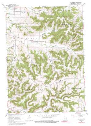
Saint Joseph Topo Map Wisconsin
To zoom in, hover over the map of Saint Joseph
USGS Topo Quad 43091g1 - 1:24,000 scale
| Topo Map Name: | Saint Joseph |
| USGS Topo Quad ID: | 43091g1 |
| Print Size: | ca. 21 1/4" wide x 27" high |
| Southeast Coordinates: | 43.75° N latitude / 91° W longitude |
| Map Center Coordinates: | 43.8125° N latitude / 91.0625° W longitude |
| U.S. State: | WI |
| Filename: | o43091g1.jpg |
| Download Map JPG Image: | Saint Joseph topo map 1:24,000 scale |
| Map Type: | Topographic |
| Topo Series: | 7.5´ |
| Map Scale: | 1:24,000 |
| Source of Map Images: | United States Geological Survey (USGS) |
| Alternate Map Versions: |
St. Joseph WI 1963, updated 1964 Download PDF Buy paper map St. Joseph WI 1963, updated 1992 Download PDF Buy paper map Saint Joseph WI 2010 Download PDF Buy paper map Saint Joseph WI 2013 Download PDF Buy paper map Saint Joseph WI 2015 Download PDF Buy paper map |
1:24,000 Topo Quads surrounding Saint Joseph
> Back to 43091e1 at 1:100,000 scale
> Back to 43090a1 at 1:250,000 scale
> Back to U.S. Topo Maps home
Saint Joseph topo map: Gazetteer
Saint Joseph: Forests
Coulee State Experimental Forest elevation 319m 1046′Saint Joseph: Populated Places
Barre Mills elevation 220m 721′Saint Joseph elevation 397m 1302′
Saint Joseph: Ridges
Cattail Ridge elevation 391m 1282′Saint Joseph Ridge elevation 378m 1240′
Saint Joseph: Valleys
Drectrah Coulee elevation 220m 721′Garbers Coulee elevation 214m 702′
Hagenbarth Coulee elevation 232m 761′
Johns Coulee elevation 222m 728′
Kammel Coulee elevation 278m 912′
Krelbich Coulee elevation 250m 820′
Moonshine Hollow elevation 262m 859′
Pleasant Valley elevation 282m 925′
Russlan Coulee elevation 226m 741′
Saint Joseph Coulee elevation 225m 738′
Tollefson Coulee elevation 218m 715′
Saint Joseph digital topo map on disk
Buy this Saint Joseph topo map showing relief, roads, GPS coordinates and other geographical features, as a high-resolution digital map file on DVD:


