Mound Prairie Topo Map Minnesota
To zoom in, hover over the map of Mound Prairie
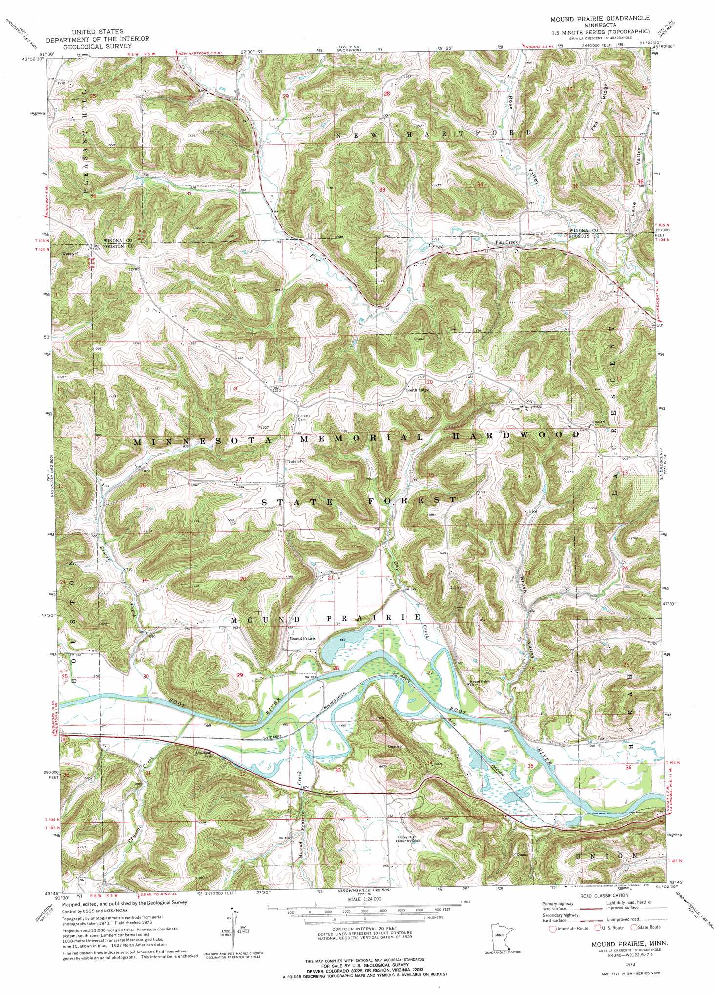
USGS Topo Quad 43091g4 - 1:24,000 scale
| Topo Map Name: | Mound Prairie |
| USGS Topo Quad ID: | 43091g4 |
| Print Size: | ca. 21 1/4" wide x 27" high |
| Southeast Coordinates: | 43.75° N latitude / 91.375° W longitude |
| Map Center Coordinates: | 43.8125° N latitude / 91.4375° W longitude |
| U.S. State: | MN |
| Filename: | o43091g4.jpg |
| Download Map JPG Image: | Mound Prairie topo map 1:24,000 scale |
| Map Type: | Topographic |
| Topo Series: | 7.5´ |
| Map Scale: | 1:24,000 |
| Source of Map Images: | United States Geological Survey (USGS) |
| Alternate Map Versions: |
Mound Prairie MN 1973, updated 1975 Download PDF Buy paper map Mound Prairie MN 2010 Download PDF Buy paper map Mound Prairie MN 2013 Download PDF Buy paper map Mound Prairie MN 2016 Download PDF Buy paper map |
1:24,000 Topo Quads surrounding Mound Prairie
Winona West |
Winona East |
Trempealeau |
Galesville |
Stevenstown |
Wilson |
Witoka |
Pickwick |
Holmen |
Onalaska |
Rushford East |
Houston |
Mound Prairie |
La Crescent |
La Crosse |
Yucatan |
Sheldon |
Caledonia |
Brownsville |
Stoddard |
Spring Grove |
Wilmington |
Eitzen |
Reno |
Genoa |
> Back to 43091e1 at 1:100,000 scale
> Back to 43090a1 at 1:250,000 scale
> Back to U.S. Topo Maps home
Mound Prairie topo map: Gazetteer
Mound Prairie: Dams
Baumgartner Group Structure Dam elevation 309m 1013′Blumentritt Detention Dam elevation 297m 974′
Karl Rauk Detention Dam elevation 252m 826′
Mound Prairie: Populated Places
Pine Creek elevation 216m 708′South Ridge elevation 366m 1200′
Mound Prairie: Post Offices
Mound Prairie Post Office (historical) elevation 222m 728′Mound Prairie: Ridges
Pea Ridge elevation 377m 1236′Mound Prairie: Streams
Crystal Creek elevation 201m 659′Day Creek elevation 201m 659′
Mound Prairie Creek elevation 201m 659′
Silver Creek elevation 203m 666′
Storer Creek elevation 201m 659′
Mound Prairie: Valleys
Brush Valley elevation 203m 666′Hop Hollow elevation 209m 685′
Lane Valley elevation 207m 679′
Rose Valley elevation 210m 688′
Mound Prairie digital topo map on disk
Buy this Mound Prairie topo map showing relief, roads, GPS coordinates and other geographical features, as a high-resolution digital map file on DVD: