Protivin Topo Map Iowa
To zoom in, hover over the map of Protivin
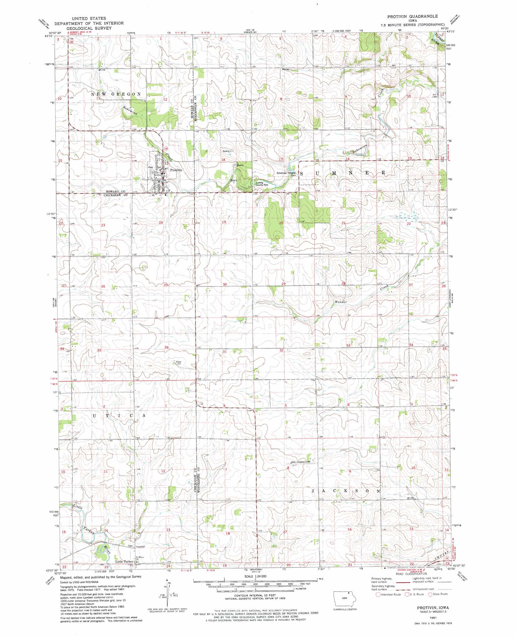
USGS Topo Quad 43092b1 - 1:24,000 scale
| Topo Map Name: | Protivin |
| USGS Topo Quad ID: | 43092b1 |
| Print Size: | ca. 21 1/4" wide x 27" high |
| Southeast Coordinates: | 43.125° N latitude / 92° W longitude |
| Map Center Coordinates: | 43.1875° N latitude / 92.0625° W longitude |
| U.S. State: | IA |
| Filename: | o43092b1.jpg |
| Download Map JPG Image: | Protivin topo map 1:24,000 scale |
| Map Type: | Topographic |
| Topo Series: | 7.5´ |
| Map Scale: | 1:24,000 |
| Source of Map Images: | United States Geological Survey (USGS) |
| Alternate Map Versions: |
Protivin IA 1981, updated 1982 Download PDF Buy paper map Protivin IA 2010 Download PDF Buy paper map Protivin IA 2013 Download PDF Buy paper map Protivin IA 2015 Download PDF Buy paper map |
1:24,000 Topo Quads surrounding Protivin
Lime Springs |
Cresco Nw |
Cresco Ne |
Bluffton |
Burr Oak |
Lourdes |
Cresco Sw |
Cresco Se |
Ridgeway |
Decorah |
Jerico |
Saude |
Protivin |
Fort Atkinson |
Calmar |
New Hampton |
Lawler |
Waucoma |
Saint Lucas |
Festina |
Frederika |
Fredericksburg |
Alpha |
Hawkeye |
West Union |
> Back to 43092a1 at 1:100,000 scale
> Back to 43092a1 at 1:250,000 scale
> Back to U.S. Topo Maps home
Protivin topo map: Gazetteer
Protivin: Airports
Jirak Landing Strip elevation 361m 1184′Protivin: Parks
Chipera Prairie Park elevation 352m 1154′Ludwig County Park elevation 346m 1135′
Sluggo's Pond Park elevation 329m 1079′
Protivin: Populated Places
Little Turkey elevation 337m 1105′Protivin elevation 351m 1151′
Protivin: Post Offices
Little Turkey Post Office (historical) elevation 337m 1105′Protivin Post Office elevation 351m 1151′
Protivin digital topo map on disk
Buy this Protivin topo map showing relief, roads, GPS coordinates and other geographical features, as a high-resolution digital map file on DVD: