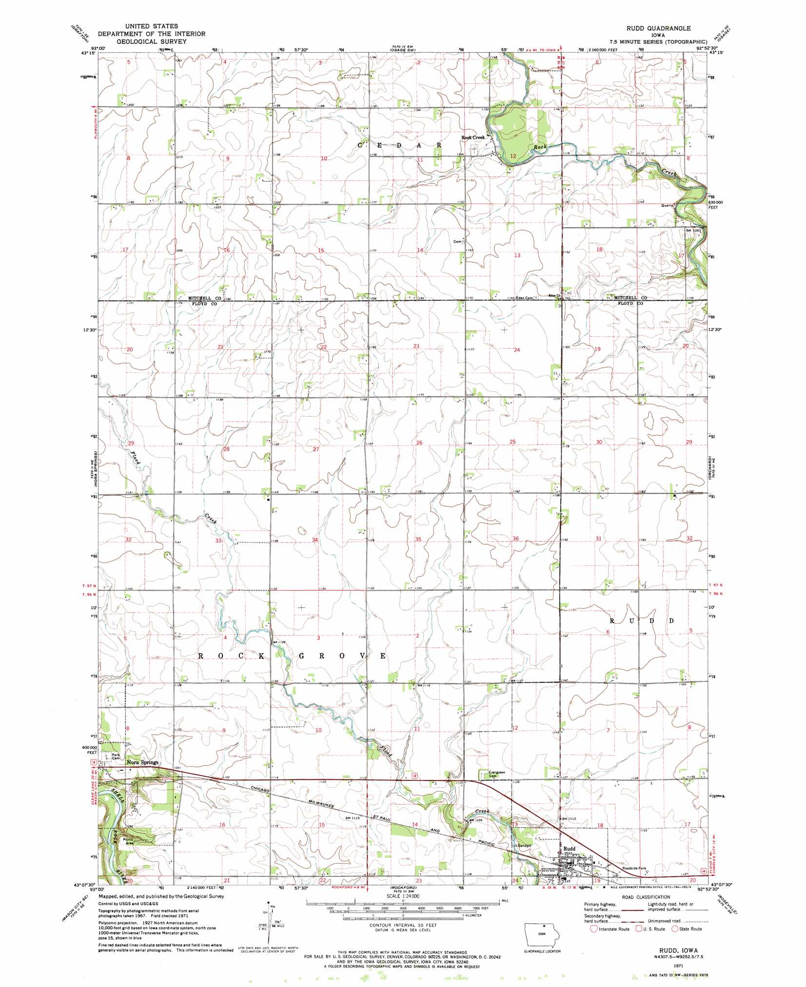
Rudd Topo Map Iowa
To zoom in, hover over the map of Rudd
USGS Topo Quad 43092b8 - 1:24,000 scale
| Topo Map Name: | Rudd |
| USGS Topo Quad ID: | 43092b8 |
| Print Size: | ca. 21 1/4" wide x 27" high |
| Southeast Coordinates: | 43.125° N latitude / 92.875° W longitude |
| Map Center Coordinates: | 43.1875° N latitude / 92.9375° W longitude |
| U.S. State: | IA |
| Filename: | o43092b8.jpg |
| Download Map JPG Image: | Rudd topo map 1:24,000 scale |
| Map Type: | Topographic |
| Topo Series: | 7.5´ |
| Map Scale: | 1:24,000 |
| Source of Map Images: | United States Geological Survey (USGS) |
| Alternate Map Versions: |
Rudd IA 1971, updated 1973 Download PDF Buy paper map Rudd IA 2010 Download PDF Buy paper map Rudd IA 2013 Download PDF Buy paper map Rudd IA 2015 Download PDF Buy paper map |
1:24,000 Topo Quads surrounding Rudd
Northwood |
Carpenter |
Saint Ansgar |
Stacyville |
Little Cedar |
Manly |
Grafton |
Osage Sw |
Osage |
New Haven |
Mason City |
Nora Springs |
Rudd |
Orchard |
Floyd |
Hanford |
Mason City Se |
Rockford |
Roseville |
Charles City |
Sheffield |
Dougherty |
Aureola |
Greene |
Nashua Nw |
> Back to 43092a1 at 1:100,000 scale
> Back to 43092a1 at 1:250,000 scale
> Back to U.S. Topo Maps home
Rudd topo map: Gazetteer
Rudd: Airports
Folkerts Airport elevation 352m 1154′Rudd: Parks
Flood Creek Hunting Preserve elevation 338m 1108′Mathers Woods elevation 330m 1082′
Rudd: Populated Places
Rock Creek elevation 343m 1125′Rudd elevation 338m 1108′
Rudd: Post Offices
Dramen Post Office (historical) elevation 350m 1148′Flood Creek Post Office (historical) elevation 344m 1128′
Meroa Post Office (historical) elevation 345m 1131′
Rock Grove City Post Office (historical) elevation 338m 1108′
Rudd Post Office elevation 342m 1122′
Rudd digital topo map on disk
Buy this Rudd topo map showing relief, roads, GPS coordinates and other geographical features, as a high-resolution digital map file on DVD: