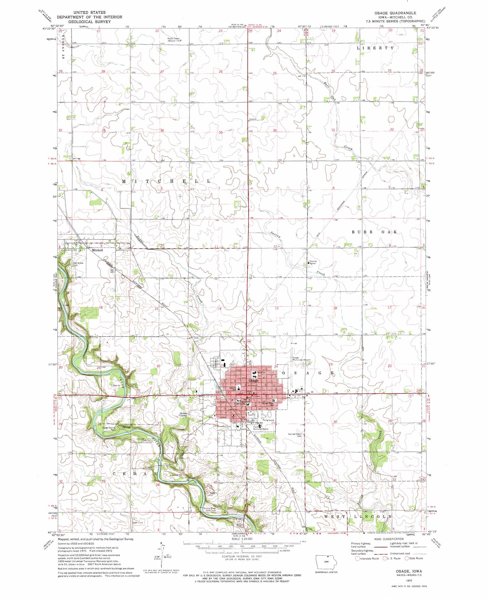
Osage Topo Map Iowa
To zoom in, hover over the map of Osage
USGS Topo Quad 43092c7 - 1:24,000 scale
| Topo Map Name: | Osage |
| USGS Topo Quad ID: | 43092c7 |
| Print Size: | ca. 21 1/4" wide x 27" high |
| Southeast Coordinates: | 43.25° N latitude / 92.75° W longitude |
| Map Center Coordinates: | 43.3125° N latitude / 92.8125° W longitude |
| U.S. State: | IA |
| Filename: | o43092c7.jpg |
| Download Map JPG Image: | Osage topo map 1:24,000 scale |
| Map Type: | Topographic |
| Topo Series: | 7.5´ |
| Map Scale: | 1:24,000 |
| Source of Map Images: | United States Geological Survey (USGS) |
| Alternate Map Versions: |
Osage IA 1972, updated 1974 Download PDF Buy paper map Osage IA 2010 Download PDF Buy paper map Osage IA 2013 Download PDF Buy paper map Osage IA 2015 Download PDF Buy paper map |
1:24,000 Topo Quads surrounding Osage
London |
Lyle |
Rose Creek |
Adams |
Le Roy |
Carpenter |
Saint Ansgar |
Stacyville |
Little Cedar |
Mcintire |
Grafton |
Osage Sw |
Osage |
New Haven |
Riceville |
Nora Springs |
Rudd |
Orchard |
Floyd |
Colwell |
Mason City Se |
Rockford |
Roseville |
Charles City |
Bassett |
> Back to 43092a1 at 1:100,000 scale
> Back to 43092a1 at 1:250,000 scale
> Back to U.S. Topo Maps home
Osage topo map: Gazetteer
Osage: Airports
Osage Municipal Airport elevation 354m 1161′Osage: Bridges
Highway Number Nine Bridge elevation 324m 1062′Osage: Parks
Falk Wildlife Area elevation 357m 1171′Old Stone Mill Historical Marker elevation 357m 1171′
Osage City Park elevation 356m 1167′
Osage Spring Park elevation 325m 1066′
Student Hamlin Garland Historical Marker elevation 358m 1174′
The Dragoons - Mitchell County Historical Marker elevation 352m 1154′
Osage: Populated Places
Mitchell elevation 363m 1190′Osage elevation 360m 1181′
Osage: Post Offices
Fuller Post Office (historical) elevation 357m 1171′Mitchell Post Office (historical) elevation 363m 1190′
Osage Post Office elevation 359m 1177′
West Mitchell Post Office (historical) elevation 362m 1187′
Osage: Streams
Sugar Creek elevation 320m 1049′Osage: Trails
Cedar River Greenbelt Trail elevation 327m 1072′Osage digital topo map on disk
Buy this Osage topo map showing relief, roads, GPS coordinates and other geographical features, as a high-resolution digital map file on DVD: