Le Roy Topo Map Minnesota
To zoom in, hover over the map of Le Roy
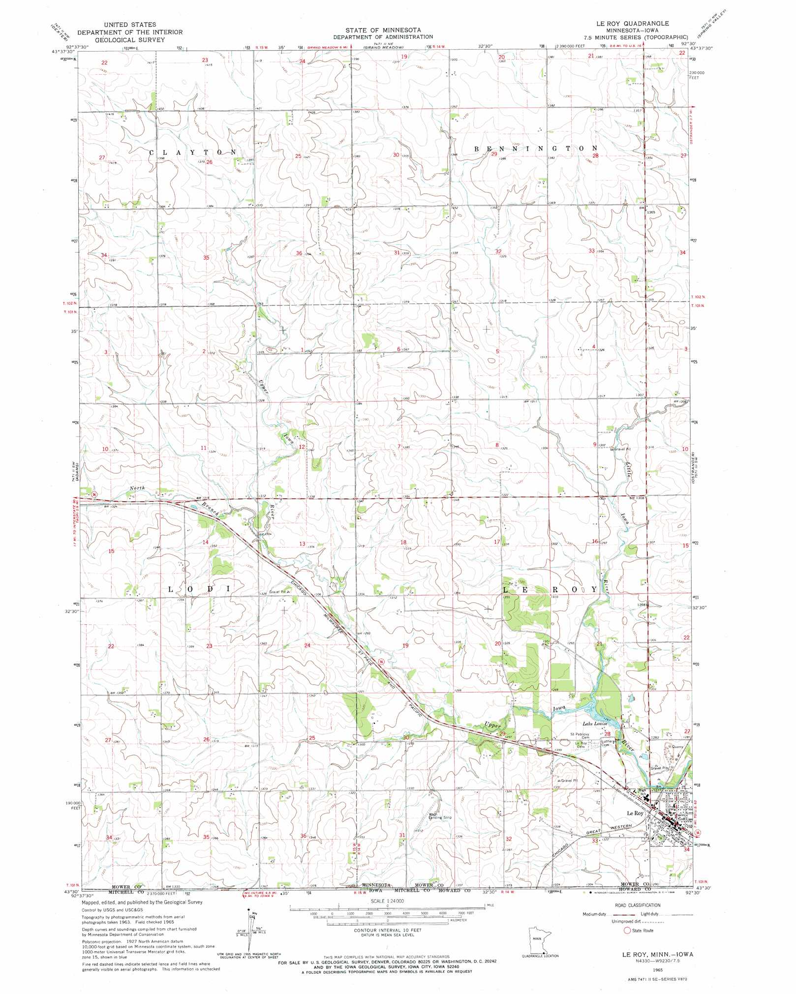
USGS Topo Quad 43092e5 - 1:24,000 scale
| Topo Map Name: | Le Roy |
| USGS Topo Quad ID: | 43092e5 |
| Print Size: | ca. 21 1/4" wide x 27" high |
| Southeast Coordinates: | 43.5° N latitude / 92.5° W longitude |
| Map Center Coordinates: | 43.5625° N latitude / 92.5625° W longitude |
| U.S. States: | MN, IA |
| Filename: | o43092e5.jpg |
| Download Map JPG Image: | Le Roy topo map 1:24,000 scale |
| Map Type: | Topographic |
| Topo Series: | 7.5´ |
| Map Scale: | 1:24,000 |
| Source of Map Images: | United States Geological Survey (USGS) |
| Alternate Map Versions: |
Le Roy MN 1965, updated 1966 Download PDF Buy paper map Le Roy MN 2010 Download PDF Buy paper map Le Roy MN 2013 Download PDF Buy paper map Le Roy MN 2016 Download PDF Buy paper map |
1:24,000 Topo Quads surrounding Le Roy
Sargeant |
High Forest Sw |
High Forest |
Stewartville |
Washington |
Brownsdale |
Dexter |
Grand Meadow |
Spring Valley |
Wykoff |
Rose Creek |
Adams |
Le Roy |
Ostrander |
Cherry Grove |
Stacyville |
Little Cedar |
Mcintire |
Lime Springs Nw |
Lime Springs |
Osage |
New Haven |
Riceville |
Saratoga |
Lourdes |
> Back to 43092e1 at 1:100,000 scale
> Back to 43092a1 at 1:250,000 scale
> Back to U.S. Topo Maps home
Le Roy topo map: Gazetteer
Le Roy: Dams
Lake Louise Dam elevation 383m 1256′Le Roy: Lakes
Lake Louise elevation 386m 1266′Le Roy: Parks
Lake Louise State Park elevation 394m 1292′Le Roy: Populated Places
Le Roy elevation 393m 1289′Le Roy Parkside Mobile Home Park elevation 392m 1286′
Le Roy: Post Offices
Le Roy Post Office elevation 393m 1289′Le Roy: Reservoirs
Lake Louise elevation 383m 1256′Le Roy: Streams
Little Iowa River elevation 386m 1266′North Branch Upper Iowa River elevation 395m 1295′
Le Roy digital topo map on disk
Buy this Le Roy topo map showing relief, roads, GPS coordinates and other geographical features, as a high-resolution digital map file on DVD: