Grand Meadow Topo Map Minnesota
To zoom in, hover over the map of Grand Meadow
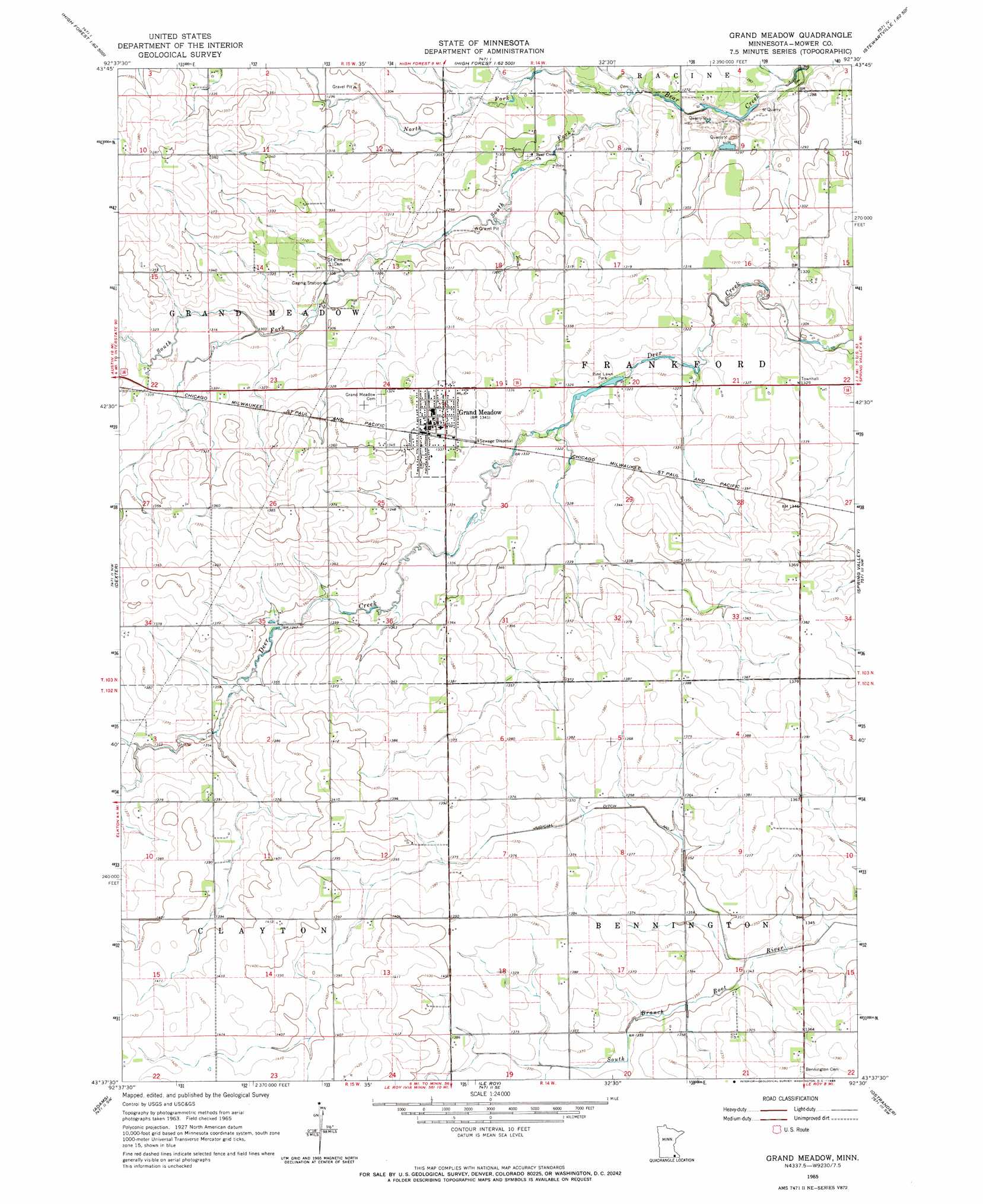
USGS Topo Quad 43092f5 - 1:24,000 scale
| Topo Map Name: | Grand Meadow |
| USGS Topo Quad ID: | 43092f5 |
| Print Size: | ca. 21 1/4" wide x 27" high |
| Southeast Coordinates: | 43.625° N latitude / 92.5° W longitude |
| Map Center Coordinates: | 43.6875° N latitude / 92.5625° W longitude |
| U.S. State: | MN |
| Filename: | o43092f5.jpg |
| Download Map JPG Image: | Grand Meadow topo map 1:24,000 scale |
| Map Type: | Topographic |
| Topo Series: | 7.5´ |
| Map Scale: | 1:24,000 |
| Source of Map Images: | United States Geological Survey (USGS) |
| Alternate Map Versions: |
Grand Meadow MN 1965, updated 1966 Download PDF Buy paper map Grand Meadow MN 2010 Download PDF Buy paper map Grand Meadow MN 2013 Download PDF Buy paper map Grand Meadow MN 2016 Download PDF Buy paper map |
1:24,000 Topo Quads surrounding Grand Meadow
Hayfield |
Rock Dell |
Salem Corners |
Simpson |
Marion |
Sargeant |
High Forest Sw |
High Forest |
Stewartville |
Washington |
Brownsdale |
Dexter |
Grand Meadow |
Spring Valley |
Wykoff |
Rose Creek |
Adams |
Le Roy |
Ostrander |
Cherry Grove |
Stacyville |
Little Cedar |
Mcintire |
Lime Springs Nw |
Lime Springs |
> Back to 43092e1 at 1:100,000 scale
> Back to 43092a1 at 1:250,000 scale
> Back to U.S. Topo Maps home
Grand Meadow topo map: Gazetteer
Grand Meadow: Airports
Grand Meadow Airport elevation 400m 1312′Grand Meadow: Canals
Judicial Ditch Number One elevation 418m 1371′Grand Meadow: Dams
Pine Lawn Park Structure Dam elevation 405m 1328′Grand Meadow: Parks
Pine Lawn Park elevation 402m 1318′Grand Meadow: Populated Places
Grand Meadow elevation 412m 1351′Meadow Mobile Home Park elevation 406m 1332′
Grand Meadow: Post Offices
Grand Meadow Post Office elevation 409m 1341′Grand Meadow: Streams
North Fork Bear Creek elevation 387m 1269′South Fork Bear Creek elevation 387m 1269′
Grand Meadow digital topo map on disk
Buy this Grand Meadow topo map showing relief, roads, GPS coordinates and other geographical features, as a high-resolution digital map file on DVD: