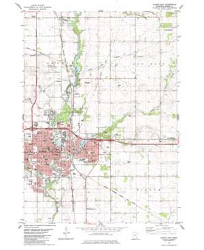
Austin East Topo Map Minnesota
To zoom in, hover over the map of Austin East
USGS Topo Quad 43092f8 - 1:24,000 scale
| Topo Map Name: | Austin East |
| USGS Topo Quad ID: | 43092f8 |
| Print Size: | ca. 21 1/4" wide x 27" high |
| Southeast Coordinates: | 43.625° N latitude / 92.875° W longitude |
| Map Center Coordinates: | 43.6875° N latitude / 92.9375° W longitude |
| U.S. State: | MN |
| Filename: | o43092f8.jpg |
| Download Map JPG Image: | Austin East topo map 1:24,000 scale |
| Map Type: | Topographic |
| Topo Series: | 7.5´ |
| Map Scale: | 1:24,000 |
| Source of Map Images: | United States Geological Survey (USGS) |
| Alternate Map Versions: |
Austin East MN 1982, updated 1983 Download PDF Buy paper map Austin East MN 2010 Download PDF Buy paper map Austin East MN 2013 Download PDF Buy paper map Austin East MN 2016 Download PDF Buy paper map |
1:24,000 Topo Quads surrounding Austin East
> Back to 43092e1 at 1:100,000 scale
> Back to 43092a1 at 1:250,000 scale
> Back to U.S. Topo Maps home
Austin East topo map: Gazetteer
Austin East: Airports
Austin Municipal Airport elevation 374m 1227′Saint Olaf Hospital Heliport elevation 367m 1204′
Austin East: Bridges
Historic Roosevelt Bridge elevation 359m 1177′Austin East: Canals
Judicial Ditch Number Five elevation 375m 1230′Austin East: Crossings
Interchange 177 elevation 373m 1223′Interchange 180 elevation 370m 1213′
Austin East: Dams
Cedar River Dam elevation 359m 1177′Dobbins Creek Dam elevation 380m 1246′
Ramsey Dam elevation 368m 1207′
Austin East: Lakes
East Side Lake elevation 360m 1181′Austin East: Parks
Community Park elevation 366m 1200′Crane Park elevation 367m 1204′
Cullen Park elevation 365m 1197′
Decker Park elevation 369m 1210′
Dreisner Park elevation 359m 1177′
East Side Lake Park elevation 367m 1204′
Fayette Sherman Park elevation 366m 1200′
Galloway Park elevation 369m 1210′
Hillside Park elevation 365m 1197′
Horace Austin Park elevation 367m 1204′
Jay C Hormel Nature Center elevation 368m 1207′
Kaufman Park elevation 364m 1194′
Lafayette Park elevation 360m 1181′
Lions Park elevation 365m 1197′
Marcusen Park elevation 359m 1177′
Mower County Veterans Memorial elevation 368m 1207′
Neveln Park elevation 371m 1217′
North West Park elevation 374m 1227′
South Grove Park elevation 363m 1190′
Sterling Park elevation 369m 1210′
Sulton Park elevation 364m 1194′
Todd Park elevation 367m 1204′
Austin East: Populated Places
Andyville elevation 379m 1243′Austin elevation 368m 1207′
Austin Mobile Home Park elevation 369m 1210′
Countryside Mobile Home Park elevation 369m 1210′
Lansing elevation 374m 1227′
Mapleview elevation 372m 1220′
Nicolville elevation 379m 1243′
Ramsey elevation 371m 1217′
Austin East: Post Offices
Austin Post Office elevation 367m 1204′Lansing Post Office elevation 374m 1227′
Ramsey Post Office (historical) elevation 371m 1217′
Austin East: Reservoirs
East Side Lake elevation 380m 1246′Mill Pond elevation 359m 1177′
Ramsey Mill Pond elevation 368m 1207′
Austin East: Streams
Dobbins Creek elevation 359m 1177′Murphy Creek elevation 362m 1187′
Turtle Creek elevation 357m 1171′
Wolf Creek elevation 362m 1187′
Austin East digital topo map on disk
Buy this Austin East topo map showing relief, roads, GPS coordinates and other geographical features, as a high-resolution digital map file on DVD:


