Washington Topo Map Minnesota
To zoom in, hover over the map of Washington
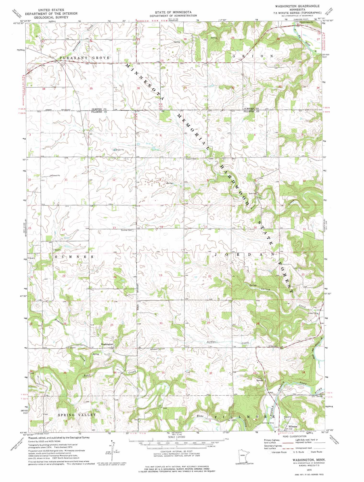
USGS Topo Quad 43092g3 - 1:24,000 scale
| Topo Map Name: | Washington |
| USGS Topo Quad ID: | 43092g3 |
| Print Size: | ca. 21 1/4" wide x 27" high |
| Southeast Coordinates: | 43.75° N latitude / 92.25° W longitude |
| Map Center Coordinates: | 43.8125° N latitude / 92.3125° W longitude |
| U.S. State: | MN |
| Filename: | o43092g3.jpg |
| Download Map JPG Image: | Washington topo map 1:24,000 scale |
| Map Type: | Topographic |
| Topo Series: | 7.5´ |
| Map Scale: | 1:24,000 |
| Source of Map Images: | United States Geological Survey (USGS) |
| Alternate Map Versions: |
Washington MN 1974, updated 1976 Download PDF Buy paper map Washington MN 2010 Download PDF Buy paper map Washington MN 2013 Download PDF Buy paper map Washington MN 2016 Download PDF Buy paper map |
1:24,000 Topo Quads surrounding Washington
Douglas |
Rochester |
Chester |
Plainview Sw |
Elba |
Salem Corners |
Simpson |
Marion |
Eyota |
Saint Charles |
High Forest |
Stewartville |
Washington |
Chatfield |
Pilot Mound |
Grand Meadow |
Spring Valley |
Wykoff |
Fountain |
Preston |
Le Roy |
Ostrander |
Cherry Grove |
Greenleafton |
Harmony |
> Back to 43092e1 at 1:100,000 scale
> Back to 43092a1 at 1:250,000 scale
> Back to U.S. Topo Maps home
Washington topo map: Gazetteer
Washington: Airports
Flying A Airport elevation 403m 1322′Washington: Dams
Ness, Rudlong and Ellenberg Group Dam elevation 353m 1158′Rudlong Structure Dam elevation 386m 1266′
Washington: Populated Places
Cummingsville elevation 308m 1010′Washington elevation 350m 1148′
Washington: Post Offices
Washington Post Office (historical) elevation 350m 1148′Washington: Streams
Kedron Creek elevation 335m 1099′Washington digital topo map on disk
Buy this Washington topo map showing relief, roads, GPS coordinates and other geographical features, as a high-resolution digital map file on DVD: