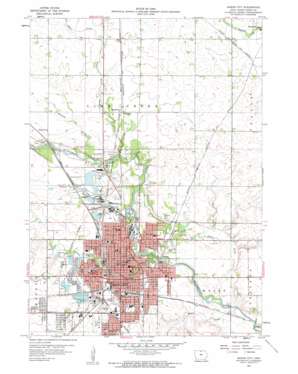
Mason City Topo Map Iowa
To zoom in, hover over the map of Mason City
USGS Topo Quad 43093b2 - 1:24,000 scale
| Topo Map Name: | Mason City |
| USGS Topo Quad ID: | 43093b2 |
| Print Size: | ca. 21 1/4" wide x 27" high |
| Southeast Coordinates: | 43.125° N latitude / 93.125° W longitude |
| Map Center Coordinates: | 43.1875° N latitude / 93.1875° W longitude |
| U.S. State: | IA |
| Filename: | o43093b2.jpg |
| Download Map JPG Image: | Mason City topo map 1:24,000 scale |
| Map Type: | Topographic |
| Topo Series: | 7.5´ |
| Map Scale: | 1:24,000 |
| Source of Map Images: | United States Geological Survey (USGS) |
| Alternate Map Versions: |
Mason City IA 1959, updated 1960 Download PDF Buy paper map Mason City IA 2010 Download PDF Buy paper map Mason City IA 2013 Download PDF Buy paper map Mason City IA 2015 Download PDF Buy paper map |
1:24,000 Topo Quads surrounding Mason City
> Back to 43093a1 at 1:100,000 scale
> Back to 43092a1 at 1:250,000 scale
> Back to U.S. Topo Maps home
Mason City topo map: Gazetteer
Mason City: Bridges
Meredith Willson - Music Man Footbridge elevation 331m 1085′State Street Bridge elevation 331m 1085′
Stewart Avenue Bridge elevation 327m 1072′
Winnebago River Bridge elevation 332m 1089′
Mason City: Mines
Mason City Quarry elevation 344m 1128′Mason City: Parks
Asbury Park elevation 322m 1056′Blue Pit elevation 343m 1125′
Central Park elevation 345m 1131′
East Park elevation 328m 1076′
Frederick Hanford Park elevation 359m 1177′
Georgia L Hanford MacNider Park elevation 352m 1154′
Kiwanis Park elevation 338m 1108′
Lester Milligan Park elevation 343m 1125′
Lewis Kipper Park elevation 344m 1128′
Lime Creek Nature Center elevation 342m 1122′
MacNiders Woods elevation 338m 1108′
Margaret MacNider Park elevation 331m 1085′
McNider Park elevation 336m 1102′
Morgan Park elevation 345m 1131′
Norris Youth Softball Complex elevation 327m 1072′
Oak Park elevation 329m 1079′
Parkers Woods elevation 339m 1112′
Ray Rorick Park elevation 348m 1141′
South Washington Park elevation 349m 1145′
Spring Creek Preserve elevation 341m 1118′
West Park elevation 338m 1108′
Mason City: Populated Places
Central Heights elevation 360m 1181′Freeman elevation 350m 1148′
Mason City elevation 344m 1128′
Plymouth Junction elevation 349m 1145′
Mason City: Post Offices
Freeman Post Office (historical) elevation 350m 1148′Lime Creek Post Office (historical) elevation 343m 1125′
Mason City Post Office elevation 344m 1128′
Mason City: Reservoirs
Briarstone Lake elevation 354m 1161′Lake Cona Toma elevation 340m 1115′
Spring Lake elevation 346m 1135′
Sunset Lake elevation 343m 1125′
Mason City: Streams
Blair Creek elevation 344m 1128′Calmus Creek elevation 327m 1072′
Cheslea Creek elevation 341m 1118′
Ideal Creek elevation 323m 1059′
Mason Creek elevation 319m 1046′
Spring Creek elevation 330m 1082′
Wharam Creek elevation 332m 1089′
Willow Creek elevation 326m 1069′
Mason City digital topo map on disk
Buy this Mason City topo map showing relief, roads, GPS coordinates and other geographical features, as a high-resolution digital map file on DVD:


