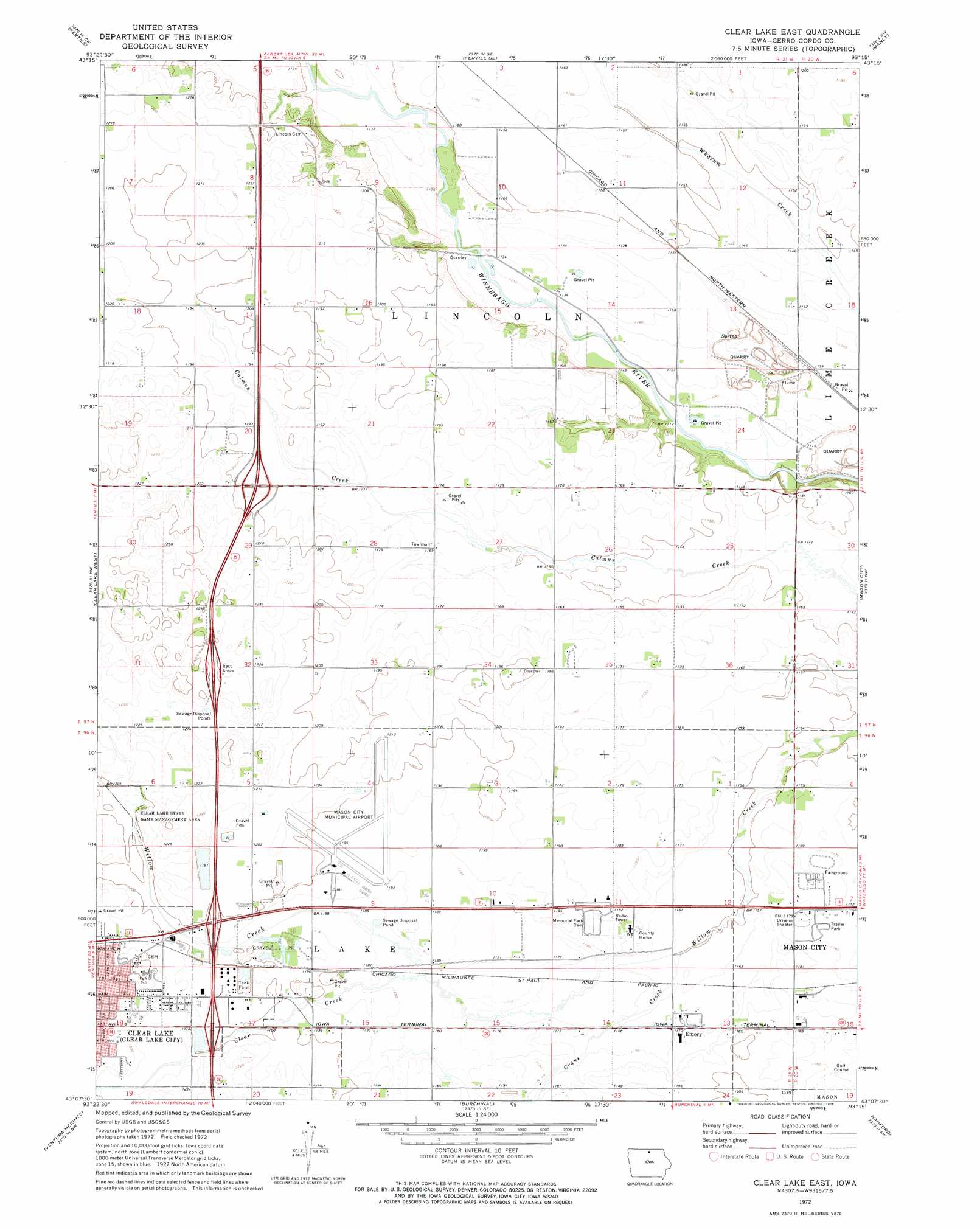
Clear Lake East Topo Map Iowa
To zoom in, hover over the map of Clear Lake East
USGS Topo Quad 43093b3 - 1:24,000 scale
| Topo Map Name: | Clear Lake East |
| USGS Topo Quad ID: | 43093b3 |
| Print Size: | ca. 21 1/4" wide x 27" high |
| Southeast Coordinates: | 43.125° N latitude / 93.25° W longitude |
| Map Center Coordinates: | 43.1875° N latitude / 93.3125° W longitude |
| U.S. State: | IA |
| Filename: | o43093b3.jpg |
| Download Map JPG Image: | Clear Lake East topo map 1:24,000 scale |
| Map Type: | Topographic |
| Topo Series: | 7.5´ |
| Map Scale: | 1:24,000 |
| Source of Map Images: | United States Geological Survey (USGS) |
| Alternate Map Versions: |
Clear Lake East IA 1972, updated 1975 Download PDF Buy paper map Clear Lake East IA 2010 Download PDF Buy paper map Clear Lake East IA 2013 Download PDF Buy paper map Clear Lake East IA 2015 Download PDF Buy paper map |
1:24,000 Topo Quads surrounding Clear Lake East
Lake Mills |
Bristol |
Fertile Ne |
Northwood |
Carpenter |
Pilot Knob |
Fertile |
Fertile Se |
Manly |
Grafton |
Miller |
Clear Lake West |
Clear Lake East |
Mason City |
Nora Springs |
Garner |
Ventura Heights |
Burchinal |
Hanford |
Mason City Se |
Goodell |
Thornton |
Swaledale |
Sheffield |
Dougherty |
> Back to 43093a1 at 1:100,000 scale
> Back to 43092a1 at 1:250,000 scale
> Back to U.S. Topo Maps home
Clear Lake East topo map: Gazetteer
Clear Lake East: Airports
Mason City Municipal Airport elevation 364m 1194′Clear Lake East: Crossings
Interchange 193 elevation 371m 1217′Interchange 194 elevation 365m 1197′
Interchange 197 elevation 363m 1190′
Clear Lake East: Parks
Blair Meadows Preserve elevation 346m 1135′Clear Lake State Game Management Area elevation 362m 1187′
Fieldstone Park elevation 369m 1210′
Historic Northern Iowa State Historical Marker elevation 378m 1240′
Iowa Trolley Park elevation 366m 1200′
Marion Park elevation 377m 1236′
River City Greenbelt Trail System elevation 355m 1164′
Clear Lake East: Populated Places
Creamery elevation 366m 1200′Emery elevation 357m 1171′
Orchard Park Mobile Home Court elevation 371m 1217′
Registry Park elevation 359m 1177′
Clear Lake East: Post Offices
Creamery Post Office (historical) elevation 366m 1200′Emery Post Office (historical) elevation 357m 1171′
Rock Post Office (historical) elevation 374m 1227′
Wheelerwood Post Office (historical) elevation 352m 1154′
Clear Lake East: Streams
Clear Creek elevation 358m 1174′Crane Creek elevation 351m 1151′
Clear Lake East digital topo map on disk
Buy this Clear Lake East topo map showing relief, roads, GPS coordinates and other geographical features, as a high-resolution digital map file on DVD: