Pilot Knob Topo Map Iowa
To zoom in, hover over the map of Pilot Knob
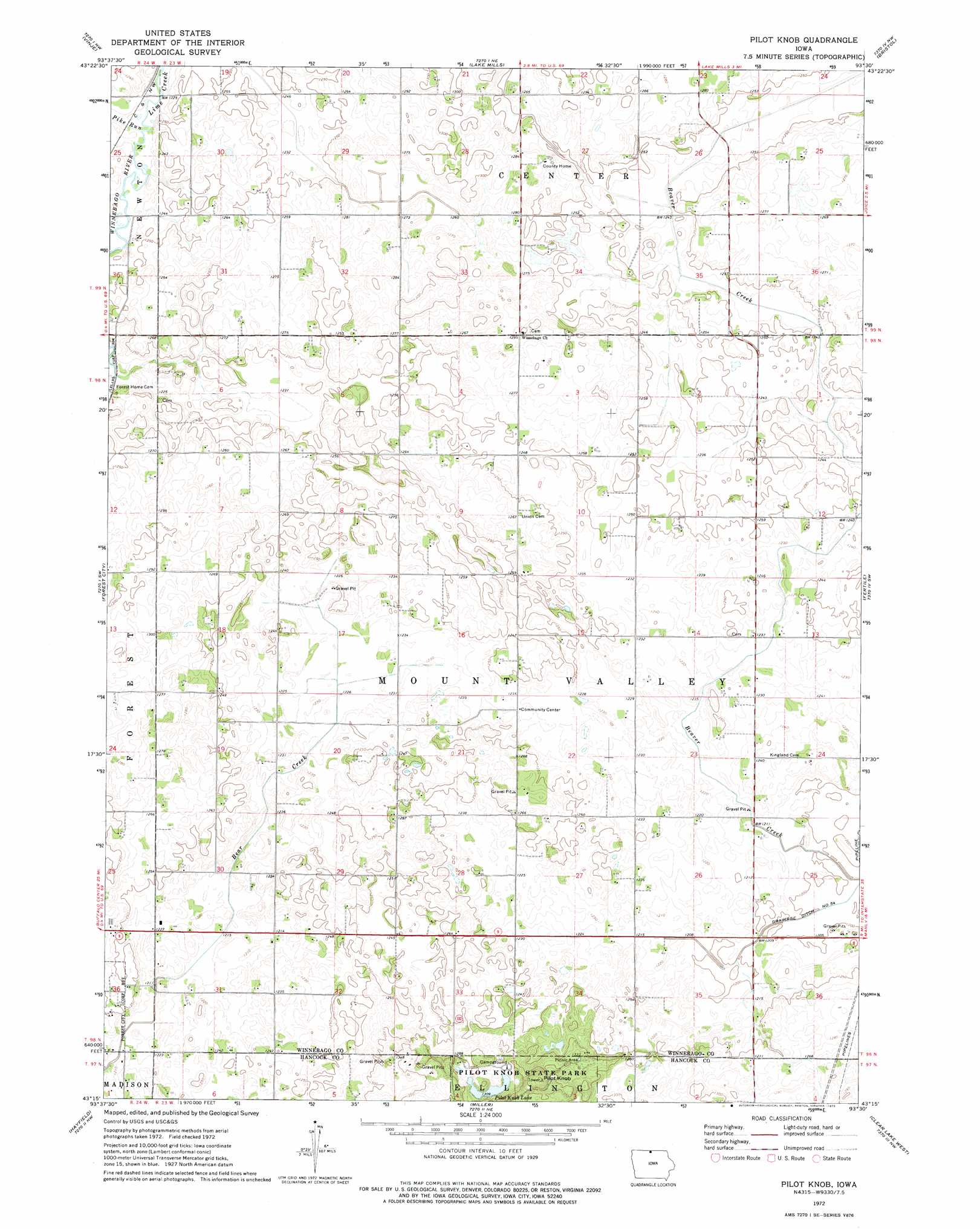
USGS Topo Quad 43093c5 - 1:24,000 scale
| Topo Map Name: | Pilot Knob |
| USGS Topo Quad ID: | 43093c5 |
| Print Size: | ca. 21 1/4" wide x 27" high |
| Southeast Coordinates: | 43.25° N latitude / 93.5° W longitude |
| Map Center Coordinates: | 43.3125° N latitude / 93.5625° W longitude |
| U.S. State: | IA |
| Filename: | o43093c5.jpg |
| Download Map JPG Image: | Pilot Knob topo map 1:24,000 scale |
| Map Type: | Topographic |
| Topo Series: | 7.5´ |
| Map Scale: | 1:24,000 |
| Source of Map Images: | United States Geological Survey (USGS) |
| Alternate Map Versions: |
Pilot Knob IA 1972, updated 1975 Download PDF Buy paper map Pilot Knob IA 1972, updated 1975 Download PDF Buy paper map Pilot Knob IA 2010 Download PDF Buy paper map Pilot Knob IA 2013 Download PDF Buy paper map Pilot Knob IA 2015 Download PDF Buy paper map |
1:24,000 Topo Quads surrounding Pilot Knob
Bricelyn |
Kiester |
Conger |
Emmons |
Glenville |
Buffalo Center Ne |
Vinje |
Lake Mills |
Bristol |
Fertile Ne |
Thompson |
Forest City |
Pilot Knob |
Fertile |
Fertile Se |
Crystal Lake |
Hayfield |
Miller |
Clear Lake West |
Clear Lake East |
Britt |
Duncan |
Garner |
Ventura Heights |
Burchinal |
> Back to 43093a1 at 1:100,000 scale
> Back to 43092a1 at 1:250,000 scale
> Back to U.S. Topo Maps home
Pilot Knob topo map: Gazetteer
Pilot Knob: Canals
Drainage Ditch Number 54 elevation 365m 1197′Pilot Knob: Dams
Pilot Knob Lake Dam elevation 412m 1351′Pilot Knob: Lakes
Bear Lake (historical) elevation 372m 1220′Pilot Knob Lake elevation 400m 1312′
Pilot Knob: Parks
C A Block Wildlife Area elevation 372m 1220′Pilot Knob: Populated Places
Ratna (historical) elevation 380m 1246′Pilot Knob: Post Offices
Benson Grove Post Office (historical) elevation 384m 1259′Delano Post Office (historical) elevation 387m 1269′
Mount Valley Post Office (historical) elevation 376m 1233′
Ratna Post Office (historical) elevation 380m 1246′
Pilot Knob: Streams
Lime Creek elevation 372m 1220′Pike Run elevation 370m 1213′
Pilot Knob: Summits
Pilot Knob elevation 443m 1453′Pilot Knob digital topo map on disk
Buy this Pilot Knob topo map showing relief, roads, GPS coordinates and other geographical features, as a high-resolution digital map file on DVD: