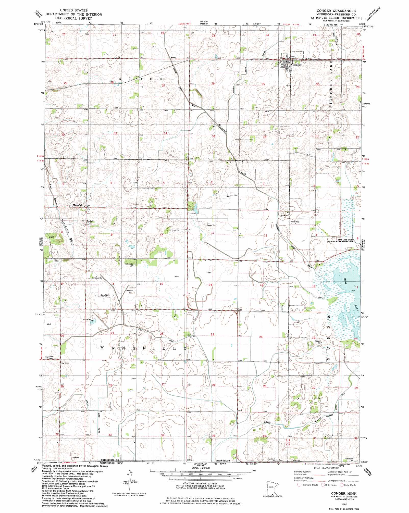
Conger Topo Map Minnesota
To zoom in, hover over the map of Conger
USGS Topo Quad 43093e5 - 1:24,000 scale
| Topo Map Name: | Conger |
| USGS Topo Quad ID: | 43093e5 |
| Print Size: | ca. 21 1/4" wide x 27" high |
| Southeast Coordinates: | 43.5° N latitude / 93.5° W longitude |
| Map Center Coordinates: | 43.5625° N latitude / 93.5625° W longitude |
| U.S. State: | MN |
| Filename: | o43093e5.jpg |
| Download Map JPG Image: | Conger topo map 1:24,000 scale |
| Map Type: | Topographic |
| Topo Series: | 7.5´ |
| Map Scale: | 1:24,000 |
| Source of Map Images: | United States Geological Survey (USGS) |
| Alternate Map Versions: |
Conger MN 1982, updated 1983 Download PDF Buy paper map Conger MN 2010 Download PDF Buy paper map Conger MN 2013 Download PDF Buy paper map Conger MN 2016 Download PDF Buy paper map |
1:24,000 Topo Quads surrounding Conger
Minnesota Lake |
Matawan |
Freeborn |
Hartland |
Ellendale |
Brush Creek |
Wells |
Alden |
Albert Lea West |
Albert Lea East |
Bricelyn |
Kiester |
Conger |
Emmons |
Glenville |
Buffalo Center Ne |
Vinje |
Lake Mills |
Bristol |
Fertile Ne |
Thompson |
Forest City |
Pilot Knob |
Fertile |
Fertile Se |
> Back to 43093e1 at 1:100,000 scale
> Back to 43092a1 at 1:250,000 scale
> Back to U.S. Topo Maps home
Conger topo map: Gazetteer
Conger: Canals
County Ditch Number Five elevation 378m 1240′County Ditch Number Fortyeight elevation 383m 1256′
County Ditch Number Twentythree elevation 384m 1259′
Judicial Ditch Number Twentyfive elevation 381m 1250′
Judicial Ditch Number Twentysix elevation 381m 1250′
Conger: Populated Places
Conger elevation 394m 1292′Mansfield elevation 381m 1250′
Conger: Post Offices
Conger Post Office elevation 394m 1292′Mansfield Post Office (historical) elevation 381m 1250′
Conger: Streams
Steward Creek elevation 377m 1236′Conger digital topo map on disk
Buy this Conger topo map showing relief, roads, GPS coordinates and other geographical features, as a high-resolution digital map file on DVD: