Blooming Prairie Topo Map Minnesota
To zoom in, hover over the map of Blooming Prairie
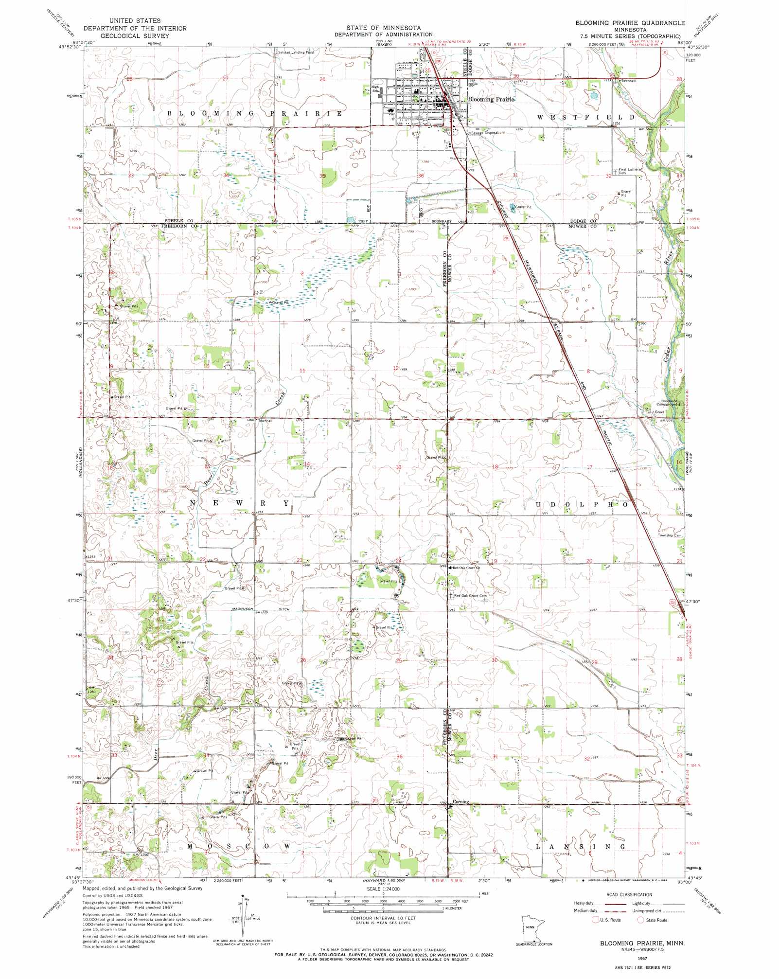
USGS Topo Quad 43093g1 - 1:24,000 scale
| Topo Map Name: | Blooming Prairie |
| USGS Topo Quad ID: | 43093g1 |
| Print Size: | ca. 21 1/4" wide x 27" high |
| Southeast Coordinates: | 43.75° N latitude / 93° W longitude |
| Map Center Coordinates: | 43.8125° N latitude / 93.0625° W longitude |
| U.S. State: | MN |
| Filename: | o43093g1.jpg |
| Download Map JPG Image: | Blooming Prairie topo map 1:24,000 scale |
| Map Type: | Topographic |
| Topo Series: | 7.5´ |
| Map Scale: | 1:24,000 |
| Source of Map Images: | United States Geological Survey (USGS) |
| Alternate Map Versions: |
Blooming Prairie MN 1967, updated 1968 Download PDF Buy paper map Blooming Prairie MN 2010 Download PDF Buy paper map Blooming Prairie MN 2013 Download PDF Buy paper map Blooming Prairie MN 2016 Download PDF Buy paper map |
1:24,000 Topo Quads surrounding Blooming Prairie
Saco |
Owatonna |
Owatonna Se |
Claremont |
Dodge Center |
Hope |
Steele Center |
Bixby |
Hayfield Nw |
Hayfield |
Ellendale |
Hollandale |
Blooming Prairie |
Waltham |
Sargeant |
Albert Lea East |
Hayward |
Austin West |
Austin East |
Brownsdale |
Glenville |
Myrtle |
London |
Lyle |
Rose Creek |
> Back to 43093e1 at 1:100,000 scale
> Back to 43092a1 at 1:250,000 scale
> Back to U.S. Topo Maps home
Blooming Prairie topo map: Gazetteer
Blooming Prairie: Canals
Magnuson Ditch elevation 375m 1230′Blooming Prairie: Populated Places
Bass Mobile Home Park elevation 393m 1289′Blooming Prairie elevation 394m 1292′
Corning elevation 390m 1279′
Blooming Prairie: Post Offices
Blooming Prairie Post Office elevation 392m 1286′Blooming Prairie digital topo map on disk
Buy this Blooming Prairie topo map showing relief, roads, GPS coordinates and other geographical features, as a high-resolution digital map file on DVD: