Algona Topo Map Iowa
To zoom in, hover over the map of Algona
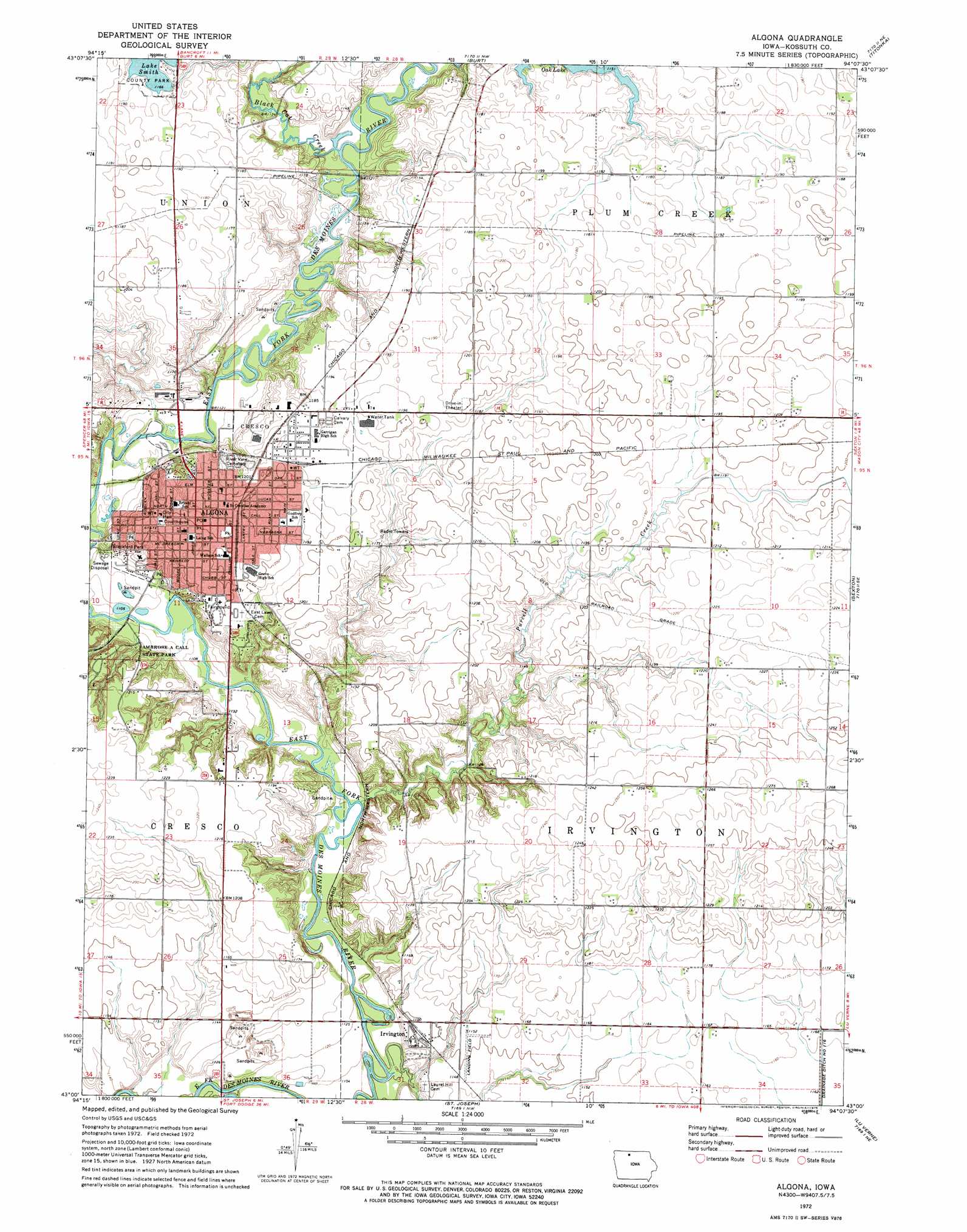
USGS Topo Quad 43094a2 - 1:24,000 scale
| Topo Map Name: | Algona |
| USGS Topo Quad ID: | 43094a2 |
| Print Size: | ca. 21 1/4" wide x 27" high |
| Southeast Coordinates: | 43° N latitude / 94.125° W longitude |
| Map Center Coordinates: | 43.0625° N latitude / 94.1875° W longitude |
| U.S. State: | IA |
| Filename: | o43094a2.jpg |
| Download Map JPG Image: | Algona topo map 1:24,000 scale |
| Map Type: | Topographic |
| Topo Series: | 7.5´ |
| Map Scale: | 1:24,000 |
| Source of Map Images: | United States Geological Survey (USGS) |
| Alternate Map Versions: |
Algona IA 1972, updated 1975 Download PDF Buy paper map Algona IA 1972, updated 1975 Download PDF Buy paper map Algona IA 2010 Download PDF Buy paper map Algona IA 2013 Download PDF Buy paper map Algona IA 2015 Download PDF Buy paper map |
1:24,000 Topo Quads surrounding Algona
Seneca |
Armstrong Se |
Bancroft |
German Valley |
Buffalo Center Sw |
Fenton |
Lone Rock |
Burt |
Titonka |
Woden |
Whittemore |
Hobarton |
Algona |
Sexton |
Wesley |
Unique |
West Bend Ne |
Saint Joseph |
Lu Verne |
Corwith |
Bradgate |
Bode |
Livermore |
Hardy |
Renwick |
> Back to 43094a1 at 1:100,000 scale
> Back to 43094a1 at 1:250,000 scale
> Back to U.S. Topo Maps home
Algona topo map: Gazetteer
Algona: Areas
Smith Prairie elevation 370m 1213′Algona: Dams
Lake Smith Dam elevation 356m 1167′Algona: Lakes
Oak Lake elevation 351m 1151′Algona: Parks
Ambrose A Call State Park elevation 370m 1213′Blackford Park elevation 354m 1161′
Central Park elevation 366m 1200′
First College in Kossuth County Historical Marker elevation 358m 1174′
First Log Cabin in Kossuth County Historical Marker elevation 338m 1108′
Hurlburt Wildlife Area elevation 340m 1115′
Lake Smith Park elevation 355m 1164′
Maple Park elevation 365m 1197′
North Park elevation 340m 1115′
Plum Creek Wildlife Area elevation 344m 1128′
Smith Lake Park elevation 354m 1161′
Smith Wildlife Area elevation 346m 1135′
Stockade to Protect Pioneers Historical Marker elevation 368m 1207′
Veterans Park elevation 341m 1118′
Algona: Populated Places
Algona elevation 364m 1194′Irvington elevation 351m 1151′
Algona: Post Offices
Algona Post Office elevation 364m 1194′Irvington Post Office (historical) elevation 351m 1151′
Plum Creek Post Office (historical) elevation 358m 1174′
Algona: Streams
Black Cat Creek elevation 338m 1108′Purcell Creek elevation 338m 1108′
Algona digital topo map on disk
Buy this Algona topo map showing relief, roads, GPS coordinates and other geographical features, as a high-resolution digital map file on DVD: