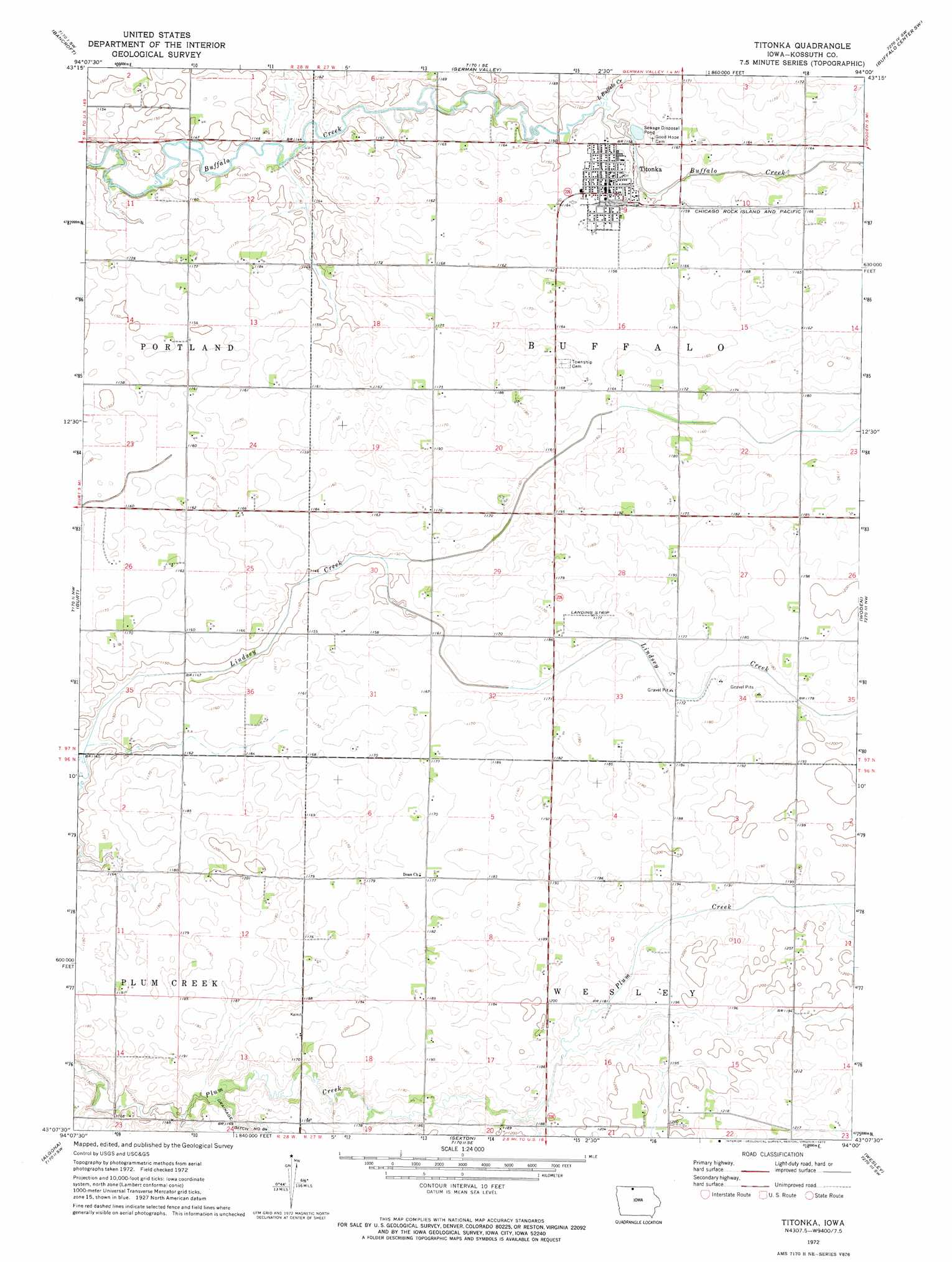
Titonka Topo Map Iowa
To zoom in, hover over the map of Titonka
USGS Topo Quad 43094b1 - 1:24,000 scale
| Topo Map Name: | Titonka |
| USGS Topo Quad ID: | 43094b1 |
| Print Size: | ca. 21 1/4" wide x 27" high |
| Southeast Coordinates: | 43.125° N latitude / 94° W longitude |
| Map Center Coordinates: | 43.1875° N latitude / 94.0625° W longitude |
| U.S. State: | IA |
| Filename: | o43094b1.jpg |
| Download Map JPG Image: | Titonka topo map 1:24,000 scale |
| Map Type: | Topographic |
| Topo Series: | 7.5´ |
| Map Scale: | 1:24,000 |
| Source of Map Images: | United States Geological Survey (USGS) |
| Alternate Map Versions: |
Titonka IA 1972, updated 1975 Download PDF Buy paper map Titonka IA 2010 Download PDF Buy paper map Titonka IA 2013 Download PDF Buy paper map Titonka IA 2015 Download PDF Buy paper map |
1:24,000 Topo Quads surrounding Titonka
Swea City |
Ledyard |
Lakota |
Buffalo Center |
Buffalo Center Ne |
Armstrong Se |
Bancroft |
German Valley |
Buffalo Center Sw |
Thompson |
Lone Rock |
Burt |
Titonka |
Woden |
Crystal Lake |
Hobarton |
Algona |
Sexton |
Wesley |
Britt |
West Bend Ne |
Saint Joseph |
Lu Verne |
Corwith |
Kanawha |
> Back to 43094a1 at 1:100,000 scale
> Back to 43094a1 at 1:250,000 scale
> Back to U.S. Topo Maps home
Titonka topo map: Gazetteer
Titonka: Populated Places
Titonka elevation 354m 1161′Titonka: Post Offices
Titonka Post Office elevation 354m 1161′Titonka: Streams
Little Buffalo Creek elevation 350m 1148′Titonka: Swamps
Michaelsen Marsh elevation 348m 1141′Titonka digital topo map on disk
Buy this Titonka topo map showing relief, roads, GPS coordinates and other geographical features, as a high-resolution digital map file on DVD: