Swea City Topo Map Iowa
To zoom in, hover over the map of Swea City
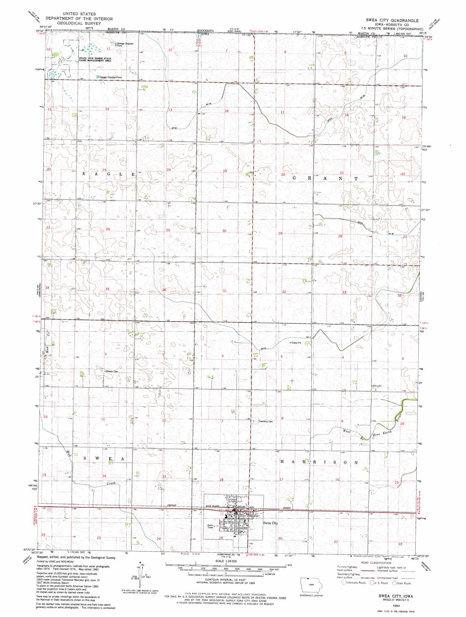
USGS Topo Quad 43094d3 - 1:24,000 scale
| Topo Map Name: | Swea City |
| USGS Topo Quad ID: | 43094d3 |
| Print Size: | ca. 21 1/4" wide x 27" high |
| Southeast Coordinates: | 43.375° N latitude / 94.25° W longitude |
| Map Center Coordinates: | 43.4375° N latitude / 94.3125° W longitude |
| U.S. State: | IA |
| Filename: | o43094d3.jpg |
| Download Map JPG Image: | Swea City topo map 1:24,000 scale |
| Map Type: | Topographic |
| Topo Series: | 7.5´ |
| Map Scale: | 1:24,000 |
| Source of Map Images: | United States Geological Survey (USGS) |
| Alternate Map Versions: |
Swea City IA 1980, updated 1980 Download PDF Buy paper map Swea City IA 2010 Download PDF Buy paper map Swea City IA 2013 Download PDF Buy paper map Swea City IA 2015 Download PDF Buy paper map |
1:24,000 Topo Quads surrounding Swea City
Welcome |
Fairmont |
Granada |
Huntley |
Blue Earth |
Wilbert |
Wilmert Lake |
East Chain |
Pilot Grove |
Elmore |
Dolliver |
Armstrong |
Swea City |
Ledyard |
Lakota |
Ringsted |
Seneca |
Armstrong Se |
Bancroft |
German Valley |
Depew |
Fenton |
Lone Rock |
Burt |
Titonka |
> Back to 43094a1 at 1:100,000 scale
> Back to 43094a1 at 1:250,000 scale
> Back to U.S. Topo Maps home
Swea City topo map: Gazetteer
Swea City: Canals
Ditch Number 60 elevation 348m 1141′Drainage Ditch Number 3 elevation 353m 1158′
Swea City: Lakes
Bancroft Lake (historical) elevation 350m 1148′Swea City: Parks
State Line Marsh State Game Management Area elevation 362m 1187′Swea City: Populated Places
Swea City elevation 360m 1181′Swea City: Post Offices
Swea City Post Office elevation 359m 1177′Swea Post Office (historical) elevation 365m 1197′
Swea City digital topo map on disk
Buy this Swea City topo map showing relief, roads, GPS coordinates and other geographical features, as a high-resolution digital map file on DVD: