Armstrong Topo Map Iowa
To zoom in, hover over the map of Armstrong
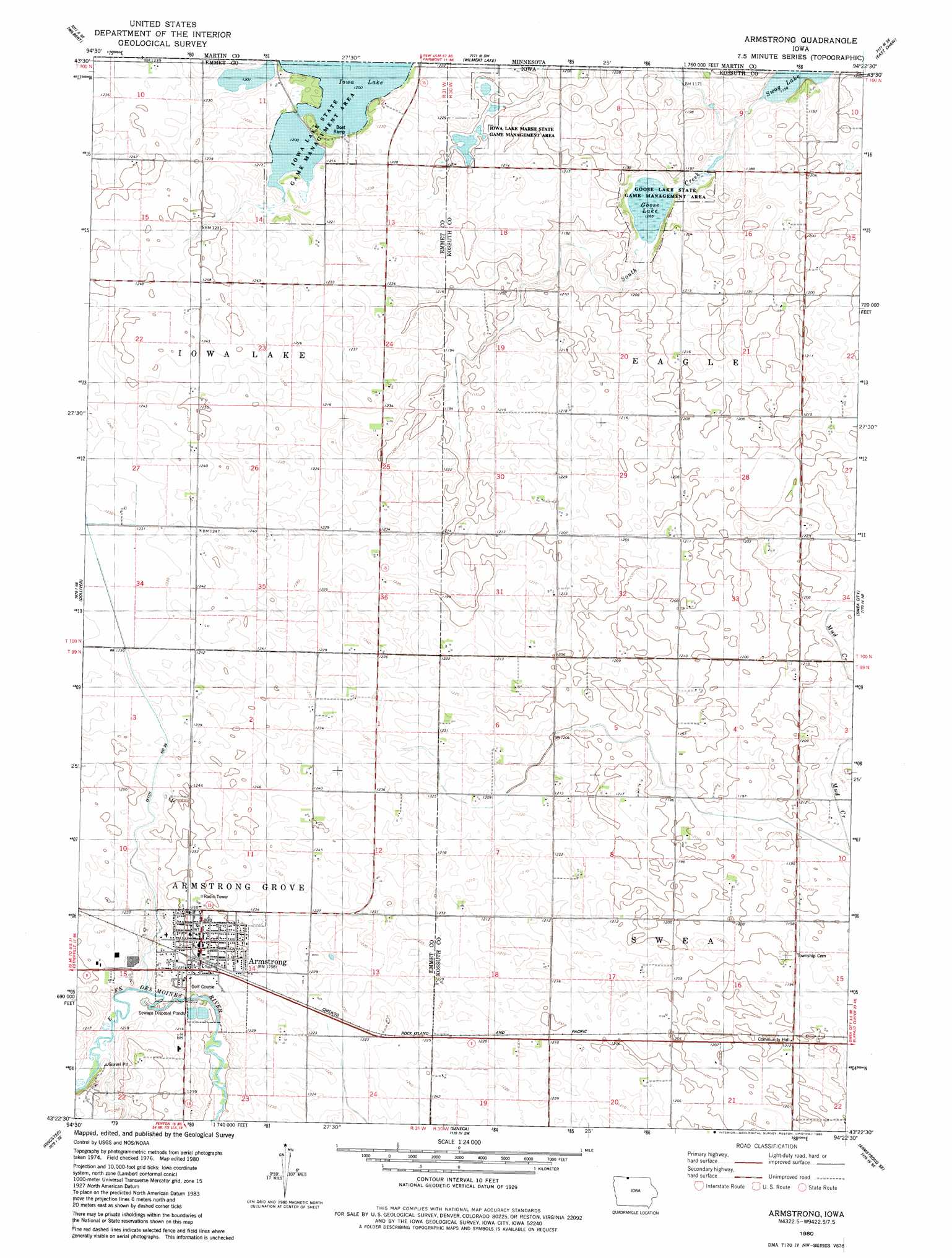
USGS Topo Quad 43094d4 - 1:24,000 scale
| Topo Map Name: | Armstrong |
| USGS Topo Quad ID: | 43094d4 |
| Print Size: | ca. 21 1/4" wide x 27" high |
| Southeast Coordinates: | 43.375° N latitude / 94.375° W longitude |
| Map Center Coordinates: | 43.4375° N latitude / 94.4375° W longitude |
| U.S. State: | IA |
| Filename: | o43094d4.jpg |
| Download Map JPG Image: | Armstrong topo map 1:24,000 scale |
| Map Type: | Topographic |
| Topo Series: | 7.5´ |
| Map Scale: | 1:24,000 |
| Source of Map Images: | United States Geological Survey (USGS) |
| Alternate Map Versions: |
Armstrong IA 1980, updated 1980 Download PDF Buy paper map Armstrong IA 2010 Download PDF Buy paper map Armstrong IA 2013 Download PDF Buy paper map Armstrong IA 2015 Download PDF Buy paper map |
1:24,000 Topo Quads surrounding Armstrong
Sherburn |
Welcome |
Fairmont |
Granada |
Huntley |
Ceylon |
Wilbert |
Wilmert Lake |
East Chain |
Pilot Grove |
Gruver |
Dolliver |
Armstrong |
Swea City |
Ledyard |
Ingham Lake |
Ringsted |
Seneca |
Armstrong Se |
Bancroft |
Graettinger East |
Depew |
Fenton |
Lone Rock |
Burt |
> Back to 43094a1 at 1:100,000 scale
> Back to 43094a1 at 1:250,000 scale
> Back to U.S. Topo Maps home
Armstrong topo map: Gazetteer
Armstrong: Areas
Iowa Lake Marsh State Game Management Area elevation 365m 1197′Armstrong: Canals
Ditch Number 35 elevation 375m 1230′Armstrong: Lakes
Eagle Lake (historical) elevation 361m 1184′Goose Lake elevation 366m 1200′
Iowa Lake elevation 366m 1200′
Swag Lake elevation 352m 1154′
Armstrong: Parks
Goose Lake State Game Management Area elevation 355m 1164′Iowa Lake State Game Management Area elevation 373m 1223′
Armstrong: Populated Places
Armstrong elevation 381m 1250′Swea (historical) elevation 366m 1200′
Armstrong: Post Offices
Armstrong Post Office elevation 381m 1250′Iowa Lake Post Office (historical) elevation 376m 1233′
Armstrong: Streams
South Creek elevation 353m 1158′Armstrong digital topo map on disk
Buy this Armstrong topo map showing relief, roads, GPS coordinates and other geographical features, as a high-resolution digital map file on DVD: