Superior Topo Map Iowa
To zoom in, hover over the map of Superior
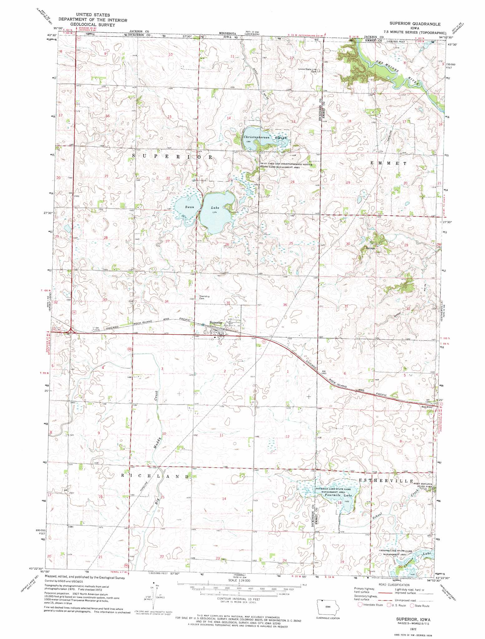
USGS Topo Quad 43094d8 - 1:24,000 scale
| Topo Map Name: | Superior |
| USGS Topo Quad ID: | 43094d8 |
| Print Size: | ca. 21 1/4" wide x 27" high |
| Southeast Coordinates: | 43.375° N latitude / 94.875° W longitude |
| Map Center Coordinates: | 43.4375° N latitude / 94.9375° W longitude |
| U.S. State: | IA |
| Filename: | o43094d8.jpg |
| Download Map JPG Image: | Superior topo map 1:24,000 scale |
| Map Type: | Topographic |
| Topo Series: | 7.5´ |
| Map Scale: | 1:24,000 |
| Source of Map Images: | United States Geological Survey (USGS) |
| Alternate Map Versions: |
Superior IA 1972, updated 1974 Download PDF Buy paper map Superior IA 2010 Download PDF Buy paper map Superior IA 2013 Download PDF Buy paper map Superior IA 2015 Download PDF Buy paper map |
1:24,000 Topo Quads surrounding Superior
Lakefield |
Lakefield Ne |
Jackson Nw |
Alpha |
Sherburn |
Lakefield Sw |
Lakefield Se |
Jackson |
Dunnell |
Ceylon |
Okoboji |
Spirit Lake |
Superior |
Estherville |
Gruver |
Milford |
Spirit Lake Se |
Terril |
Wallingford |
Ingham Lake |
Spencer |
Dickens |
Ruthven |
Graettinger West |
Graettinger East |
> Back to 43094a1 at 1:100,000 scale
> Back to 43094a1 at 1:250,000 scale
> Back to U.S. Topo Maps home
Superior topo map: Gazetteer
Superior: Canals
Ditch Number 23 elevation 414m 1358′Ditch Number 79 elevation 397m 1302′
Superior: Guts
Christopherson Slough elevation 416m 1364′Superior: Lakes
Swan Lake elevation 419m 1374′Superior: Parks
Christopherson Slough / Little Swan Lake Wildlife Management Area elevation 418m 1371′Four Mile Lake Wildlife Management Area elevation 436m 1430′
Superior Marsh Area elevation 433m 1420′
Superior: Populated Places
Superior elevation 457m 1499′Superior: Post Offices
Superior Post Office elevation 457m 1499′Superior: Reservoirs
Fourmile Lake elevation 436m 1430′Superior digital topo map on disk
Buy this Superior topo map showing relief, roads, GPS coordinates and other geographical features, as a high-resolution digital map file on DVD: