Huntley Topo Map Minnesota
To zoom in, hover over the map of Huntley
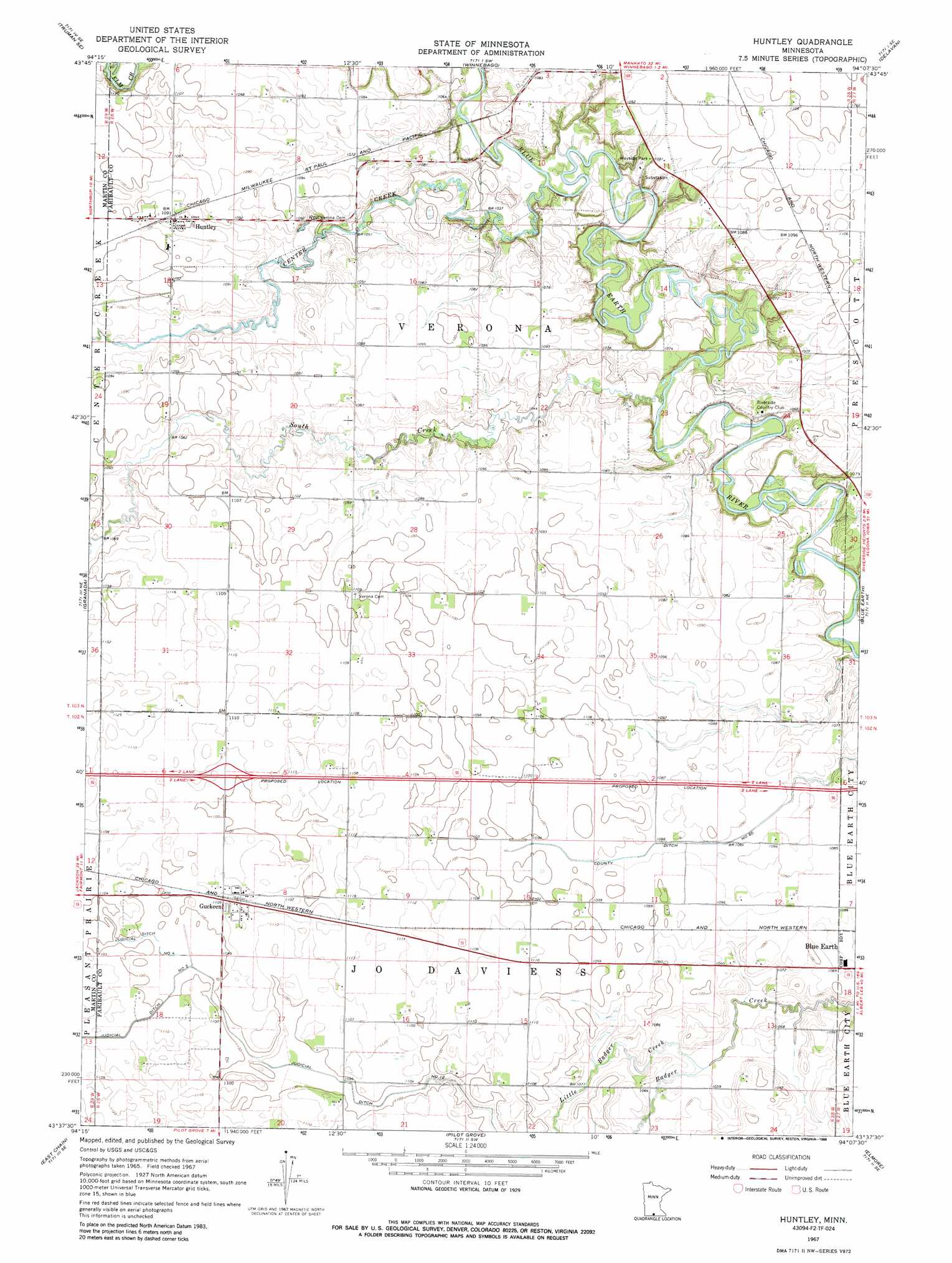
USGS Topo Quad 43094f2 - 1:24,000 scale
| Topo Map Name: | Huntley |
| USGS Topo Quad ID: | 43094f2 |
| Print Size: | ca. 21 1/4" wide x 27" high |
| Southeast Coordinates: | 43.625° N latitude / 94.125° W longitude |
| Map Center Coordinates: | 43.6875° N latitude / 94.1875° W longitude |
| U.S. State: | MN |
| Filename: | o43094f2.jpg |
| Download Map JPG Image: | Huntley topo map 1:24,000 scale |
| Map Type: | Topographic |
| Topo Series: | 7.5´ |
| Map Scale: | 1:24,000 |
| Source of Map Images: | United States Geological Survey (USGS) |
| Alternate Map Versions: |
Huntley MN 1967, updated 1969 Download PDF Buy paper map Huntley MN 1967, updated 1988 Download PDF Buy paper map Huntley MN 2010 Download PDF Buy paper map Huntley MN 2013 Download PDF Buy paper map Huntley MN 2016 Download PDF Buy paper map |
1:24,000 Topo Quads surrounding Huntley
Lewisville |
Willow Creek |
Amboy |
Sterling Center |
Mapleton |
Truman |
Truman Se |
Winnebago |
Delavan |
Easton |
Fairmont |
Granada |
Huntley |
Blue Earth |
Oza Tanka Lakebed |
Wilmert Lake |
East Chain |
Pilot Grove |
Elmore |
Frost |
Armstrong |
Swea City |
Ledyard |
Lakota |
Buffalo Center |
> Back to 43094e1 at 1:100,000 scale
> Back to 43094a1 at 1:250,000 scale
> Back to U.S. Topo Maps home
Huntley topo map: Gazetteer
Huntley: Canals
County Ditch Number Sixty elevation 329m 1079′Judicial Ditch Number Four elevation 335m 1099′
Judicial Ditch Number Twelve elevation 331m 1085′
Huntley: Parks
Winnebago Wayside Park elevation 332m 1089′Huntley: Populated Places
Guckeen elevation 338m 1108′Huntley elevation 334m 1095′
Huntley: Post Offices
Guckeen Post Office (historical) elevation 338m 1108′Huntley Post Office elevation 334m 1095′
Huntley: Streams
Center Creek elevation 311m 1020′Little Badger Creek elevation 322m 1056′
South Creek elevation 314m 1030′
Huntley digital topo map on disk
Buy this Huntley topo map showing relief, roads, GPS coordinates and other geographical features, as a high-resolution digital map file on DVD: