Mountain Lake Se Topo Map Minnesota
To zoom in, hover over the map of Mountain Lake Se
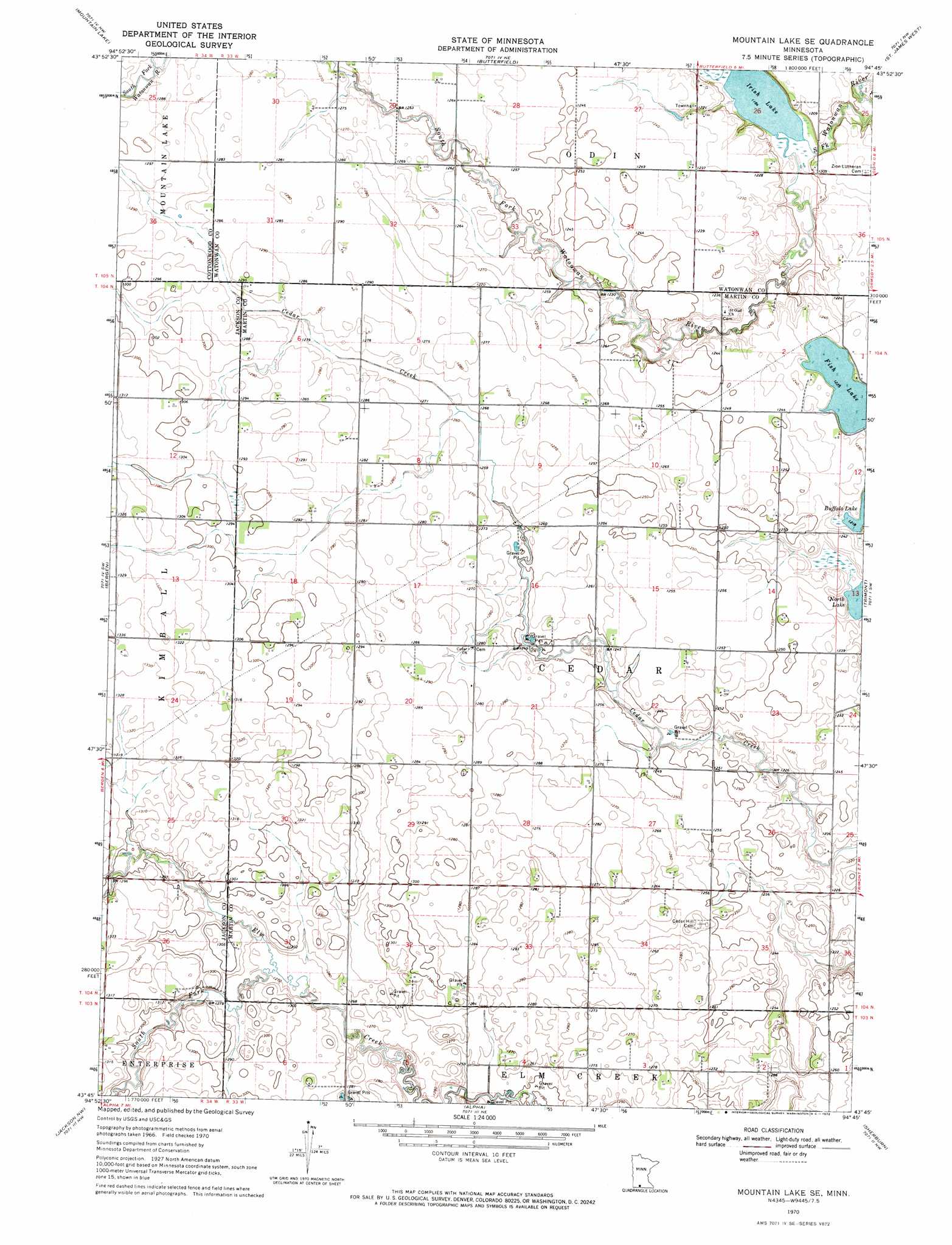
USGS Topo Quad 43094g7 - 1:24,000 scale
| Topo Map Name: | Mountain Lake Se |
| USGS Topo Quad ID: | 43094g7 |
| Print Size: | ca. 21 1/4" wide x 27" high |
| Southeast Coordinates: | 43.75° N latitude / 94.75° W longitude |
| Map Center Coordinates: | 43.8125° N latitude / 94.8125° W longitude |
| U.S. State: | MN |
| Filename: | o43094g7.jpg |
| Download Map JPG Image: | Mountain Lake Se topo map 1:24,000 scale |
| Map Type: | Topographic |
| Topo Series: | 7.5´ |
| Map Scale: | 1:24,000 |
| Source of Map Images: | United States Geological Survey (USGS) |
| Alternate Map Versions: |
Mountain Lake SE MN 1970, updated 1972 Download PDF Buy paper map Mountain Lake SE MN 2010 Download PDF Buy paper map Mountain Lake SE MN 2013 Download PDF Buy paper map Mountain Lake SE MN 2016 Download PDF Buy paper map |
1:24,000 Topo Quads surrounding Mountain Lake Se
Sanborn Se |
Comfrey |
Darfur |
Godahl |
La Salle |
Bingham Lake |
Mountain Lake |
Butterfield |
Saint James West |
Saint James East |
Windom |
Bergen |
Mountain Lake Se |
Trimont |
Saint James Se |
Lakefield Ne |
Jackson Nw |
Alpha |
Sherburn |
Welcome |
Lakefield Se |
Jackson |
Dunnell |
Ceylon |
Wilbert |
> Back to 43094e1 at 1:100,000 scale
> Back to 43094a1 at 1:250,000 scale
> Back to U.S. Topo Maps home
Mountain Lake Se topo map: Gazetteer
Mountain Lake Se: Lakes
Fish Lake elevation 373m 1223′Irish Lake elevation 361m 1184′
Mountain Lake Se: Streams
South Fork Elm Creek elevation 386m 1266′Mountain Lake Se digital topo map on disk
Buy this Mountain Lake Se topo map showing relief, roads, GPS coordinates and other geographical features, as a high-resolution digital map file on DVD: