Willow Creek Topo Map Minnesota
To zoom in, hover over the map of Willow Creek
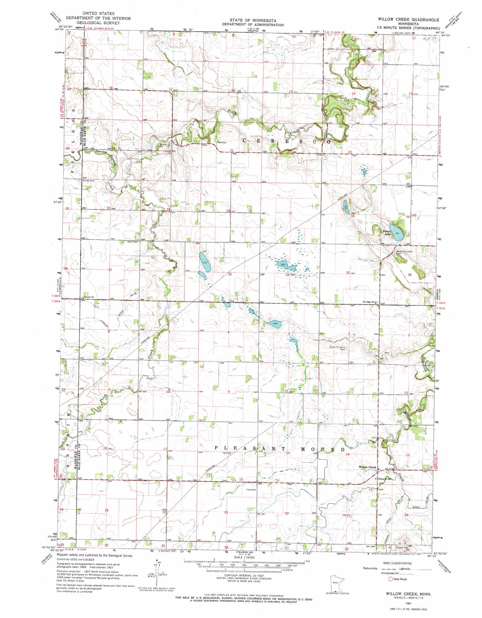
USGS Topo Quad 43094h3 - 1:24,000 scale
| Topo Map Name: | Willow Creek |
| USGS Topo Quad ID: | 43094h3 |
| Print Size: | ca. 21 1/4" wide x 27" high |
| Southeast Coordinates: | 43.875° N latitude / 94.25° W longitude |
| Map Center Coordinates: | 43.9375° N latitude / 94.3125° W longitude |
| U.S. State: | MN |
| Filename: | o43094h3.jpg |
| Download Map JPG Image: | Willow Creek topo map 1:24,000 scale |
| Map Type: | Topographic |
| Topo Series: | 7.5´ |
| Map Scale: | 1:24,000 |
| Source of Map Images: | United States Geological Survey (USGS) |
| Alternate Map Versions: |
Willow Creek MN 1967, updated 1968 Download PDF Buy paper map Willow Creek MN 2010 Download PDF Buy paper map Willow Creek MN 2013 Download PDF Buy paper map Willow Creek MN 2016 Download PDF Buy paper map |
1:24,000 Topo Quads surrounding Willow Creek
Lake Hanska East |
Hanska |
Cambria |
Judson |
Mankato West |
La Salle |
Madelia |
Perth |
Lake Crystal |
Good Thunder |
Saint James East |
Lewisville |
Willow Creek |
Amboy |
Sterling Center |
Saint James Se |
Truman |
Truman Se |
Winnebago |
Delavan |
Welcome |
Fairmont |
Granada |
Huntley |
Blue Earth |
> Back to 43094e1 at 1:100,000 scale
> Back to 43094a1 at 1:250,000 scale
> Back to U.S. Topo Maps home
Willow Creek topo map: Gazetteer
Willow Creek: Canals
County Ditch Number Eightynine elevation 308m 1010′Judicial Ditch Number Fiftytwo elevation 315m 1033′
Willow Creek: Lakes
Porter Lake elevation 302m 990′Willow Creek: Populated Places
Willow Creek elevation 312m 1023′Willow Creek: Post Offices
Willowcreek Post Office (historical) elevation 312m 1023′Willow Creek: Streams
Spring Branch Creek elevation 302m 990′Willow Creek digital topo map on disk
Buy this Willow Creek topo map showing relief, roads, GPS coordinates and other geographical features, as a high-resolution digital map file on DVD: