Lewisville Topo Map Minnesota
To zoom in, hover over the map of Lewisville
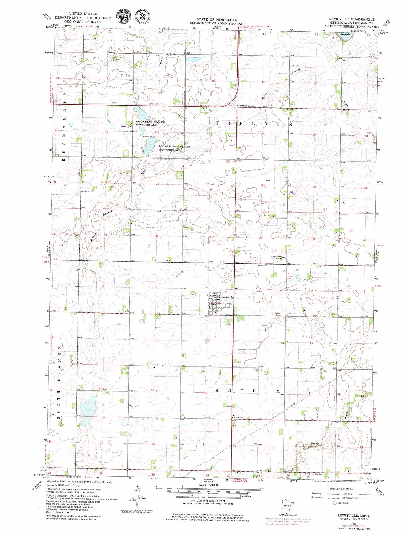
USGS Topo Quad 43094h4 - 1:24,000 scale
| Topo Map Name: | Lewisville |
| USGS Topo Quad ID: | 43094h4 |
| Print Size: | ca. 21 1/4" wide x 27" high |
| Southeast Coordinates: | 43.875° N latitude / 94.375° W longitude |
| Map Center Coordinates: | 43.9375° N latitude / 94.4375° W longitude |
| U.S. State: | MN |
| Filename: | o43094h4.jpg |
| Download Map JPG Image: | Lewisville topo map 1:24,000 scale |
| Map Type: | Topographic |
| Topo Series: | 7.5´ |
| Map Scale: | 1:24,000 |
| Source of Map Images: | United States Geological Survey (USGS) |
| Alternate Map Versions: |
Lewisville MN 1967, updated 1968 Download PDF Buy paper map Lewisville MN 2010 Download PDF Buy paper map Lewisville MN 2013 Download PDF Buy paper map Lewisville MN 2016 Download PDF Buy paper map |
1:24,000 Topo Quads surrounding Lewisville
Lake Hanska West |
Lake Hanska East |
Hanska |
Cambria |
Judson |
Godahl |
La Salle |
Madelia |
Perth |
Lake Crystal |
Saint James West |
Saint James East |
Lewisville |
Willow Creek |
Amboy |
Trimont |
Saint James Se |
Truman |
Truman Se |
Winnebago |
Sherburn |
Welcome |
Fairmont |
Granada |
Huntley |
> Back to 43094e1 at 1:100,000 scale
> Back to 43094a1 at 1:250,000 scale
> Back to U.S. Topo Maps home
Lewisville topo map: Gazetteer
Lewisville: Airports
Siegs Farm Airport elevation 333m 1092′Lewisville: Lakes
Case Lake elevation 312m 1023′Lewisville: Parks
Lewisville State Wildlife Management Area elevation 319m 1046′Madelia State Wildlife Management Area elevation 326m 1069′
Lewisville: Populated Places
Lewisville elevation 325m 1066′Tenmile Corner elevation 314m 1030′
Lewisville: Post Offices
Lewisville Post Office elevation 325m 1066′Lewisville digital topo map on disk
Buy this Lewisville topo map showing relief, roads, GPS coordinates and other geographical features, as a high-resolution digital map file on DVD: