Saint James West Topo Map Minnesota
To zoom in, hover over the map of Saint James West
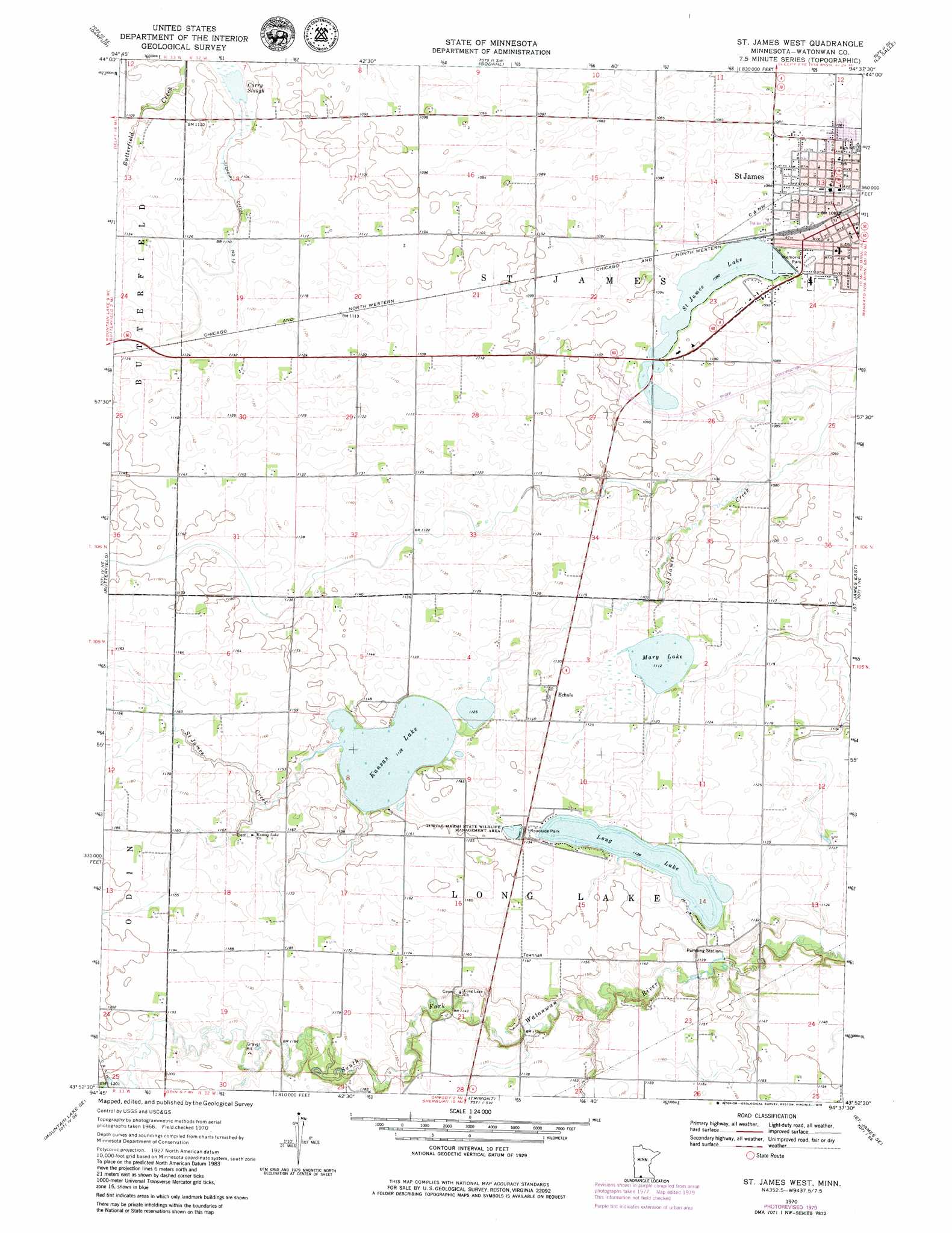
USGS Topo Quad 43094h6 - 1:24,000 scale
| Topo Map Name: | Saint James West |
| USGS Topo Quad ID: | 43094h6 |
| Print Size: | ca. 21 1/4" wide x 27" high |
| Southeast Coordinates: | 43.875° N latitude / 94.625° W longitude |
| Map Center Coordinates: | 43.9375° N latitude / 94.6875° W longitude |
| U.S. State: | MN |
| Filename: | o43094h6.jpg |
| Download Map JPG Image: | Saint James West topo map 1:24,000 scale |
| Map Type: | Topographic |
| Topo Series: | 7.5´ |
| Map Scale: | 1:24,000 |
| Source of Map Images: | United States Geological Survey (USGS) |
| Alternate Map Versions: |
St James West MN 1970, updated 1972 Download PDF Buy paper map St James West MN 1970, updated 1979 Download PDF Buy paper map Saint James West MN 2010 Download PDF Buy paper map Saint James West MN 2013 Download PDF Buy paper map Saint James West MN 2016 Download PDF Buy paper map |
1:24,000 Topo Quads surrounding Saint James West
Springfield |
Leavenworth |
Lake Hanska West |
Lake Hanska East |
Hanska |
Comfrey |
Darfur |
Godahl |
La Salle |
Madelia |
Mountain Lake |
Butterfield |
Saint James West |
Saint James East |
Lewisville |
Bergen |
Mountain Lake Se |
Trimont |
Saint James Se |
Truman |
Jackson Nw |
Alpha |
Sherburn |
Welcome |
Fairmont |
> Back to 43094e1 at 1:100,000 scale
> Back to 43094a1 at 1:250,000 scale
> Back to U.S. Topo Maps home
Saint James West topo map: Gazetteer
Saint James West: Canals
Judicial Ditch Number Thirteen elevation 338m 1108′Saint James West: Dams
Mary Lake Dam elevation 341m 1118′Saint James West: Lakes
Curry Slough elevation 331m 1085′Kansas Lake elevation 344m 1128′
Long Lake elevation 344m 1128′
Mary Lake elevation 339m 1112′
Saint James West: Parks
Long Lake Wayside Park elevation 345m 1131′Malmrose Park elevation 328m 1076′
Saint James City Park elevation 329m 1079′
Salutators Park elevation 332m 1089′
Tiell Park elevation 332m 1089′
Turtle Marsh State Wildlife Management Area elevation 345m 1131′
Saint James West: Populated Places
Echols elevation 344m 1128′Saint James elevation 329m 1079′
Saint James Place elevation 330m 1082′
Saint James West: Post Offices
Saint James Post Office elevation 329m 1079′Saint James West: Reservoirs
Mary Lake elevation 341m 1118′Saint James Lake elevation 330m 1082′
Saint James West digital topo map on disk
Buy this Saint James West topo map showing relief, roads, GPS coordinates and other geographical features, as a high-resolution digital map file on DVD: