Sheldon Se Topo Map Iowa
To zoom in, hover over the map of Sheldon Se
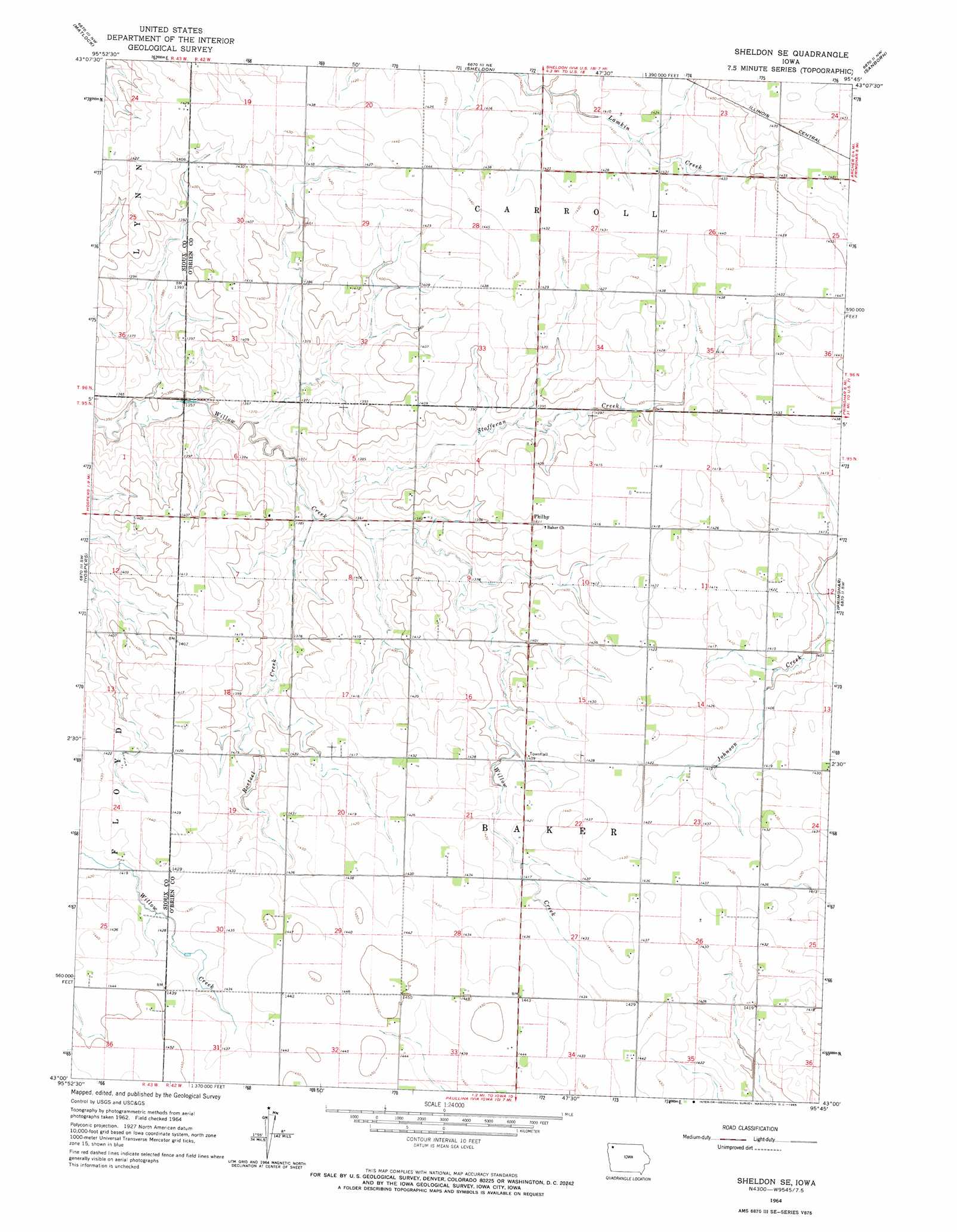
USGS Topo Quad 43095a7 - 1:24,000 scale
| Topo Map Name: | Sheldon Se |
| USGS Topo Quad ID: | 43095a7 |
| Print Size: | ca. 21 1/4" wide x 27" high |
| Southeast Coordinates: | 43° N latitude / 95.75° W longitude |
| Map Center Coordinates: | 43.0625° N latitude / 95.8125° W longitude |
| U.S. State: | IA |
| Filename: | o43095a7.jpg |
| Download Map JPG Image: | Sheldon Se topo map 1:24,000 scale |
| Map Type: | Topographic |
| Topo Series: | 7.5´ |
| Map Scale: | 1:24,000 |
| Source of Map Images: | United States Geological Survey (USGS) |
| Alternate Map Versions: |
Sheldon SE IA 1964, updated 1965 Download PDF Buy paper map Sheldon SE IA 2010 Download PDF Buy paper map Sheldon SE IA 2013 Download PDF Buy paper map Sheldon SE IA 2015 Download PDF Buy paper map |
1:24,000 Topo Quads surrounding Sheldon Se
George West |
George East |
Ashton |
Cloverdale |
Melvin |
Boyden |
Matlock |
Sheldon |
Sanborn |
Plessis |
Orange City |
Hospers |
Sheldon Se |
Primghar |
Gaza |
Alton |
Granville West |
Granville East |
Paullina |
Sutherland West |
Oyens |
Remsen |
Marcus |
Cleghorn |
Cherokee North |
> Back to 43095a1 at 1:100,000 scale
> Back to 43094a1 at 1:250,000 scale
> Back to U.S. Topo Maps home
Sheldon Se topo map: Gazetteer
Sheldon Se: Populated Places
Philby elevation 430m 1410′Sheldon Se: Post Offices
Philby Post Office (historical) elevation 430m 1410′Sheldon Se: Streams
Roetzel Creek elevation 415m 1361′Stofferan Creek elevation 415m 1361′
Sheldon Se digital topo map on disk
Buy this Sheldon Se topo map showing relief, roads, GPS coordinates and other geographical features, as a high-resolution digital map file on DVD: