Melvin Topo Map Iowa
To zoom in, hover over the map of Melvin
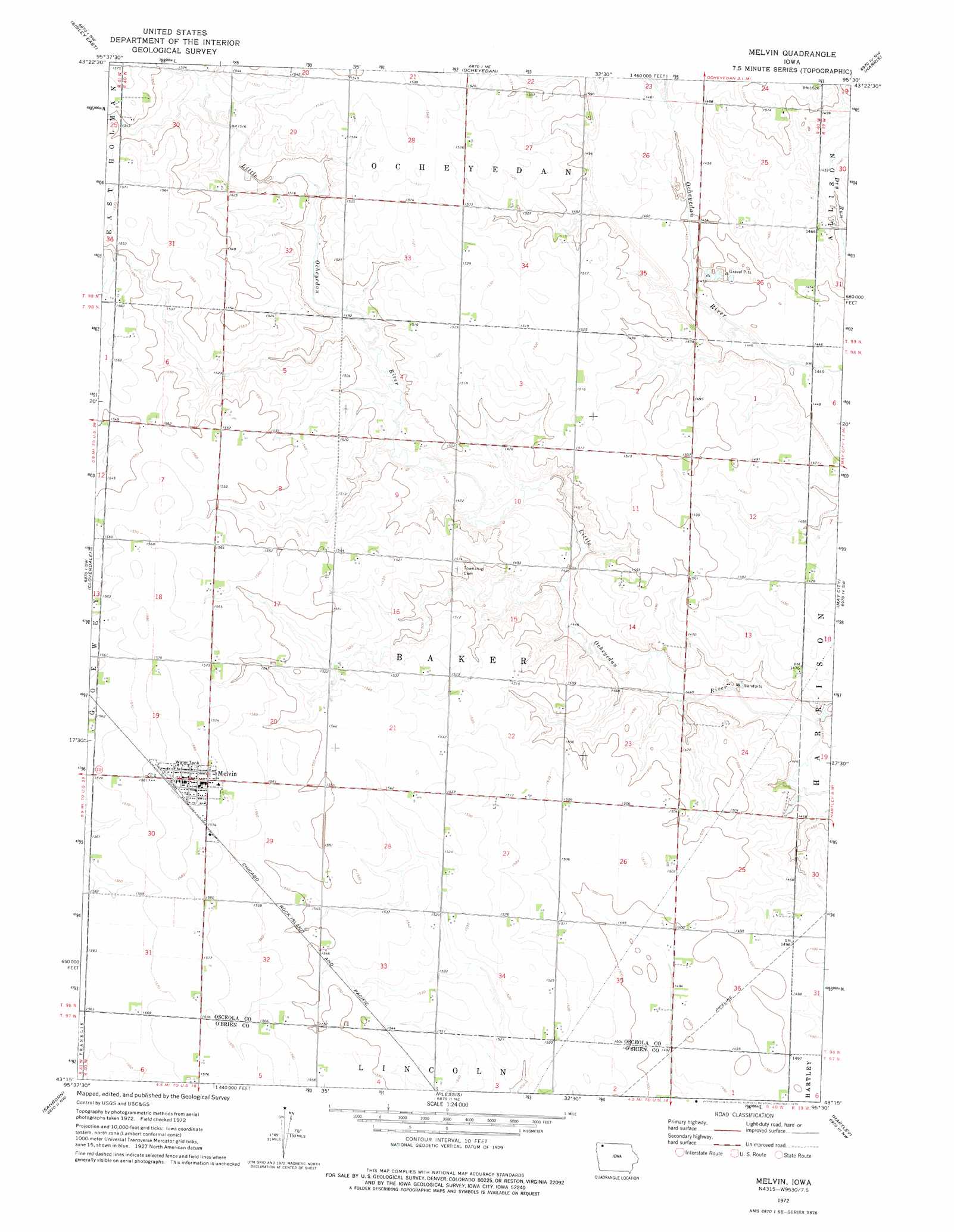
USGS Topo Quad 43095c5 - 1:24,000 scale
| Topo Map Name: | Melvin |
| USGS Topo Quad ID: | 43095c5 |
| Print Size: | ca. 21 1/4" wide x 27" high |
| Southeast Coordinates: | 43.25° N latitude / 95.5° W longitude |
| Map Center Coordinates: | 43.3125° N latitude / 95.5625° W longitude |
| U.S. State: | IA |
| Filename: | o43095c5.jpg |
| Download Map JPG Image: | Melvin topo map 1:24,000 scale |
| Map Type: | Topographic |
| Topo Series: | 7.5´ |
| Map Scale: | 1:24,000 |
| Source of Map Images: | United States Geological Survey (USGS) |
| Alternate Map Versions: |
Melvin IA 1972, updated 1975 Download PDF Buy paper map Melvin IA 2010 Download PDF Buy paper map Melvin IA 2013 Download PDF Buy paper map Melvin IA 2015 Download PDF Buy paper map |
1:24,000 Topo Quads surrounding Melvin
Rushmore |
Bigelow |
Worthington South |
Round Lake |
Sioux Valley |
Sibley West |
Sibley East |
Ocheyedan |
Harris |
Lake Park |
Ashton |
Cloverdale |
Melvin |
May City |
Lake Park Se |
Sheldon |
Sanborn |
Plessis |
Hartley |
Everly |
Sheldon Se |
Primghar |
Gaza |
Hartley Sw |
Royal |
> Back to 43095a1 at 1:100,000 scale
> Back to 43094a1 at 1:250,000 scale
> Back to U.S. Topo Maps home
Melvin topo map: Gazetteer
Melvin: Canals
Judicial Ditch Number 64 elevation 444m 1456′Melvin: Parks
Dirks Wildlife Management Area elevation 441m 1446′Melvin Arboretum Park elevation 479m 1571′
Melvin: Populated Places
Melvin elevation 482m 1581′Melvin: Post Offices
Melvin Post Office (historical) elevation 482m 1581′Runyan Post Office (historical) elevation 454m 1489′
Melvin: Streams
Rush Lake Outlet elevation 445m 1459′Melvin digital topo map on disk
Buy this Melvin topo map showing relief, roads, GPS coordinates and other geographical features, as a high-resolution digital map file on DVD: