Lake Park Topo Map Iowa
To zoom in, hover over the map of Lake Park
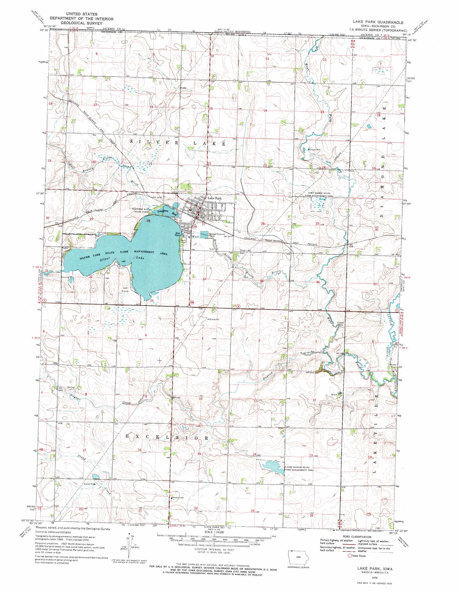
USGS Topo Quad 43095d3 - 1:24,000 scale
| Topo Map Name: | Lake Park |
| USGS Topo Quad ID: | 43095d3 |
| Print Size: | ca. 21 1/4" wide x 27" high |
| Southeast Coordinates: | 43.375° N latitude / 95.25° W longitude |
| Map Center Coordinates: | 43.4375° N latitude / 95.3125° W longitude |
| U.S. State: | IA |
| Filename: | o43095d3.jpg |
| Download Map JPG Image: | Lake Park topo map 1:24,000 scale |
| Map Type: | Topographic |
| Topo Series: | 7.5´ |
| Map Scale: | 1:24,000 |
| Source of Map Images: | United States Geological Survey (USGS) |
| Alternate Map Versions: |
Lake Park IA 1970, updated 1972 Download PDF Buy paper map Lake Park IA 2010 Download PDF Buy paper map Lake Park IA 2013 Download PDF Buy paper map Lake Park IA 2015 Download PDF Buy paper map |
1:24,000 Topo Quads surrounding Lake Park
Worthington North |
Brewster |
Okabena |
Lakefield |
Lakefield Ne |
Worthington South |
Round Lake |
Sioux Valley |
Lakefield Sw |
Lakefield Se |
Ocheyedan |
Harris |
Lake Park |
Okoboji |
Spirit Lake |
Melvin |
May City |
Lake Park Se |
Milford |
Spirit Lake Se |
Plessis |
Hartley |
Everly |
Spencer |
Dickens |
> Back to 43095a1 at 1:100,000 scale
> Back to 43094a1 at 1:250,000 scale
> Back to U.S. Topo Maps home
Lake Park topo map: Gazetteer
Lake Park: Bays
Trappers Bay elevation 445m 1459′Lake Park: Parks
Cory Marsh State Game Management Area elevation 435m 1427′Dugout Creek Wildlife Management Area elevation 448m 1469′
Silver Lake Fen State Preserve elevation 458m 1502′
Silver Lake Wildlife Management Area elevation 445m 1459′
Trappers Bay State Park elevation 445m 1459′
Twin Forks Wildlife Area elevation 423m 1387′
Yager Slough State Game Management Area elevation 443m 1453′
Lake Park: Populated Places
Lake Park elevation 454m 1489′Lake Park: Post Offices
Austin Post Office (historical) elevation 445m 1459′Lake Park Post Office elevation 454m 1489′
Lake Park: Reservoirs
Silver Lake elevation 445m 1459′Lake Park: Streams
Dugout Creek elevation 428m 1404′West Branch Little Sioux River elevation 430m 1410′
West Fork Little Sioux River elevation 421m 1381′
Lake Park digital topo map on disk
Buy this Lake Park topo map showing relief, roads, GPS coordinates and other geographical features, as a high-resolution digital map file on DVD: