Lakefield Topo Map Minnesota
To zoom in, hover over the map of Lakefield
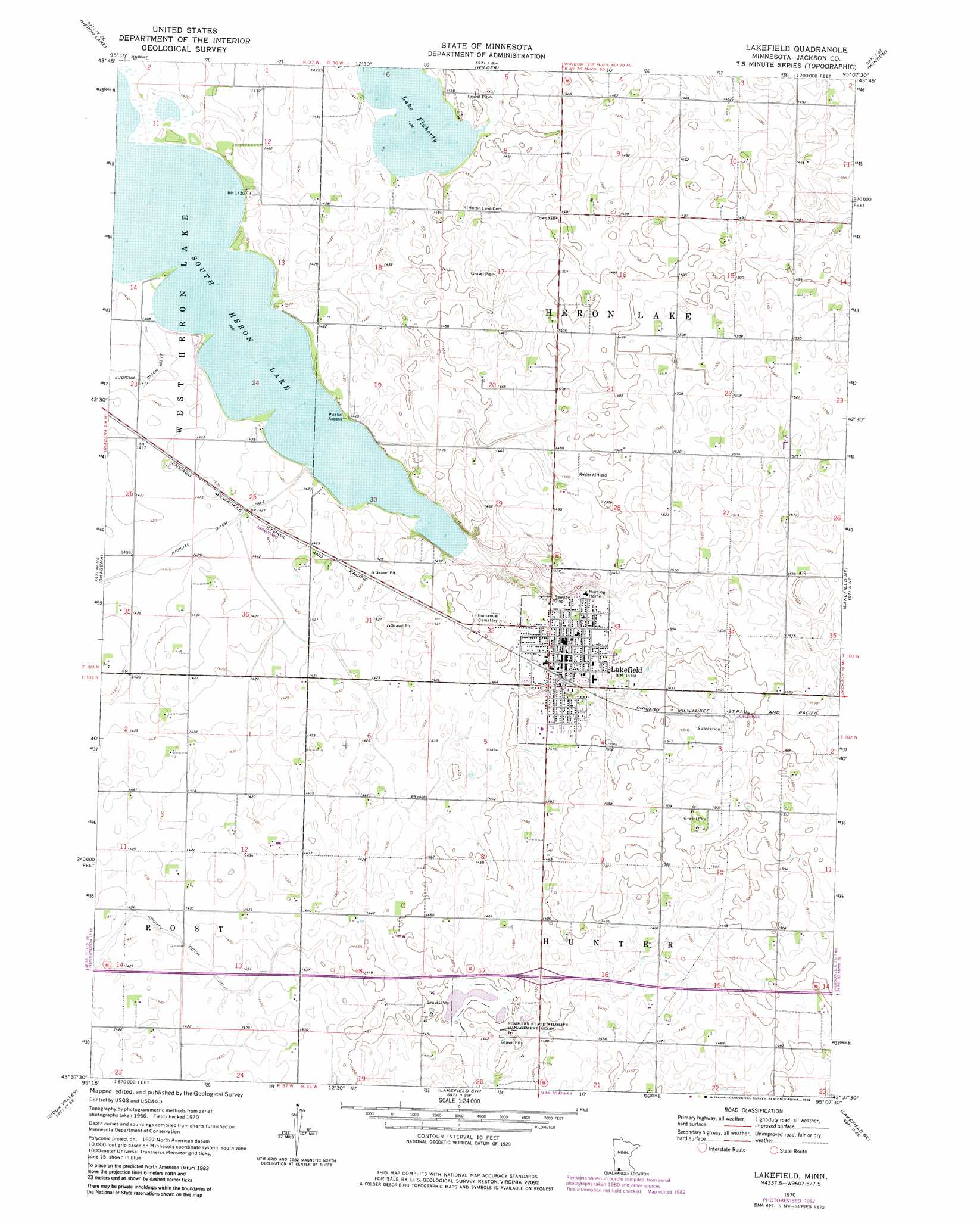
USGS Topo Quad 43095f2 - 1:24,000 scale
| Topo Map Name: | Lakefield |
| USGS Topo Quad ID: | 43095f2 |
| Print Size: | ca. 21 1/4" wide x 27" high |
| Southeast Coordinates: | 43.625° N latitude / 95.125° W longitude |
| Map Center Coordinates: | 43.6875° N latitude / 95.1875° W longitude |
| U.S. State: | MN |
| Filename: | o43095f2.jpg |
| Download Map JPG Image: | Lakefield topo map 1:24,000 scale |
| Map Type: | Topographic |
| Topo Series: | 7.5´ |
| Map Scale: | 1:24,000 |
| Source of Map Images: | United States Geological Survey (USGS) |
| Alternate Map Versions: |
Lakefield MN 1970, updated 1972 Download PDF Buy paper map Lakefield MN 1970, updated 1982 Download PDF Buy paper map Lakefield MN 2010 Download PDF Buy paper map Lakefield MN 2013 Download PDF Buy paper map Lakefield MN 2016 Download PDF Buy paper map |
1:24,000 Topo Quads surrounding Lakefield
Heron Lake Nw |
Heron Lake Ne |
Harder Lake |
Bingham Lake |
Mountain Lake |
Dundee |
Heron Lake |
Wilder |
Windom |
Bergen |
Brewster |
Okabena |
Lakefield |
Lakefield Ne |
Jackson Nw |
Round Lake |
Sioux Valley |
Lakefield Sw |
Lakefield Se |
Jackson |
Harris |
Lake Park |
Okoboji |
Spirit Lake |
Superior |
> Back to 43095e1 at 1:100,000 scale
> Back to 43094a1 at 1:250,000 scale
> Back to U.S. Topo Maps home
Lakefield topo map: Gazetteer
Lakefield: Airports
H Reder Field elevation 454m 1489′Lakefield: Crossings
Interchange 64 elevation 448m 1469′Lakefield: Lakes
Lake Flaherty elevation 437m 1433′South Heron Lake elevation 427m 1400′
Lakefield: Parks
Summers State Wildlife Management Area elevation 441m 1446′Lakefield: Populated Places
Lakefield elevation 452m 1482′Lakefield: Post Offices
Lakefield Post Office elevation 453m 1486′Lakefield digital topo map on disk
Buy this Lakefield topo map showing relief, roads, GPS coordinates and other geographical features, as a high-resolution digital map file on DVD: