Harder Lake Topo Map Minnesota
To zoom in, hover over the map of Harder Lake
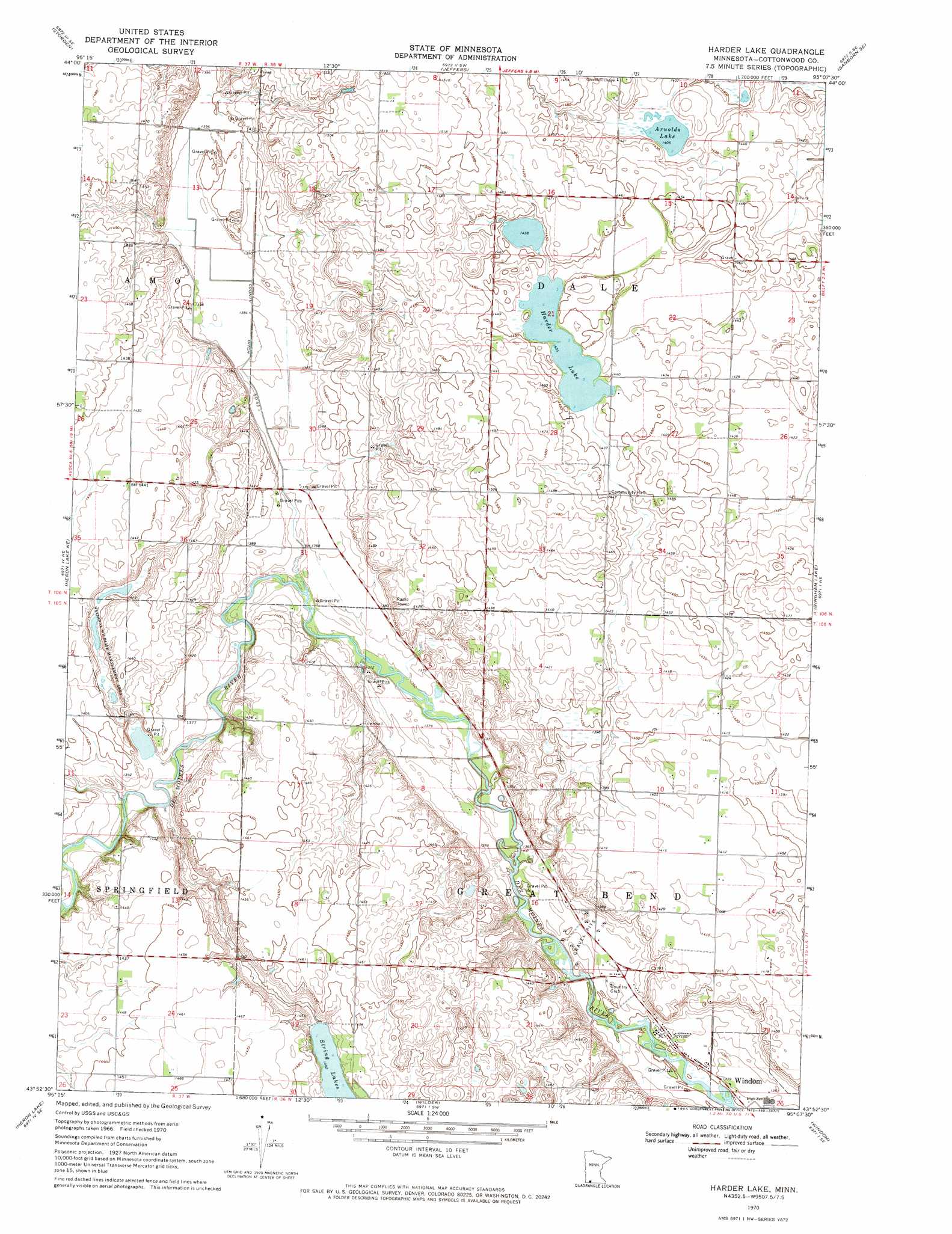
USGS Topo Quad 43095h2 - 1:24,000 scale
| Topo Map Name: | Harder Lake |
| USGS Topo Quad ID: | 43095h2 |
| Print Size: | ca. 21 1/4" wide x 27" high |
| Southeast Coordinates: | 43.875° N latitude / 95.125° W longitude |
| Map Center Coordinates: | 43.9375° N latitude / 95.1875° W longitude |
| U.S. State: | MN |
| Filename: | o43095h2.jpg |
| Download Map JPG Image: | Harder Lake topo map 1:24,000 scale |
| Map Type: | Topographic |
| Topo Series: | 7.5´ |
| Map Scale: | 1:24,000 |
| Source of Map Images: | United States Geological Survey (USGS) |
| Alternate Map Versions: |
Harder Lake MN 1970, updated 1972 Download PDF Buy paper map Harder Lake MN 2010 Download PDF Buy paper map Harder Lake MN 2013 Download PDF Buy paper map Harder Lake MN 2016 Download PDF Buy paper map |
1:24,000 Topo Quads surrounding Harder Lake
Walnut Grove |
Lamberton |
Sanborn |
Sanborn Ne |
Springfield |
Westbrook |
Storden |
Jeffers |
Sanborn Se |
Comfrey |
Heron Lake Nw |
Heron Lake Ne |
Harder Lake |
Bingham Lake |
Mountain Lake |
Dundee |
Heron Lake |
Wilder |
Windom |
Bergen |
Brewster |
Okabena |
Lakefield |
Lakefield Ne |
Jackson Nw |
> Back to 43095e1 at 1:100,000 scale
> Back to 43094a1 at 1:250,000 scale
> Back to U.S. Topo Maps home
Harder Lake topo map: Gazetteer
Harder Lake: Lakes
Arnolds Lake elevation 427m 1400′Harder Lake elevation 436m 1430′
Harder Lake: Parks
Dynamite County Park elevation 411m 1348′Jens Park elevation 418m 1371′
Harder Lake digital topo map on disk
Buy this Harder Lake topo map showing relief, roads, GPS coordinates and other geographical features, as a high-resolution digital map file on DVD: