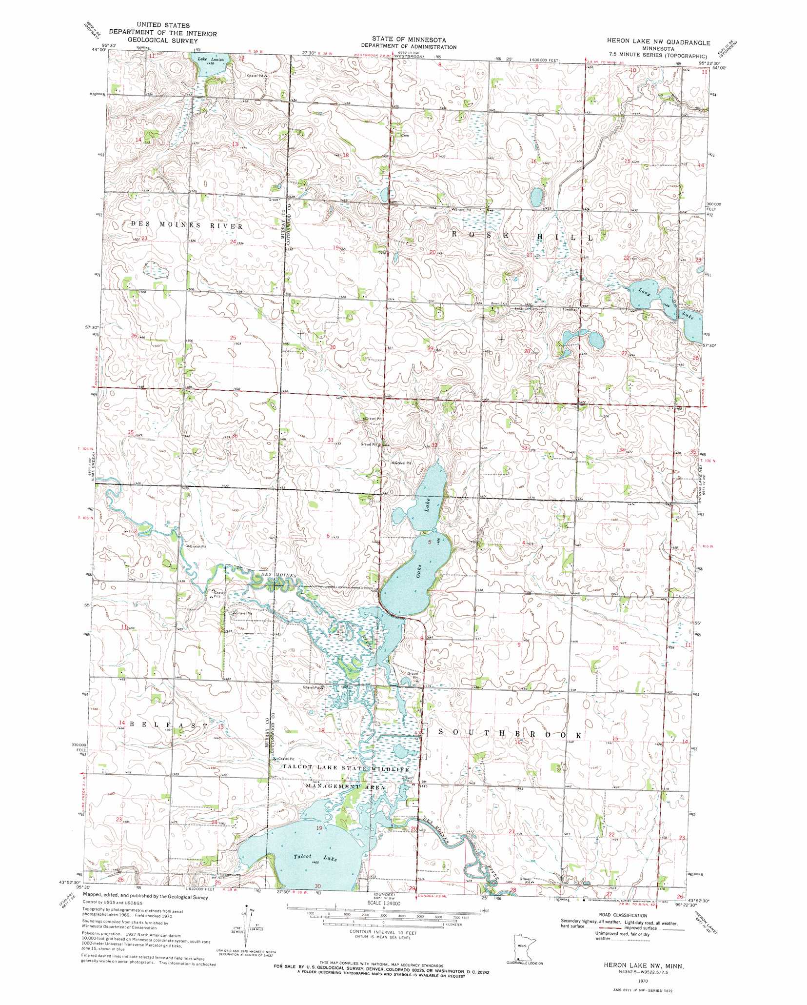
Heron Lake Nw Topo Map Minnesota
To zoom in, hover over the map of Heron Lake Nw
USGS Topo Quad 43095h4 - 1:24,000 scale
| Topo Map Name: | Heron Lake Nw |
| USGS Topo Quad ID: | 43095h4 |
| Print Size: | ca. 21 1/4" wide x 27" high |
| Southeast Coordinates: | 43.875° N latitude / 95.375° W longitude |
| Map Center Coordinates: | 43.9375° N latitude / 95.4375° W longitude |
| U.S. State: | MN |
| Filename: | o43095h4.jpg |
| Download Map JPG Image: | Heron Lake Nw topo map 1:24,000 scale |
| Map Type: | Topographic |
| Topo Series: | 7.5´ |
| Map Scale: | 1:24,000 |
| Source of Map Images: | United States Geological Survey (USGS) |
| Alternate Map Versions: |
Heron Lake NW MN 1970, updated 1972 Download PDF Buy paper map Heron Lake NW MN 2010 Download PDF Buy paper map Heron Lake NW MN 2013 Download PDF Buy paper map Heron Lake NW MN 2016 Download PDF Buy paper map |
1:24,000 Topo Quads surrounding Heron Lake Nw
Tracy West |
Tracy East |
Walnut Grove |
Lamberton |
Sanborn |
Currie |
Dovray |
Westbrook |
Storden |
Jeffers |
Avoca |
Lime Creek |
Heron Lake Nw |
Heron Lake Ne |
Harder Lake |
Fulda Sw |
Fulda |
Dundee |
Heron Lake |
Wilder |
Reading |
Worthington North |
Brewster |
Okabena |
Lakefield |
> Back to 43095e1 at 1:100,000 scale
> Back to 43094a1 at 1:250,000 scale
> Back to U.S. Topo Maps home
Heron Lake Nw topo map: Gazetteer
Heron Lake Nw: Dams
Talcot Lake Wildlife Management Area Dam elevation 428m 1404′Talcot Lake Wildlife Management Area-Frerichs Tract Impoundment Dam elevation 430m 1410′
Heron Lake Nw: Lakes
Long Lake elevation 436m 1430′Oaks Lake elevation 429m 1407′
Talcot Lake elevation 428m 1404′
Heron Lake Nw: Parks
Lady Bird County Park elevation 430m 1410′Talcot Lake State Wildlife Management Area elevation 431m 1414′
Heron Lake Nw: Reservoirs
Talcot Lake elevation 428m 1404′Wildlife Pond elevation 430m 1410′
Heron Lake Nw digital topo map on disk
Buy this Heron Lake Nw topo map showing relief, roads, GPS coordinates and other geographical features, as a high-resolution digital map file on DVD: