Lime Creek Topo Map Minnesota
To zoom in, hover over the map of Lime Creek
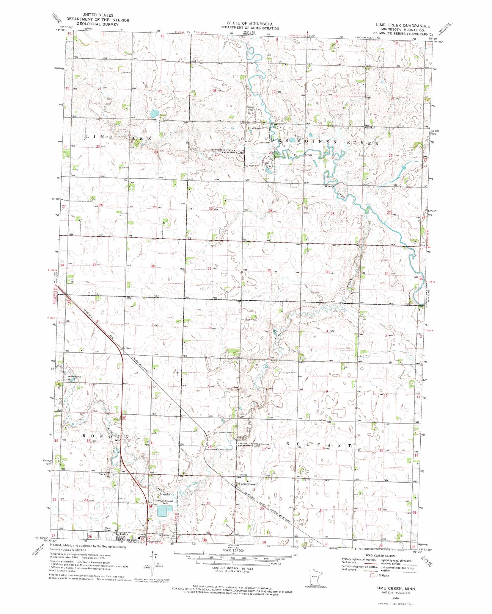
USGS Topo Quad 43095h5 - 1:24,000 scale
| Topo Map Name: | Lime Creek |
| USGS Topo Quad ID: | 43095h5 |
| Print Size: | ca. 21 1/4" wide x 27" high |
| Southeast Coordinates: | 43.875° N latitude / 95.5° W longitude |
| Map Center Coordinates: | 43.9375° N latitude / 95.5625° W longitude |
| U.S. State: | MN |
| Filename: | o43095h5.jpg |
| Download Map JPG Image: | Lime Creek topo map 1:24,000 scale |
| Map Type: | Topographic |
| Topo Series: | 7.5´ |
| Map Scale: | 1:24,000 |
| Source of Map Images: | United States Geological Survey (USGS) |
| Alternate Map Versions: |
Lime Creek MN 1970, updated 1972 Download PDF Buy paper map Lime Creek MN 2010 Download PDF Buy paper map Lime Creek MN 2013 Download PDF Buy paper map Lime Creek MN 2016 Download PDF Buy paper map |
1:24,000 Topo Quads surrounding Lime Creek
Balaton |
Tracy West |
Tracy East |
Walnut Grove |
Lamberton |
Hadley |
Currie |
Dovray |
Westbrook |
Storden |
Slayton |
Avoca |
Lime Creek |
Heron Lake Nw |
Heron Lake Ne |
Wilmont |
Fulda Sw |
Fulda |
Dundee |
Heron Lake |
Adrian Ne |
Reading |
Worthington North |
Brewster |
Okabena |
> Back to 43095e1 at 1:100,000 scale
> Back to 43094a1 at 1:250,000 scale
> Back to U.S. Topo Maps home
Lime Creek topo map: Gazetteer
Lime Creek: Parks
Haberman State Wildlife Management Area elevation 445m 1459′Irrupption State Wildlife Management Area elevation 436m 1430′
Lime Creek: Populated Places
Lime Creek elevation 454m 1489′Lime Creek: Post Offices
Lime Creek Post Office (historical) elevation 454m 1489′Lime Creek: Streams
Devils Run elevation 439m 1440′Lime Creek elevation 436m 1430′
Lime Creek digital topo map on disk
Buy this Lime Creek topo map showing relief, roads, GPS coordinates and other geographical features, as a high-resolution digital map file on DVD: