Slayton Topo Map Minnesota
To zoom in, hover over the map of Slayton
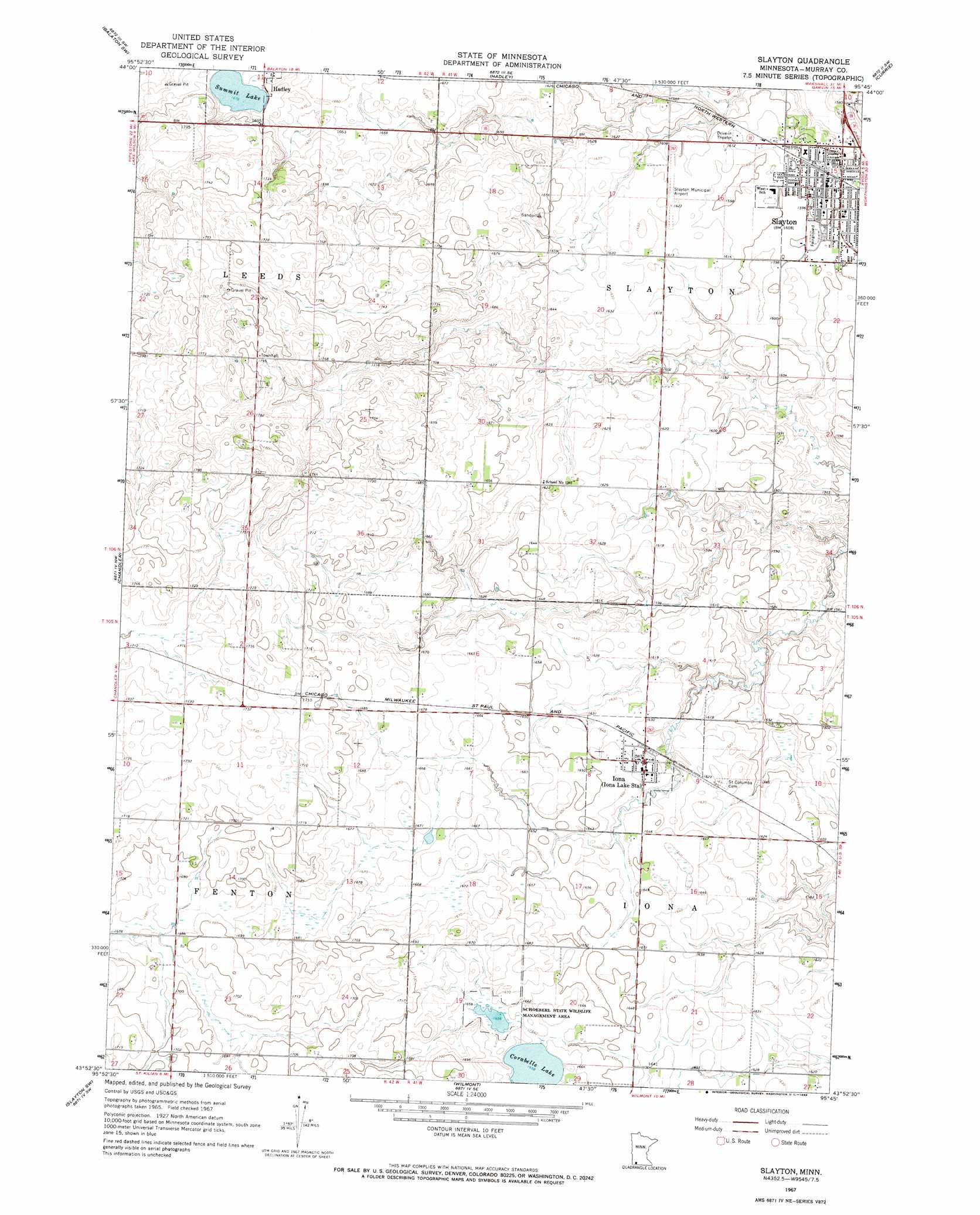
USGS Topo Quad 43095h7 - 1:24,000 scale
| Topo Map Name: | Slayton |
| USGS Topo Quad ID: | 43095h7 |
| Print Size: | ca. 21 1/4" wide x 27" high |
| Southeast Coordinates: | 43.875° N latitude / 95.75° W longitude |
| Map Center Coordinates: | 43.9375° N latitude / 95.8125° W longitude |
| U.S. State: | MN |
| Filename: | o43095h7.jpg |
| Download Map JPG Image: | Slayton topo map 1:24,000 scale |
| Map Type: | Topographic |
| Topo Series: | 7.5´ |
| Map Scale: | 1:24,000 |
| Source of Map Images: | United States Geological Survey (USGS) |
| Alternate Map Versions: |
Slayton MN 1967, updated 1968 Download PDF Buy paper map Slayton MN 2010 Download PDF Buy paper map Slayton MN 2013 Download PDF Buy paper map Slayton MN 2016 Download PDF Buy paper map |
1:24,000 Topo Quads surrounding Slayton
Ruthton |
Current Lake |
Balaton |
Tracy West |
Tracy East |
Woodstock |
Balaton Sw |
Hadley |
Currie |
Dovray |
Edgerton Ne |
Chandler |
Slayton |
Avoca |
Lime Creek |
Kenneth |
Slayton Sw |
Wilmont |
Fulda Sw |
Fulda |
Magnolia |
Adrian |
Adrian Ne |
Reading |
Worthington North |
> Back to 43095e1 at 1:100,000 scale
> Back to 43094a1 at 1:250,000 scale
> Back to U.S. Topo Maps home
Slayton topo map: Gazetteer
Slayton: Airports
Slayton Municipal Airport elevation 495m 1624′Slayton: Lakes
Corabelle Lake elevation 506m 1660′Summit Lake elevation 511m 1676′
Slayton: Parks
Schoeberl State Wildlife Management Area elevation 505m 1656′Slayton: Populated Places
Iona elevation 498m 1633′Slayton elevation 488m 1601′
Slayton: Post Offices
Iona Post Office elevation 494m 1620′Slayton Post Office elevation 488m 1601′
Slayton digital topo map on disk
Buy this Slayton topo map showing relief, roads, GPS coordinates and other geographical features, as a high-resolution digital map file on DVD: