Orange City Topo Map Iowa
To zoom in, hover over the map of Orange City
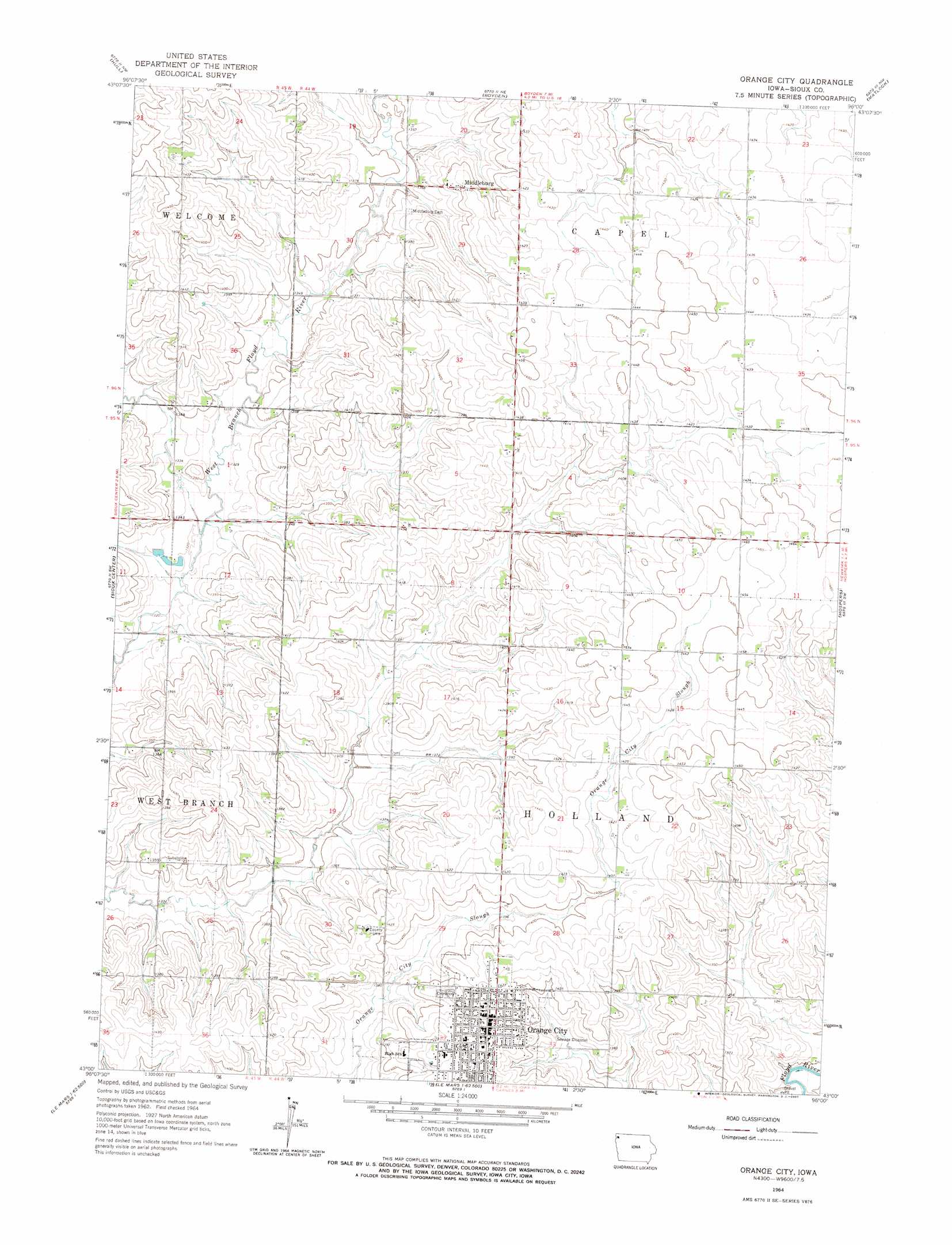
USGS Topo Quad 43096a1 - 1:24,000 scale
| Topo Map Name: | Orange City |
| USGS Topo Quad ID: | 43096a1 |
| Print Size: | ca. 21 1/4" wide x 27" high |
| Southeast Coordinates: | 43° N latitude / 96° W longitude |
| Map Center Coordinates: | 43.0625° N latitude / 96.0625° W longitude |
| U.S. State: | IA |
| Filename: | o43096a1.jpg |
| Download Map JPG Image: | Orange City topo map 1:24,000 scale |
| Map Type: | Topographic |
| Topo Series: | 7.5´ |
| Map Scale: | 1:24,000 |
| Source of Map Images: | United States Geological Survey (USGS) |
| Alternate Map Versions: |
Orange City IA 1964, updated 1965 Download PDF Buy paper map Orange City IA 2010 Download PDF Buy paper map Orange City IA 2013 Download PDF Buy paper map Orange City IA 2015 Download PDF Buy paper map |
1:24,000 Topo Quads surrounding Orange City
Alvord |
Doon |
George West |
George East |
Ashton |
Rock Valley |
Hull |
Boyden |
Matlock |
Sheldon |
Lebanon |
Sioux Center |
Orange City |
Hospers |
Sheldon Se |
Ireton |
Maurice |
Alton |
Granville West |
Granville East |
Brunsville |
Le Mars |
Oyens |
Remsen |
Marcus |
> Back to 43096a1 at 1:100,000 scale
> Back to 43096a1 at 1:250,000 scale
> Back to U.S. Topo Maps home
Orange City topo map: Gazetteer
Orange City: Parks
East Park elevation 417m 1368′Jaycee Park elevation 437m 1433′
Sandy Hollow Recreation Area elevation 403m 1322′
Veterans Memorial Park elevation 431m 1414′
Windmill Square elevation 440m 1443′
Orange City: Populated Places
Middleburg elevation 428m 1404′Orange City elevation 440m 1443′
Orange City: Post Offices
Middleburg Post Office (historical) elevation 428m 1404′Orange City Post Office elevation 439m 1440′
Orange City digital topo map on disk
Buy this Orange City topo map showing relief, roads, GPS coordinates and other geographical features, as a high-resolution digital map file on DVD:
Eastern North Dakota & Eastern South Dakota
Buy digital topo maps: Eastern North Dakota & Eastern South Dakota