Sioux Center Topo Map Iowa
To zoom in, hover over the map of Sioux Center
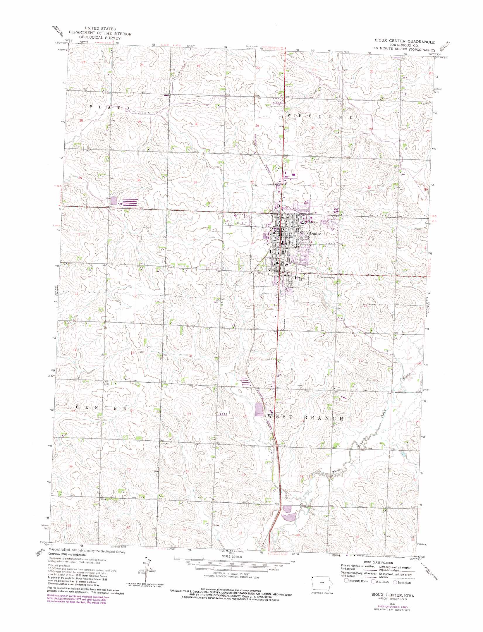
USGS Topo Quad 43096a2 - 1:24,000 scale
| Topo Map Name: | Sioux Center |
| USGS Topo Quad ID: | 43096a2 |
| Print Size: | ca. 21 1/4" wide x 27" high |
| Southeast Coordinates: | 43° N latitude / 96.125° W longitude |
| Map Center Coordinates: | 43.0625° N latitude / 96.1875° W longitude |
| U.S. State: | IA |
| Filename: | o43096a2.jpg |
| Download Map JPG Image: | Sioux Center topo map 1:24,000 scale |
| Map Type: | Topographic |
| Topo Series: | 7.5´ |
| Map Scale: | 1:24,000 |
| Source of Map Images: | United States Geological Survey (USGS) |
| Alternate Map Versions: |
Sioux Center IA 1964, updated 1966 Download PDF Buy paper map Sioux Center IA 1964, updated 1980 Download PDF Buy paper map Sioux Center IA 2010 Download PDF Buy paper map Sioux Center IA 2013 Download PDF Buy paper map Sioux Center IA 2015 Download PDF Buy paper map |
1:24,000 Topo Quads surrounding Sioux Center
Inwood |
Alvord |
Doon |
George West |
George East |
Fairview |
Rock Valley |
Hull |
Boyden |
Matlock |
Hawarden North |
Lebanon |
Sioux Center |
Orange City |
Hospers |
Hawarden South |
Ireton |
Maurice |
Alton |
Granville West |
Ireton Sw |
Brunsville |
Le Mars |
Oyens |
Remsen |
> Back to 43096a1 at 1:100,000 scale
> Back to 43096a1 at 1:250,000 scale
> Back to U.S. Topo Maps home
Sioux Center topo map: Gazetteer
Sioux Center: Parks
Central Park elevation 441m 1446′Childrens Park elevation 431m 1414′
Open Space Park elevation 445m 1459′
Regency Park elevation 435m 1427′
Tower Fields elevation 446m 1463′
Westside Park elevation 434m 1423′
Sioux Center: Populated Places
Sioux Center elevation 446m 1463′Sunrise Mobile Home Park elevation 443m 1453′
Westbrook Village elevation 435m 1427′
Sioux Center: Post Offices
Sioux Center Post Office elevation 445m 1459′Sioux Center digital topo map on disk
Buy this Sioux Center topo map showing relief, roads, GPS coordinates and other geographical features, as a high-resolution digital map file on DVD:
Eastern North Dakota & Eastern South Dakota
Buy digital topo maps: Eastern North Dakota & Eastern South Dakota