Centerville Topo Map South Dakota
To zoom in, hover over the map of Centerville
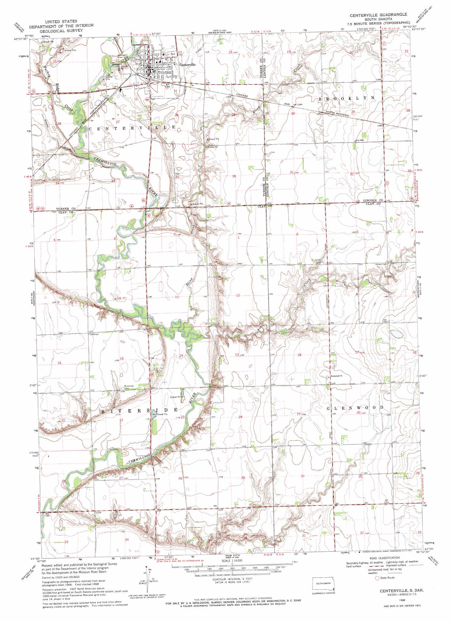
USGS Topo Quad 43096a8 - 1:24,000 scale
| Topo Map Name: | Centerville |
| USGS Topo Quad ID: | 43096a8 |
| Print Size: | ca. 21 1/4" wide x 27" high |
| Southeast Coordinates: | 43° N latitude / 96.875° W longitude |
| Map Center Coordinates: | 43.0625° N latitude / 96.9375° W longitude |
| U.S. State: | SD |
| Filename: | o43096a8.jpg |
| Download Map JPG Image: | Centerville topo map 1:24,000 scale |
| Map Type: | Topographic |
| Topo Series: | 7.5´ |
| Map Scale: | 1:24,000 |
| Source of Map Images: | United States Geological Survey (USGS) |
| Alternate Map Versions: |
Centerville SD 1968, updated 1971 Download PDF Buy paper map Centerville SD 2012 Download PDF Buy paper map Centerville SD 2015 Download PDF Buy paper map |
1:24,000 Topo Quads surrounding Centerville
Parker Sw |
Hurley |
Lennox |
Worthing |
Canton Sw |
Center Point |
Viborg |
Beresford Nw |
Beresford Ne |
Alcester Nw |
Irene |
Wakonda |
Centerville |
Beresford |
Alcester |
Gayville |
Gayville Ne |
Hub City |
Alsen |
Nora |
Saint Helena |
Meckling |
Vermillon |
Vermillon Se |
Richland |
> Back to 43096a1 at 1:100,000 scale
> Back to 43096a1 at 1:250,000 scale
> Back to U.S. Topo Maps home
Centerville topo map: Gazetteer
Centerville: Airports
Ward Airfield elevation 392m 1286′Centerville: Canals
Bonine Ditch elevation 370m 1213′Noble Ditch elevation 374m 1227′
Centerville: Populated Places
Centerville elevation 374m 1227′Komstad (historical) elevation 389m 1276′
Centerville: Streams
Ash Creek elevation 357m 1171′Blind Creek elevation 356m 1167′
Turkey Ridge Creek elevation 364m 1194′
Centerville digital topo map on disk
Buy this Centerville topo map showing relief, roads, GPS coordinates and other geographical features, as a high-resolution digital map file on DVD:
Eastern North Dakota & Eastern South Dakota
Buy digital topo maps: Eastern North Dakota & Eastern South Dakota