Fairview Topo Map Iowa
To zoom in, hover over the map of Fairview
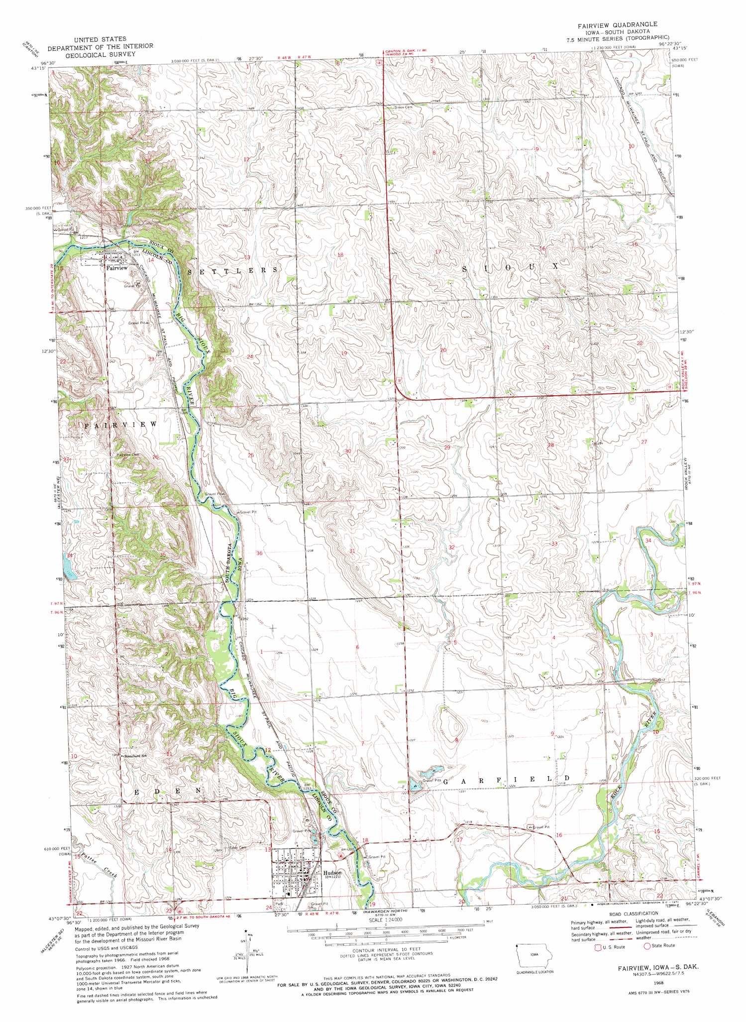
USGS Topo Quad 43096b4 - 1:24,000 scale
| Topo Map Name: | Fairview |
| USGS Topo Quad ID: | 43096b4 |
| Print Size: | ca. 21 1/4" wide x 27" high |
| Southeast Coordinates: | 43.125° N latitude / 96.375° W longitude |
| Map Center Coordinates: | 43.1875° N latitude / 96.4375° W longitude |
| U.S. States: | IA, SD |
| Filename: | o43096b4.jpg |
| Download Map JPG Image: | Fairview topo map 1:24,000 scale |
| Map Type: | Topographic |
| Topo Series: | 7.5´ |
| Map Scale: | 1:24,000 |
| Source of Map Images: | United States Geological Survey (USGS) |
| Alternate Map Versions: |
Fairview SD 1968, updated 1971 Download PDF Buy paper map Fairview SD 2011 Download PDF Buy paper map Fairview SD 2012 Download PDF Buy paper map Fairview SD 2015 Download PDF Buy paper map |
1:24,000 Topo Quads surrounding Fairview
Harrisburg |
Klondike |
Larchwood |
Lester |
Rock Rapids |
Canton Sw |
Canton |
Inwood |
Alvord |
Doon |
Alcester Nw |
Alcester Ne |
Fairview |
Rock Valley |
Hull |
Alcester |
Alcester Se |
Hawarden North |
Lebanon |
Sioux Center |
Nora |
Chatsworth |
Hawarden South |
Ireton |
Maurice |
> Back to 43096a1 at 1:100,000 scale
> Back to 43096a1 at 1:250,000 scale
> Back to U.S. Topo Maps home
Fairview topo map: Gazetteer
Fairview: Areas
Big Sioux Public Hunting Area elevation 393m 1289′Fairview: Parks
Big Sioux River Wildlife Area elevation 379m 1243′Fairview Area elevation 404m 1325′
Fairview: Populated Places
Fairview elevation 375m 1230′Hudson elevation 372m 1220′
Fairview: Post Offices
Darlington Post Office (historical) elevation 369m 1210′Elmsprings Post Office (historical) elevation 369m 1210′
Farmers Post Office (historical) elevation 448m 1469′
Fairview digital topo map on disk
Buy this Fairview topo map showing relief, roads, GPS coordinates and other geographical features, as a high-resolution digital map file on DVD:
Eastern North Dakota & Eastern South Dakota
Buy digital topo maps: Eastern North Dakota & Eastern South Dakota