Beresford Ne Topo Map South Dakota
To zoom in, hover over the map of Beresford Ne
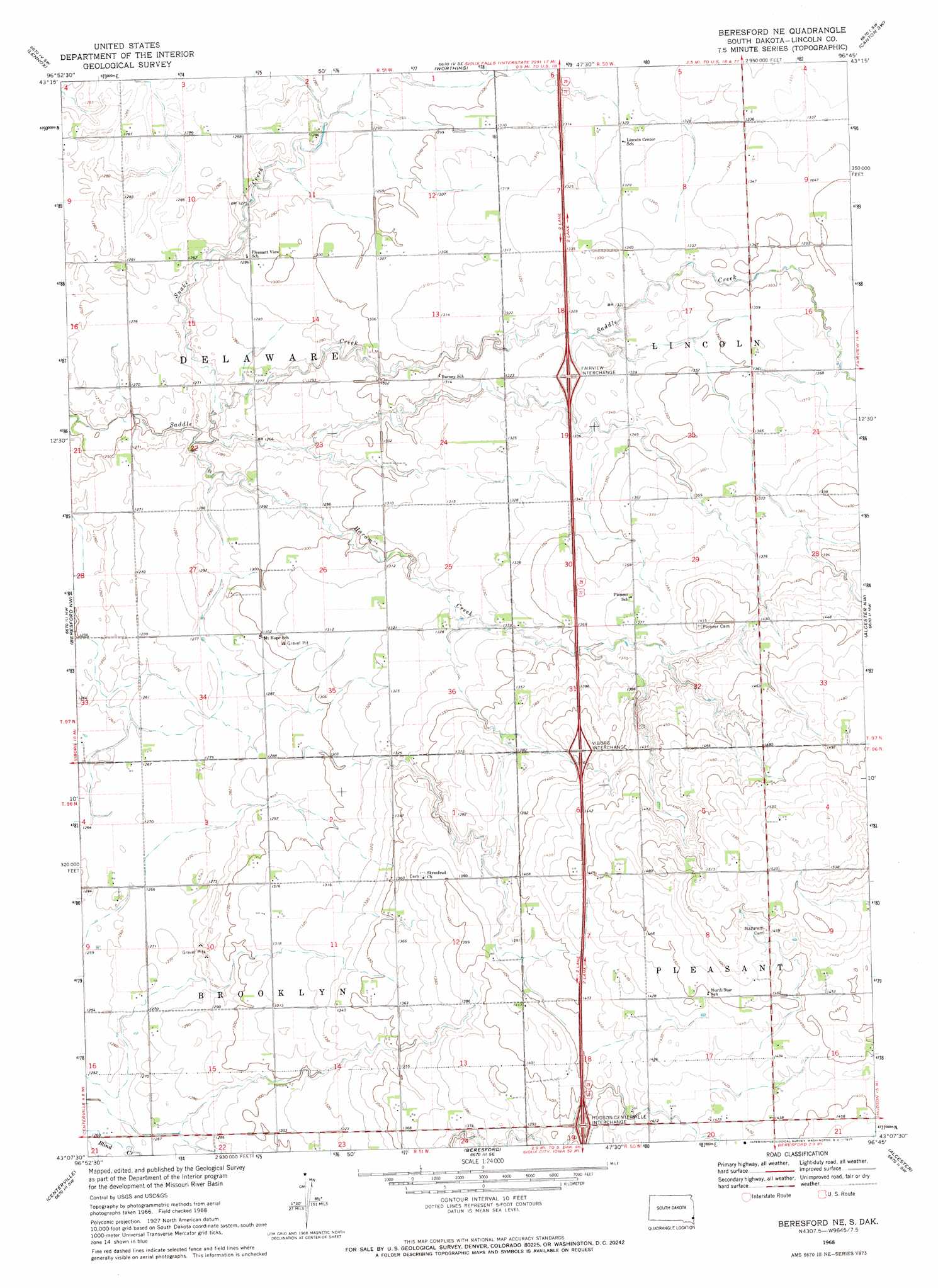
USGS Topo Quad 43096b7 - 1:24,000 scale
| Topo Map Name: | Beresford Ne |
| USGS Topo Quad ID: | 43096b7 |
| Print Size: | ca. 21 1/4" wide x 27" high |
| Southeast Coordinates: | 43.125° N latitude / 96.75° W longitude |
| Map Center Coordinates: | 43.1875° N latitude / 96.8125° W longitude |
| U.S. State: | SD |
| Filename: | o43096b7.jpg |
| Download Map JPG Image: | Beresford Ne topo map 1:24,000 scale |
| Map Type: | Topographic |
| Topo Series: | 7.5´ |
| Map Scale: | 1:24,000 |
| Source of Map Images: | United States Geological Survey (USGS) |
| Alternate Map Versions: |
Beresford NE SD 1968, updated 1971 Download PDF Buy paper map Beresford NE SD 2012 Download PDF Buy paper map Beresford NE SD 2015 Download PDF Buy paper map |
1:24,000 Topo Quads surrounding Beresford Ne
Parker Ne |
Lennox Nw |
Tea |
Harrisburg |
Klondike |
Hurley |
Lennox |
Worthing |
Canton Sw |
Canton |
Viborg |
Beresford Nw |
Beresford Ne |
Alcester Nw |
Alcester Ne |
Wakonda |
Centerville |
Beresford |
Alcester |
Alcester Se |
Gayville Ne |
Hub City |
Alsen |
Nora |
Chatsworth |
> Back to 43096a1 at 1:100,000 scale
> Back to 43096a1 at 1:250,000 scale
> Back to U.S. Topo Maps home
Beresford Ne topo map: Gazetteer
Beresford Ne: Crossings
Fairview Interchange elevation 407m 1335′Hudson-Centerville Interchange elevation 429m 1407′
Viborg Interchange elevation 432m 1417′
Beresford Ne: Streams
Haram Creek elevation 381m 1250′Snake Creek elevation 381m 1250′
Beresford Ne digital topo map on disk
Buy this Beresford Ne topo map showing relief, roads, GPS coordinates and other geographical features, as a high-resolution digital map file on DVD:
Eastern North Dakota & Eastern South Dakota
Buy digital topo maps: Eastern North Dakota & Eastern South Dakota