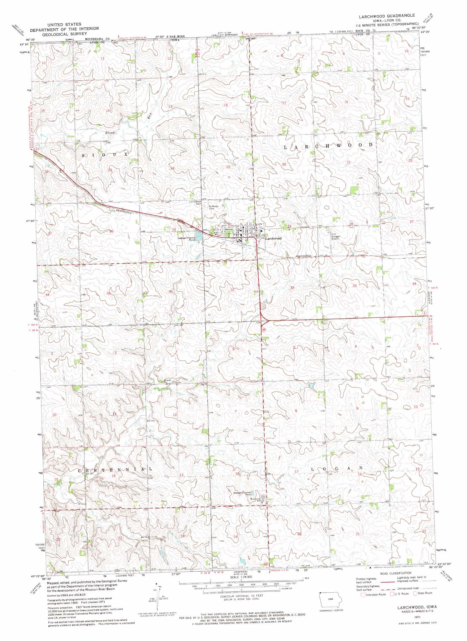
Larchwood Topo Map Iowa
To zoom in, hover over the map of Larchwood
USGS Topo Quad 43096d4 - 1:24,000 scale
| Topo Map Name: | Larchwood |
| USGS Topo Quad ID: | 43096d4 |
| Print Size: | ca. 21 1/4" wide x 27" high |
| Southeast Coordinates: | 43.375° N latitude / 96.375° W longitude |
| Map Center Coordinates: | 43.4375° N latitude / 96.4375° W longitude |
| U.S. State: | IA |
| Filename: | o43096d4.jpg |
| Download Map JPG Image: | Larchwood topo map 1:24,000 scale |
| Map Type: | Topographic |
| Topo Series: | 7.5´ |
| Map Scale: | 1:24,000 |
| Source of Map Images: | United States Geological Survey (USGS) |
| Alternate Map Versions: |
Larchwood IA 1971, updated 1973 Download PDF Buy paper map Larchwood IA 2010 Download PDF Buy paper map Larchwood IA 2013 Download PDF Buy paper map Larchwood IA 2015 Download PDF Buy paper map |
1:24,000 Topo Quads surrounding Larchwood
Renner |
Garretson West |
Garretson East |
Hills Ne |
Luverne |
Sioux Falls East |
Brandon |
Valley Springs |
Hills |
Ash Creek |
Harrisburg |
Klondike |
Larchwood |
Lester |
Rock Rapids |
Canton Sw |
Canton |
Inwood |
Alvord |
Doon |
Alcester Nw |
Alcester Ne |
Fairview |
Rock Valley |
Hull |
> Back to 43096a1 at 1:100,000 scale
> Back to 43096a1 at 1:250,000 scale
> Back to U.S. Topo Maps home
Larchwood topo map: Gazetteer
Larchwood: Airports
Zangger Airport elevation 450m 1476′Larchwood: Parks
Lake Pahoja Recreation Area elevation 428m 1404′Roeman-Stetrichs Wildlife Area elevation 421m 1381′
Tri-State Iron Post Historical Marker elevation 431m 1414′
Larchwood: Populated Places
Larchwood elevation 450m 1476′Larchwood: Post Offices
Larchwood Post Office elevation 450m 1476′Larchwood: Reservoirs
Lake Pahoja elevation 408m 1338′Larchwood: Trails
The Pahoja Recreation Trail elevation 428m 1404′Larchwood digital topo map on disk
Buy this Larchwood topo map showing relief, roads, GPS coordinates and other geographical features, as a high-resolution digital map file on DVD:
Eastern North Dakota & Eastern South Dakota
Buy digital topo maps: Eastern North Dakota & Eastern South Dakota