Hills Topo Map Minnesota
To zoom in, hover over the map of Hills
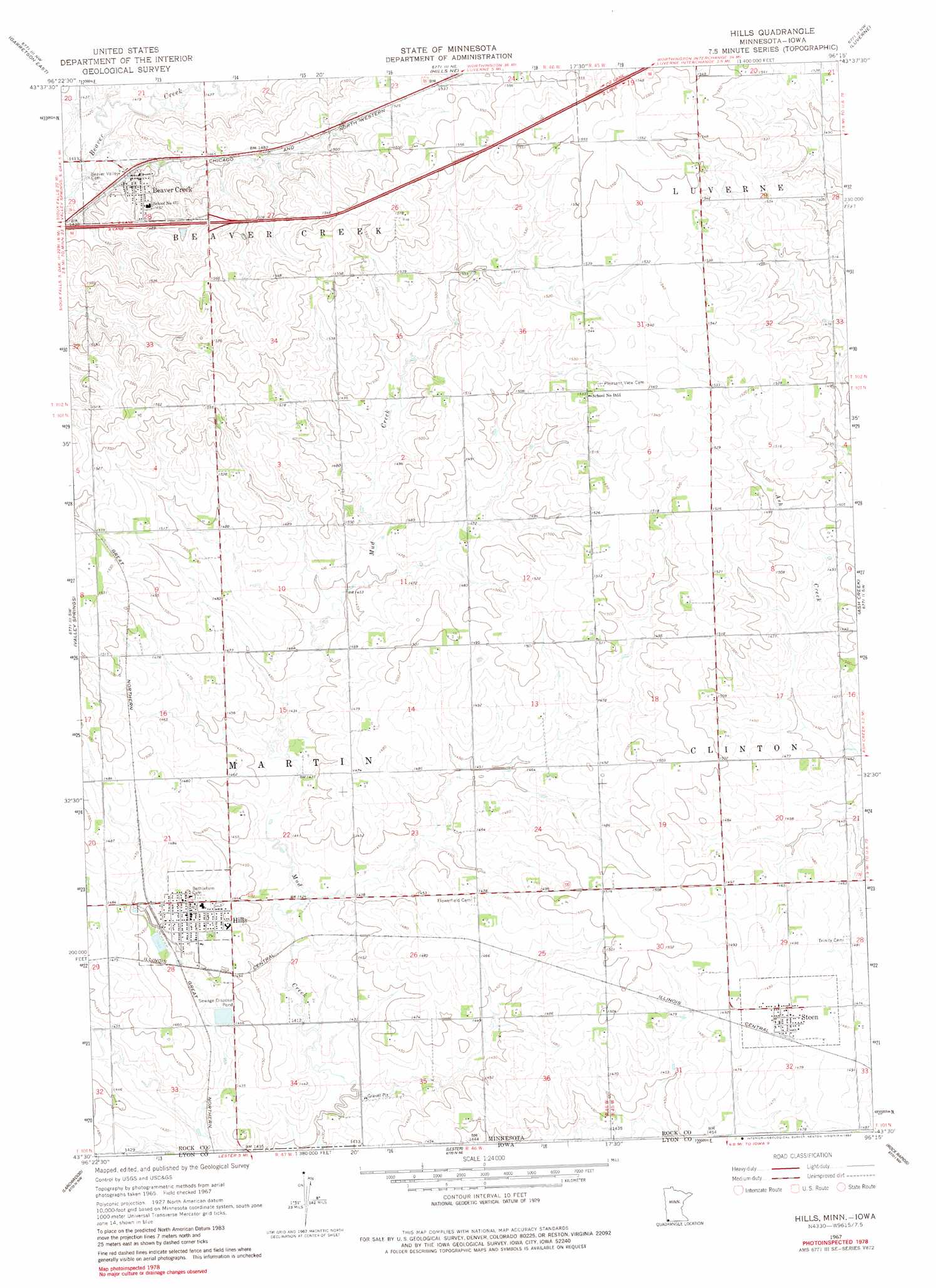
USGS Topo Quad 43096e3 - 1:24,000 scale
| Topo Map Name: | Hills |
| USGS Topo Quad ID: | 43096e3 |
| Print Size: | ca. 21 1/4" wide x 27" high |
| Southeast Coordinates: | 43.5° N latitude / 96.25° W longitude |
| Map Center Coordinates: | 43.5625° N latitude / 96.3125° W longitude |
| U.S. States: | MN, IA |
| Filename: | o43096e3.jpg |
| Download Map JPG Image: | Hills topo map 1:24,000 scale |
| Map Type: | Topographic |
| Topo Series: | 7.5´ |
| Map Scale: | 1:24,000 |
| Source of Map Images: | United States Geological Survey (USGS) |
| Alternate Map Versions: |
Hills MN 1967, updated 1968 Download PDF Buy paper map Hills MN 1967, updated 1982 Download PDF Buy paper map Hills MN 2010 Download PDF Buy paper map Hills MN 2013 Download PDF Buy paper map Hills MN 2016 Download PDF Buy paper map |
1:24,000 Topo Quads surrounding Hills
Dell Rapids Se |
Jasper |
Jasper Se |
Edgerton South |
Kenneth |
Garretson West |
Garretson East |
Hills Ne |
Luverne |
Magnolia |
Brandon |
Valley Springs |
Hills |
Ash Creek |
Ellsworth |
Klondike |
Larchwood |
Lester |
Rock Rapids |
Edna |
Canton |
Inwood |
Alvord |
Doon |
George West |
> Back to 43096e1 at 1:100,000 scale
> Back to 43096a1 at 1:250,000 scale
> Back to U.S. Topo Maps home
Hills topo map: Gazetteer
Hills: Crossings
Interchange 5 elevation 463m 1519′Hills: Parks
Jacobson Park elevation 448m 1469′Hills: Populated Places
Beaver Creek elevation 442m 1450′Hills elevation 453m 1486′
Steen elevation 454m 1489′
Hills: Post Offices
Beaver Creek Post Office elevation 442m 1450′Hills Post Office elevation 453m 1486′
Steen Post Office elevation 454m 1489′
Hills digital topo map on disk
Buy this Hills topo map showing relief, roads, GPS coordinates and other geographical features, as a high-resolution digital map file on DVD:
Eastern North Dakota & Eastern South Dakota
Buy digital topo maps: Eastern North Dakota & Eastern South Dakota