Valley Springs Topo Map Minnesota
To zoom in, hover over the map of Valley Springs
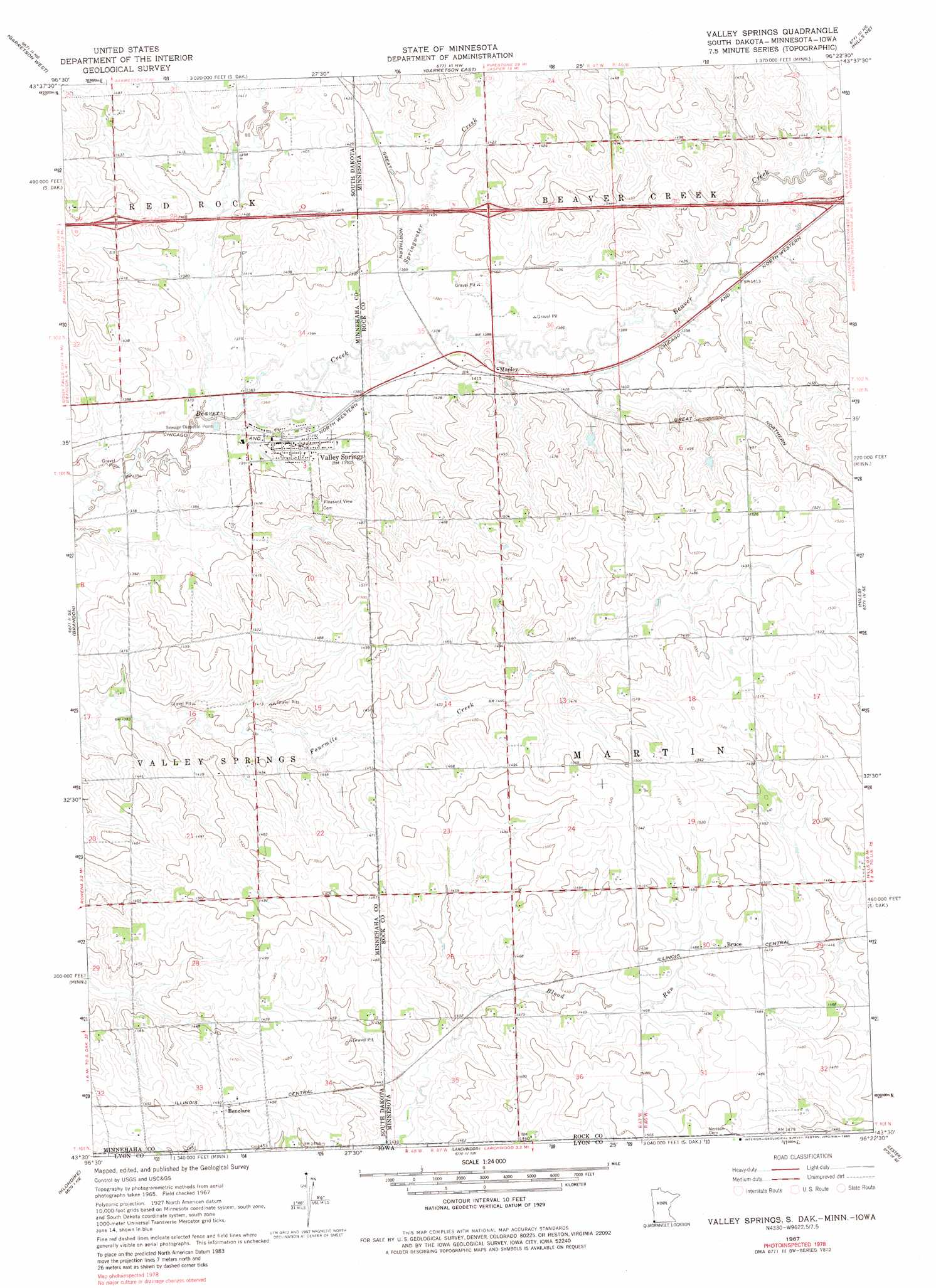
USGS Topo Quad 43096e4 - 1:24,000 scale
| Topo Map Name: | Valley Springs |
| USGS Topo Quad ID: | 43096e4 |
| Print Size: | ca. 21 1/4" wide x 27" high |
| Southeast Coordinates: | 43.5° N latitude / 96.375° W longitude |
| Map Center Coordinates: | 43.5625° N latitude / 96.4375° W longitude |
| U.S. States: | MN, IA, SD |
| Filename: | o43096e4.jpg |
| Download Map JPG Image: | Valley Springs topo map 1:24,000 scale |
| Map Type: | Topographic |
| Topo Series: | 7.5´ |
| Map Scale: | 1:24,000 |
| Source of Map Images: | United States Geological Survey (USGS) |
| Alternate Map Versions: |
Valley Springs SD 1967, updated 1968 Download PDF Buy paper map Valley Springs SD 1967, updated 1980 Download PDF Buy paper map Valley Springs SD 2010 Download PDF Buy paper map Valley Springs SD 2012 Download PDF Buy paper map Valley Springs SD 2015 Download PDF Buy paper map |
1:24,000 Topo Quads surrounding Valley Springs
Dell Rapids |
Dell Rapids Se |
Jasper |
Jasper Se |
Edgerton South |
Renner |
Garretson West |
Garretson East |
Hills Ne |
Luverne |
Sioux Falls East |
Brandon |
Valley Springs |
Hills |
Ash Creek |
Harrisburg |
Klondike |
Larchwood |
Lester |
Rock Rapids |
Canton Sw |
Canton |
Inwood |
Alvord |
Doon |
> Back to 43096e1 at 1:100,000 scale
> Back to 43096a1 at 1:250,000 scale
> Back to U.S. Topo Maps home
Valley Springs topo map: Gazetteer
Valley Springs: Crossings
Interchange 1 elevation 433m 1420′Interchange 3 elevation 441m 1446′
Valley Springs: Populated Places
Benclare elevation 455m 1492′Bruce elevation 455m 1492′
Manley elevation 428m 1404′
Valley Springs elevation 428m 1404′
Valley Springs: Post Offices
Bruce Post Office (historical) elevation 455m 1492′Manley Post Office (historical) elevation 428m 1404′
Valley Springs: Streams
Springwater Creek elevation 418m 1371′Springwater Creek elevation 418m 1371′
Valley Springs digital topo map on disk
Buy this Valley Springs topo map showing relief, roads, GPS coordinates and other geographical features, as a high-resolution digital map file on DVD:
Eastern North Dakota & Eastern South Dakota
Buy digital topo maps: Eastern North Dakota & Eastern South Dakota