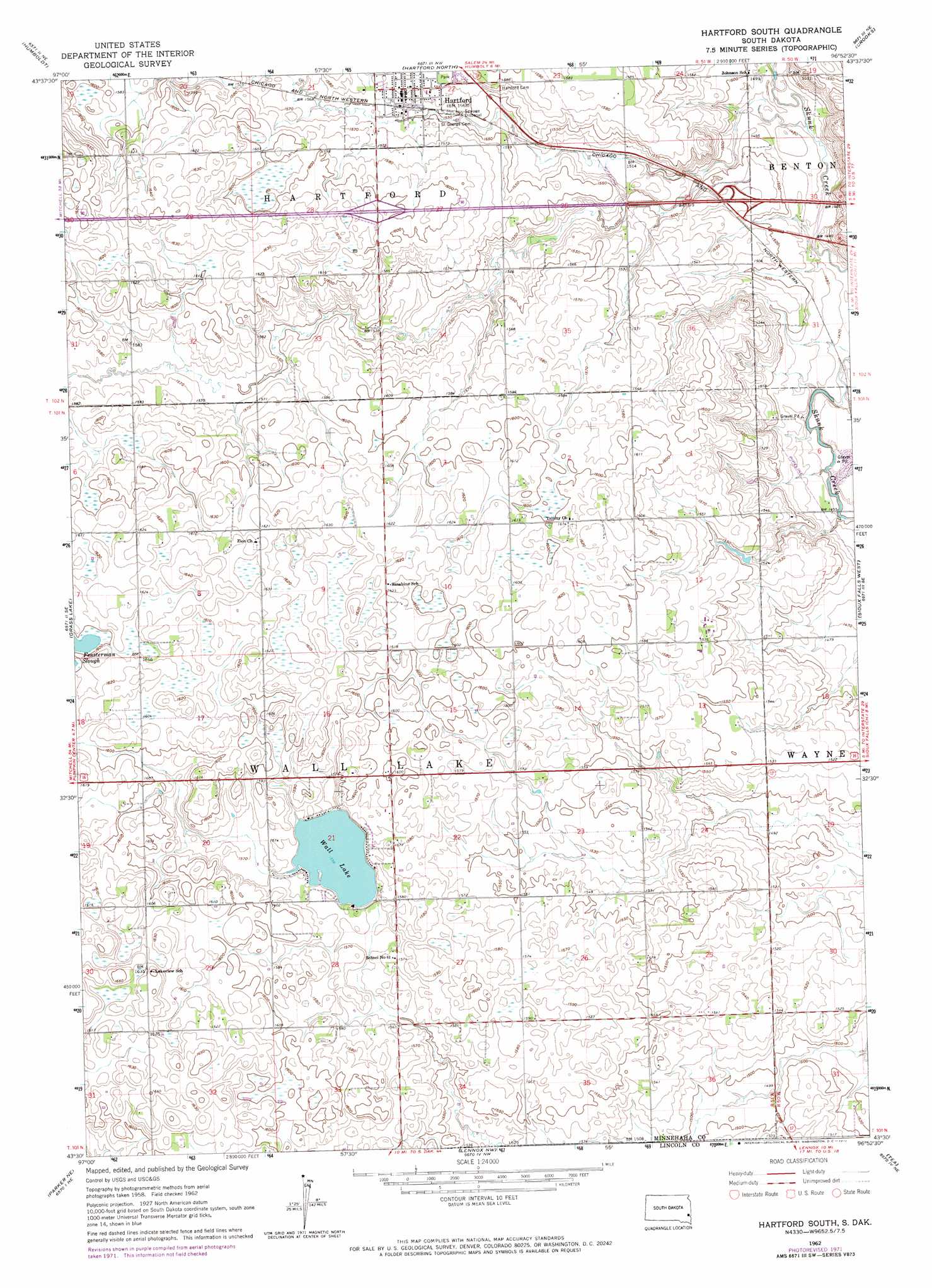
Hartford South Topo Map South Dakota
To zoom in, hover over the map of Hartford South
USGS Topo Quad 43096e8 - 1:24,000 scale
| Topo Map Name: | Hartford South |
| USGS Topo Quad ID: | 43096e8 |
| Print Size: | ca. 21 1/4" wide x 27" high |
| Southeast Coordinates: | 43.5° N latitude / 96.875° W longitude |
| Map Center Coordinates: | 43.5625° N latitude / 96.9375° W longitude |
| U.S. State: | SD |
| Filename: | o43096e8.jpg |
| Download Map JPG Image: | Hartford South topo map 1:24,000 scale |
| Map Type: | Topographic |
| Topo Series: | 7.5´ |
| Map Scale: | 1:24,000 |
| Source of Map Images: | United States Geological Survey (USGS) |
| Alternate Map Versions: |
Hartford South SD 1962, updated 1964 Download PDF Buy paper map Hartford South SD 1962, updated 1972 Download PDF Buy paper map Hartford South SD 2012 Download PDF Buy paper map Hartford South SD 2015 Download PDF Buy paper map |
1:24,000 Topo Quads surrounding Hartford South
Lake Madison Sw |
Buffalo Trading Post |
Colton |
Colton Se |
Dell Rapids |
Montrose |
Humboldt |
Hartford North |
Crooks |
Renner |
East Vermillion Lake |
Grass Lake |
Hartford South |
Sioux Falls West |
Sioux Falls East |
Parker |
Parker Ne |
Lennox Nw |
Tea |
Harrisburg |
Parker Sw |
Hurley |
Lennox |
Worthing |
Canton Sw |
> Back to 43096e1 at 1:100,000 scale
> Back to 43096a1 at 1:250,000 scale
> Back to U.S. Topo Maps home
Hartford South topo map: Gazetteer
Hartford South: Airports
Oakleaf Airfield elevation 489m 1604′Hartford South: Lakes
Wall Lake elevation 474m 1555′Hartford South: Populated Places
Country Acres elevation 463m 1519′Country Estates Subdivision elevation 485m 1591′
Hartford elevation 479m 1571′
Hartford South digital topo map on disk
Buy this Hartford South topo map showing relief, roads, GPS coordinates and other geographical features, as a high-resolution digital map file on DVD:
Eastern North Dakota & Eastern South Dakota
Buy digital topo maps: Eastern North Dakota & Eastern South Dakota