Hartford North Topo Map South Dakota
To zoom in, hover over the map of Hartford North
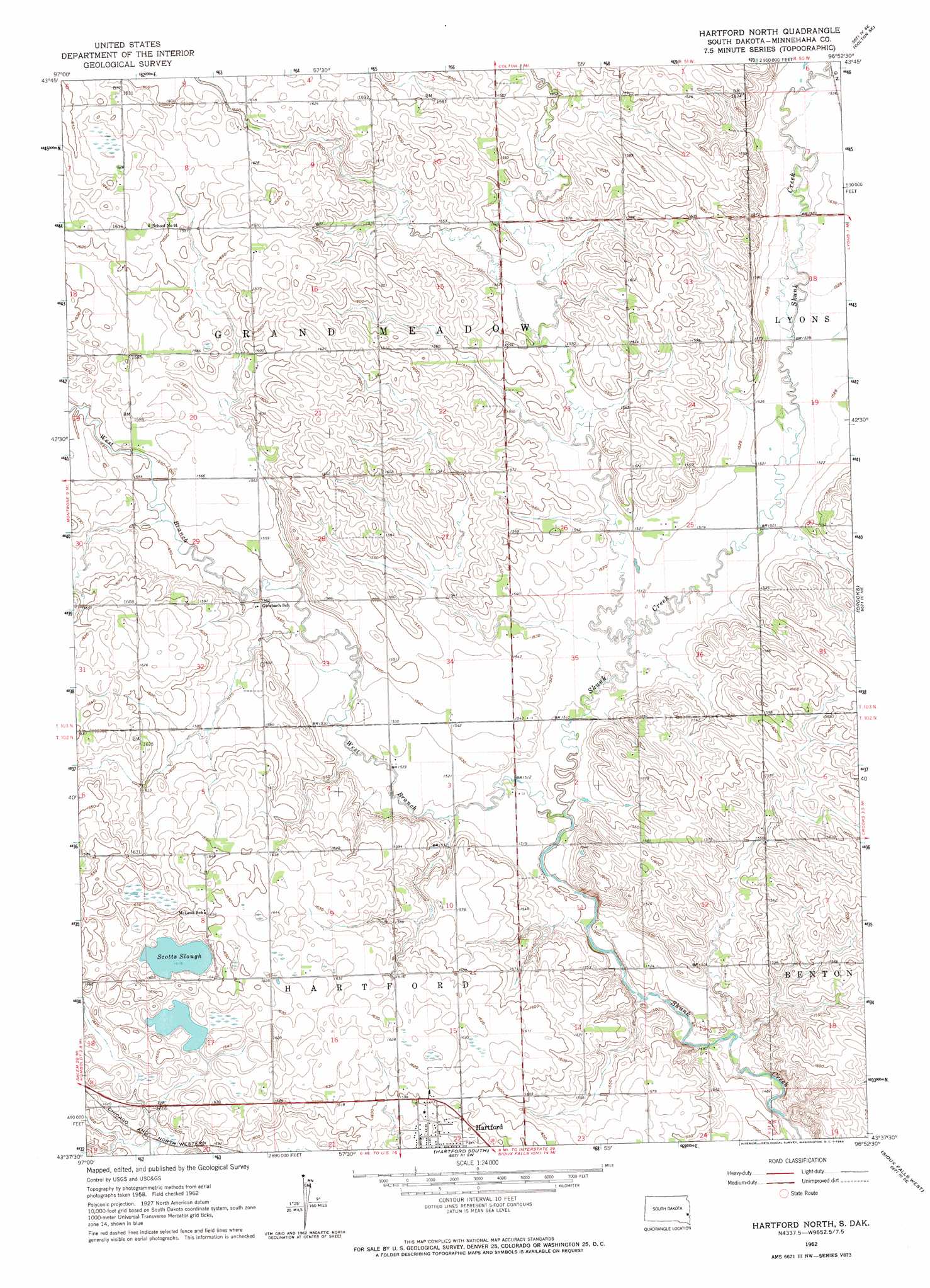
USGS Topo Quad 43096f8 - 1:24,000 scale
| Topo Map Name: | Hartford North |
| USGS Topo Quad ID: | 43096f8 |
| Print Size: | ca. 21 1/4" wide x 27" high |
| Southeast Coordinates: | 43.625° N latitude / 96.875° W longitude |
| Map Center Coordinates: | 43.6875° N latitude / 96.9375° W longitude |
| U.S. State: | SD |
| Filename: | o43096f8.jpg |
| Download Map JPG Image: | Hartford North topo map 1:24,000 scale |
| Map Type: | Topographic |
| Topo Series: | 7.5´ |
| Map Scale: | 1:24,000 |
| Source of Map Images: | United States Geological Survey (USGS) |
| Alternate Map Versions: |
Hartford North SD 1962, updated 1964 Download PDF Buy paper map Hartford North SD 2012 Download PDF Buy paper map Hartford North SD 2015 Download PDF Buy paper map |
1:24,000 Topo Quads surrounding Hartford North
Lake Herman |
Lake Madison |
Wentworth |
Colman |
Trent |
Lake Madison Sw |
Buffalo Trading Post |
Colton |
Colton Se |
Dell Rapids |
Montrose |
Humboldt |
Hartford North |
Crooks |
Renner |
East Vermillion Lake |
Grass Lake |
Hartford South |
Sioux Falls West |
Sioux Falls East |
Parker |
Parker Ne |
Lennox Nw |
Tea |
Harrisburg |
> Back to 43096e1 at 1:100,000 scale
> Back to 43096a1 at 1:250,000 scale
> Back to U.S. Topo Maps home
Hartford North topo map: Gazetteer
Hartford North: Lakes
Scotts Slough elevation 492m 1614′Hartford North: Streams
Colton Creek elevation 461m 1512′West Branch Skunk Creek elevation 457m 1499′
Hartford North digital topo map on disk
Buy this Hartford North topo map showing relief, roads, GPS coordinates and other geographical features, as a high-resolution digital map file on DVD:
Eastern North Dakota & Eastern South Dakota
Buy digital topo maps: Eastern North Dakota & Eastern South Dakota