Midway Topo Map South Dakota
To zoom in, hover over the map of Midway
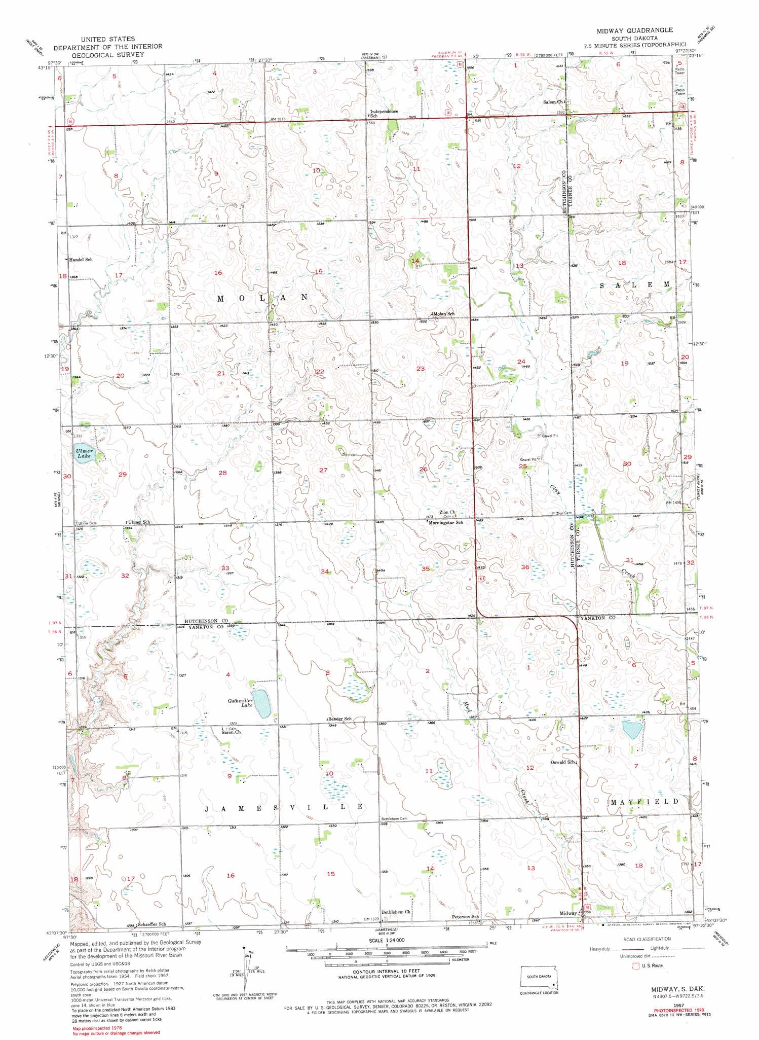
USGS Topo Quad 43097b4 - 1:24,000 scale
| Topo Map Name: | Midway |
| USGS Topo Quad ID: | 43097b4 |
| Print Size: | ca. 21 1/4" wide x 27" high |
| Southeast Coordinates: | 43.125° N latitude / 97.375° W longitude |
| Map Center Coordinates: | 43.1875° N latitude / 97.4375° W longitude |
| U.S. State: | SD |
| Filename: | o43097b4.jpg |
| Download Map JPG Image: | Midway topo map 1:24,000 scale |
| Map Type: | Topographic |
| Topo Series: | 7.5´ |
| Map Scale: | 1:24,000 |
| Source of Map Images: | United States Geological Survey (USGS) |
| Alternate Map Versions: |
Midway SD 1957, updated 1958 Download PDF Buy paper map Midway SD 1957, updated 1981 Download PDF Buy paper map Midway SD 2012 Download PDF Buy paper map Midway SD 2015 Download PDF Buy paper map |
1:24,000 Topo Quads surrounding Midway
Clayton |
Clayton Ne |
Dolton |
Marion |
Parker |
Tschetter Colony |
Wolf Creek |
Freeman |
Freeman Se |
Parker Sw |
Scotland |
Menno |
Midway |
Turkey Ridge |
Center Point |
Kloucek Lake |
Lesterville |
Jamesville |
Mayfield |
Irene |
Tabor |
Tabor Ne |
Yankton |
Mission Hill |
Gayville |
> Back to 43097a1 at 1:100,000 scale
> Back to 43096a1 at 1:250,000 scale
> Back to U.S. Topo Maps home
Midway topo map: Gazetteer
Midway: Lakes
Guthmiller Lake elevation 402m 1318′Ulmer Lake elevation 397m 1302′
Midway: Populated Places
Midway elevation 411m 1348′Midway digital topo map on disk
Buy this Midway topo map showing relief, roads, GPS coordinates and other geographical features, as a high-resolution digital map file on DVD:
Eastern North Dakota & Eastern South Dakota
Buy digital topo maps: Eastern North Dakota & Eastern South Dakota