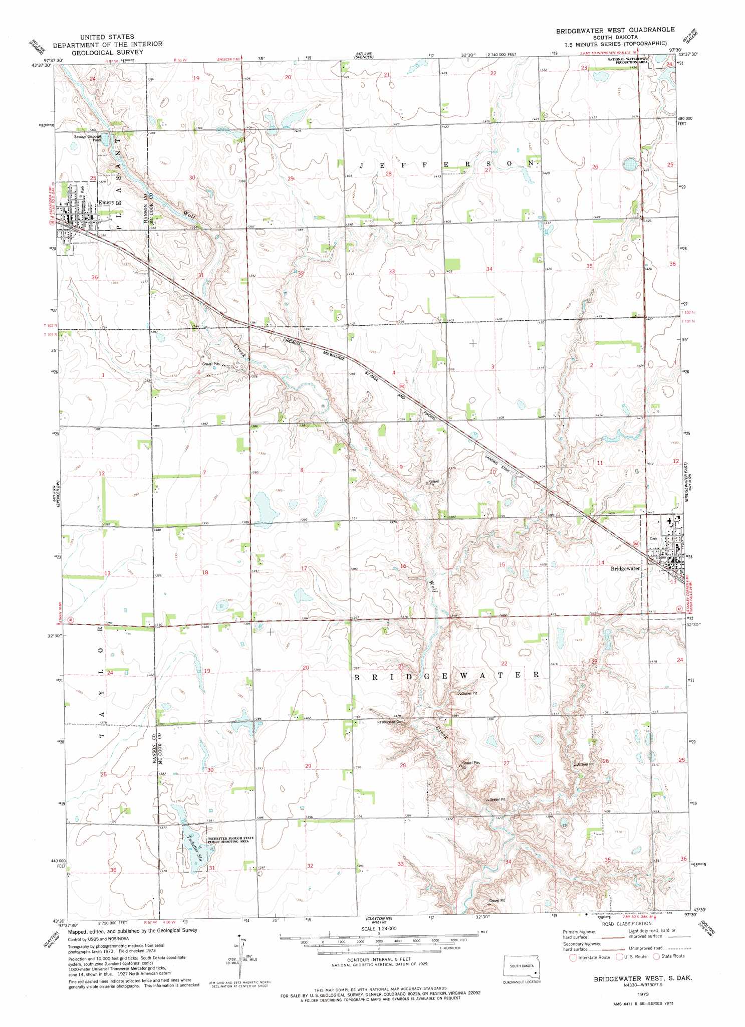
Bridgewater West Topo Map South Dakota
To zoom in, hover over the map of Bridgewater West
USGS Topo Quad 43097e5 - 1:24,000 scale
| Topo Map Name: | Bridgewater West |
| USGS Topo Quad ID: | 43097e5 |
| Print Size: | ca. 21 1/4" wide x 27" high |
| Southeast Coordinates: | 43.5° N latitude / 97.5° W longitude |
| Map Center Coordinates: | 43.5625° N latitude / 97.5625° W longitude |
| U.S. State: | SD |
| Filename: | o43097e5.jpg |
| Download Map JPG Image: | Bridgewater West topo map 1:24,000 scale |
| Map Type: | Topographic |
| Topo Series: | 7.5´ |
| Map Scale: | 1:24,000 |
| Source of Map Images: | United States Geological Survey (USGS) |
| Alternate Map Versions: |
Bridgewater West SD 1973, updated 1978 Download PDF Buy paper map Bridgewater West SD 2012 Download PDF Buy paper map Bridgewater West SD 2015 Download PDF Buy paper map |
1:24,000 Topo Quads surrounding Bridgewater West
Ness Chain Lakes |
Epiphany |
Canova Se |
Unityville |
Winfred Se |
Alexandria |
Farmer |
Spencer |
Salem |
Salem Ne |
Rockport Colony |
Spencer Sw |
Bridgewater West |
Bridgewater East |
Canistota |
Milltown |
Clayton |
Clayton Ne |
Dolton |
Marion |
Parkston Se |
Tschetter Colony |
Wolf Creek |
Freeman |
Freeman Se |
> Back to 43097e1 at 1:100,000 scale
> Back to 43096a1 at 1:250,000 scale
> Back to U.S. Topo Maps home
Bridgewater West topo map: Gazetteer
Bridgewater West: Airports
Waltner and Richards Airfield elevation 428m 1404′Bridgewater West: Lakes
Tschetter Slough elevation 418m 1371′Bridgewater West: Parks
Tschetter Slough State Public Shooting Area elevation 418m 1371′Bridgewater West: Populated Places
Bridgewater elevation 432m 1417′Emery elevation 423m 1387′
Bridgewater West digital topo map on disk
Buy this Bridgewater West topo map showing relief, roads, GPS coordinates and other geographical features, as a high-resolution digital map file on DVD:
Eastern North Dakota & Eastern South Dakota
Buy digital topo maps: Eastern North Dakota & Eastern South Dakota