Montrose Topo Map South Dakota
To zoom in, hover over the map of Montrose
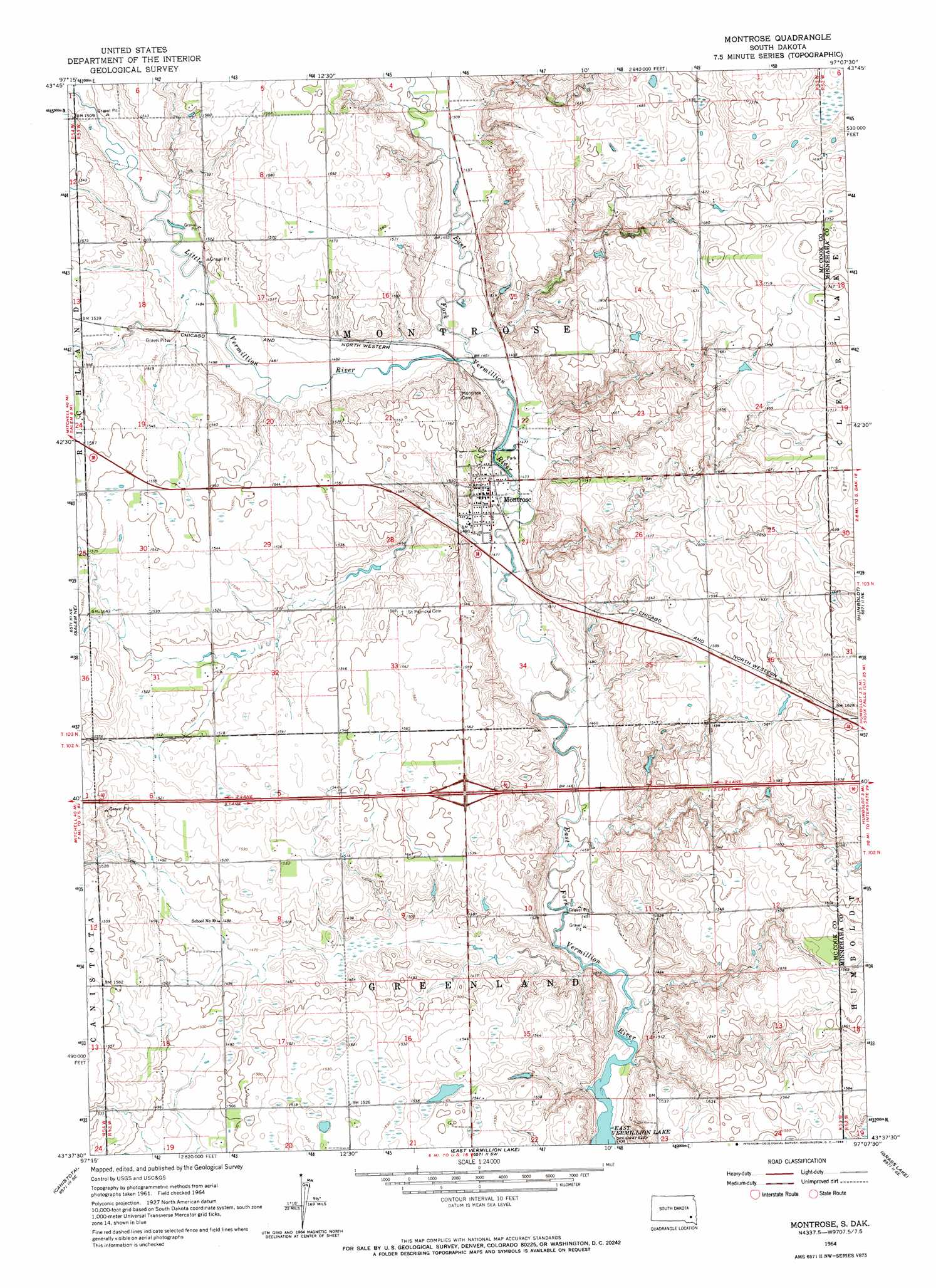
USGS Topo Quad 43097f2 - 1:24,000 scale
| Topo Map Name: | Montrose |
| USGS Topo Quad ID: | 43097f2 |
| Print Size: | ca. 21 1/4" wide x 27" high |
| Southeast Coordinates: | 43.625° N latitude / 97.125° W longitude |
| Map Center Coordinates: | 43.6875° N latitude / 97.1875° W longitude |
| U.S. State: | SD |
| Filename: | o43097f2.jpg |
| Download Map JPG Image: | Montrose topo map 1:24,000 scale |
| Map Type: | Topographic |
| Topo Series: | 7.5´ |
| Map Scale: | 1:24,000 |
| Source of Map Images: | United States Geological Survey (USGS) |
| Alternate Map Versions: |
Montrose SD 1964, updated 1966 Download PDF Buy paper map Montrose SD 2012 Download PDF Buy paper map Montrose SD 2015 Download PDF Buy paper map |
1:24,000 Topo Quads surrounding Montrose
Canova East |
Winfred |
Lake Herman |
Lake Madison |
Wentworth |
Unityville |
Winfred Se |
Lake Madison Sw |
Buffalo Trading Post |
Colton |
Salem |
Salem Ne |
Montrose |
Humboldt |
Hartford North |
Bridgewater East |
Canistota |
East Vermillion Lake |
Grass Lake |
Hartford South |
Dolton |
Marion |
Parker |
Parker Ne |
Lennox Nw |
> Back to 43097e1 at 1:100,000 scale
> Back to 43096a1 at 1:250,000 scale
> Back to U.S. Topo Maps home
Montrose topo map: Gazetteer
Montrose: Dams
Klatzer Dam elevation 488m 1601′Montrose: Populated Places
Montrose elevation 448m 1469′Montrose: Streams
Little Vermillion River elevation 449m 1473′Montrose digital topo map on disk
Buy this Montrose topo map showing relief, roads, GPS coordinates and other geographical features, as a high-resolution digital map file on DVD:
Eastern North Dakota & Eastern South Dakota
Buy digital topo maps: Eastern North Dakota & Eastern South Dakota