Farmer Topo Map South Dakota
To zoom in, hover over the map of Farmer
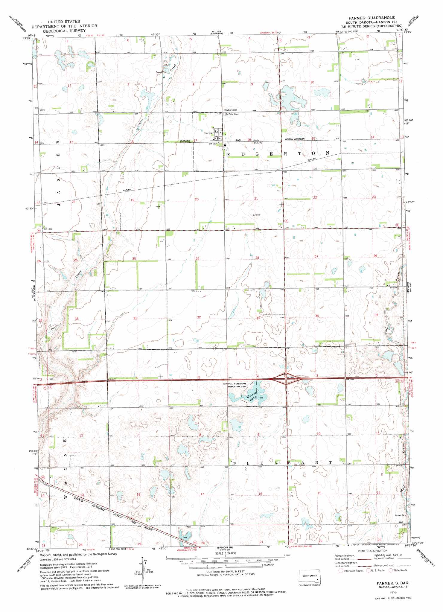
USGS Topo Quad 43097f6 - 1:24,000 scale
| Topo Map Name: | Farmer |
| USGS Topo Quad ID: | 43097f6 |
| Print Size: | ca. 21 1/4" wide x 27" high |
| Southeast Coordinates: | 43.625° N latitude / 97.625° W longitude |
| Map Center Coordinates: | 43.6875° N latitude / 97.6875° W longitude |
| U.S. State: | SD |
| Filename: | o43097f6.jpg |
| Download Map JPG Image: | Farmer topo map 1:24,000 scale |
| Map Type: | Topographic |
| Topo Series: | 7.5´ |
| Map Scale: | 1:24,000 |
| Source of Map Images: | United States Geological Survey (USGS) |
| Alternate Map Versions: |
Farmer SD 1973, updated 1978 Download PDF Buy paper map Farmer SD 2012 Download PDF Buy paper map Farmer SD 2015 Download PDF Buy paper map |
1:24,000 Topo Quads surrounding Farmer
Farwell Nw |
Morris Lake |
Bitter Lake |
Canova West |
Canova East |
Farwell |
Ness Chain Lakes |
Epiphany |
Canova Se |
Unityville |
Riverside |
Alexandria |
Farmer |
Spencer |
Salem |
Ethan |
Rockport Colony |
Spencer Sw |
Bridgewater West |
Bridgewater East |
Parkston |
Milltown |
Clayton |
Clayton Ne |
Dolton |
> Back to 43097e1 at 1:100,000 scale
> Back to 43096a1 at 1:250,000 scale
> Back to U.S. Topo Maps home
Farmer topo map: Gazetteer
Farmer: Lakes
Welker Lake elevation 414m 1358′Farmer: Populated Places
Farmer elevation 425m 1394′Farmer digital topo map on disk
Buy this Farmer topo map showing relief, roads, GPS coordinates and other geographical features, as a high-resolution digital map file on DVD:
Eastern North Dakota & Eastern South Dakota
Buy digital topo maps: Eastern North Dakota & Eastern South Dakota