Riverside Topo Map South Dakota
To zoom in, hover over the map of Riverside
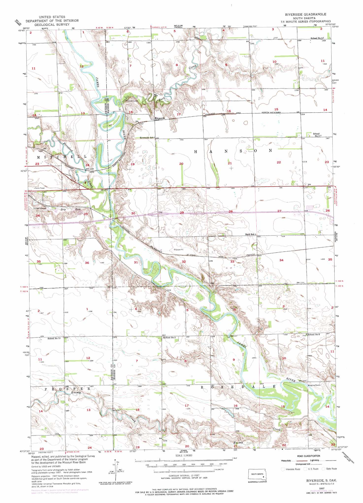
USGS Topo Quad 43097f8 - 1:24,000 scale
| Topo Map Name: | Riverside |
| USGS Topo Quad ID: | 43097f8 |
| Print Size: | ca. 21 1/4" wide x 27" high |
| Southeast Coordinates: | 43.625° N latitude / 97.875° W longitude |
| Map Center Coordinates: | 43.6875° N latitude / 97.9375° W longitude |
| U.S. State: | SD |
| Filename: | o43097f8.jpg |
| Download Map JPG Image: | Riverside topo map 1:24,000 scale |
| Map Type: | Topographic |
| Topo Series: | 7.5´ |
| Map Scale: | 1:24,000 |
| Source of Map Images: | United States Geological Survey (USGS) |
| Alternate Map Versions: |
Riverside SD 1957, updated 1959 Download PDF Buy paper map Riverside SD 1957, updated 1977 Download PDF Buy paper map Riverside SD 2012 Download PDF Buy paper map Riverside SD 2015 Download PDF Buy paper map |
1:24,000 Topo Quads surrounding Riverside
Letcher |
Letcher Ne |
Farwell Nw |
Morris Lake |
Bitter Lake |
Letcher Sw |
Loomis |
Farwell |
Ness Chain Lakes |
Epiphany |
Betts |
Mitchell |
Riverside |
Alexandria |
Farmer |
Mitchell Sw |
Shoemaker Dam |
Ethan |
Rockport Colony |
Spencer Sw |
Hillside |
Delmont Ne |
Parkston |
Milltown |
Clayton |
> Back to 43097e1 at 1:100,000 scale
> Back to 43096a1 at 1:250,000 scale
> Back to U.S. Topo Maps home
Riverside topo map: Gazetteer
Riverside: Populated Places
Riverside elevation 397m 1302′Riverside: Streams
Dry Run elevation 367m 1204′Enemy Creek elevation 369m 1210′
Firesteel Creek elevation 368m 1207′
Johnson Creek elevation 369m 1210′
Rock Creek elevation 367m 1204′
Riverside: Summits
Medicine Butte (historical) elevation 384m 1259′Riverside digital topo map on disk
Buy this Riverside topo map showing relief, roads, GPS coordinates and other geographical features, as a high-resolution digital map file on DVD:
Eastern North Dakota & Eastern South Dakota
Buy digital topo maps: Eastern North Dakota & Eastern South Dakota